MILLER FLAT RESERVOIR CAMPGROUND, UT Campground Reservation, Info, Images, Map, Directions

MILLER FLAT RESERVOIR CAMPGROUND, Utah Campground Images, Info & Reservations

Listen

Directions

From Fairview, Utah, proceed east on Utah Highway 31 for approximately 18 miles to the Miller Flat Road (Forest Road # 0014). Turn south on this road and proceed through the Lake Canyon Recreation Area, past Miller Flat Reservoir to Forest Road # 3328. Turning left (east) on this road provides entrance to the campground.

Phone

435-384-2372

Activities

CAMPING, FISHING, HIKING

Keywords

Related Link(s)

Rec Area Info & Images

Utah State Tourism

Utah State Road Conditions

Overview

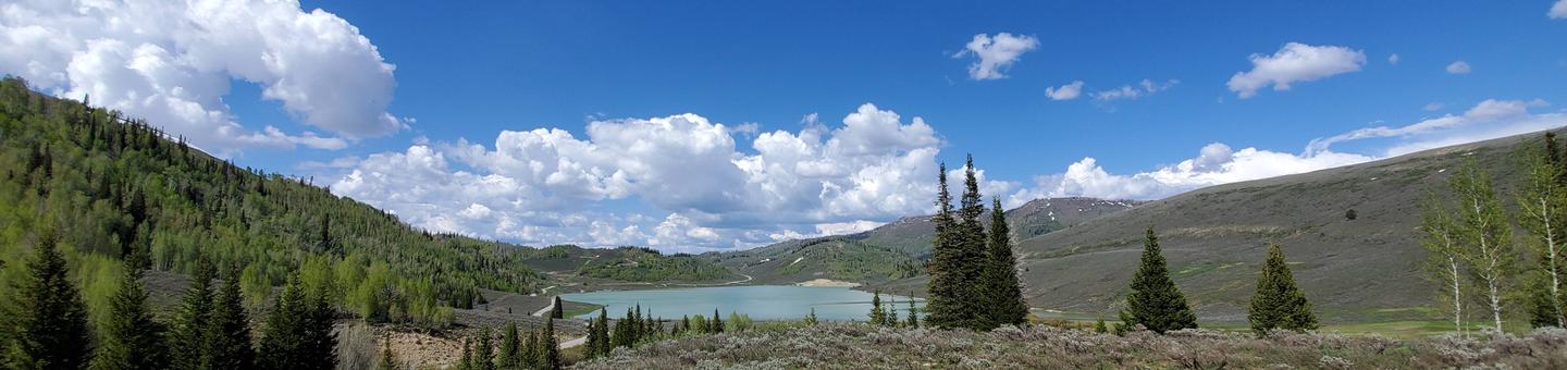
Miller Flat Reservoir Campground is located one mile south of Miller Flat Reservoir at 8,500 feet elevation, approximately five miles south of Utah Highway 31 — part of the Huntington/Eccles Canyons National Scenic Byway.

Recreation

Lake Canyon Recreation Area is located just north of the campground as is the northern trailhead of the Left Fork of Huntington National Recreation Trail. Cleveland and Huntington Reservoirs are located just minutes north of the campground along U31. Each offers trout fishing opportunities, with a boat ramp available at Huntington Reservoir.

Facilities

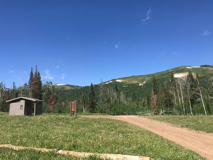
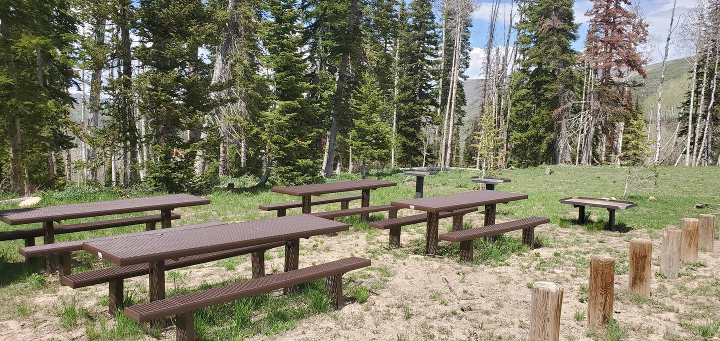
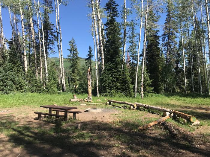
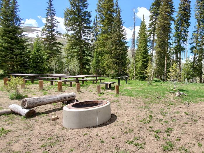
Visitors are allowed to configure their vehicles and trailers as they choose within the site. Group cooking facilities are provided including picnic tables, a fire ring, dutch oven fire pan and utility tables. A vault toilet facility is located about 50 feet from the site. There is no electricity, water, sewer or garbage services.

If the group site is not reserved, it is available to visitors on a first-come, first-served basis for $5.00 per vehicle per night. To maintain priority for reservations, first-come, first-served customers may only pay for two nights at a time. The three double family sites in the campground are only available on a first-come, first-served basis for $5.00 per vehicle per night. They are not reservable.

Natural Features

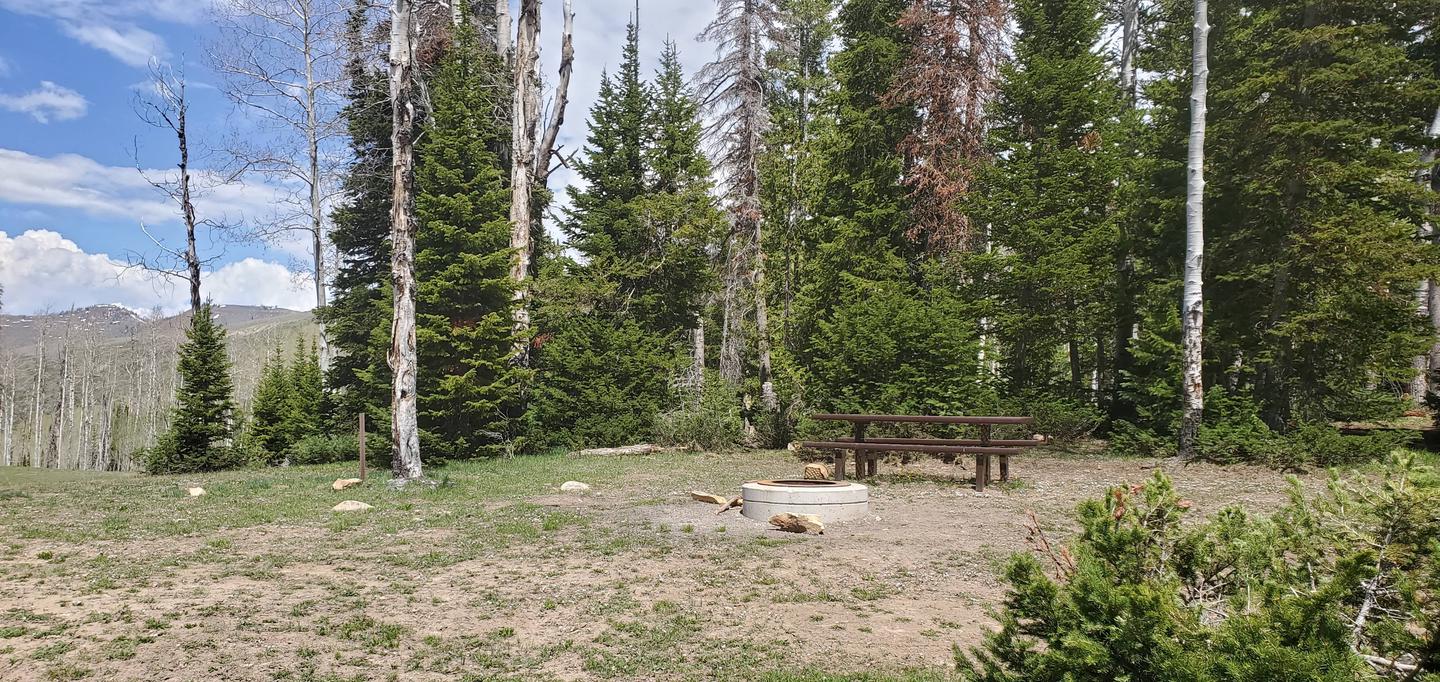
The group site is set in an open meadow with aspen and fir trees bordering the northern perimeter.

Nearby Attractions

Potters Ponds, a popular trout fishery is located approximately seven miles south of the campground. The 370-mile Arapeen Off-highway Vehicle Trail System can be accessed directly from the campground by riding north or south along the Miller Flat Road. Maps are available from hosts working in the area.

Reservation

More from CampingHiking.net:

NORWAY BEACH LOOP, Minnesota Campground Images, Info & Reservations

Listen Directions From Cass Lake, Minnesota, take U.S. Highway 2 east for 4 miles to the Norway Beach Recreation Area. Turn left and follow the campground road until the signs indicate the Norway Loop. Phone 21-835-4291 Activities BIKING, BOATING, CAMPING, FISHING, WATER SPORTS, SWIMMING SITE Keywords Norway Beach Campground,Norway Campground

DEVILS GARDEN CAMPGROUND, Utah Campground Images, Info & Reservations

Listen Directions From I-70, take Exit 182. Travel south for 26 miles to the park entrance. Take the park road 18 miles to Devils Garden. From Moab, take Highway 191 north for 4.5 miles to the park entrance. Take the park road 18 miles to Devils Garden. Phone 435-719-2299 Activities

RUARK BLUFF WEST, Missouri Campground Images, Info & Reservations

Listen Directions From Greenfield, Missouri, take State Highway H. north for 6.4 miles and turn left on the park access road. Follow signs into the park area. Phone 417-637-5279 Activities BOATING, CAMPING, FISHING, WILDLIFE VIEWING, SWIMMING SITE Keywords RUAW,STOCKTON LAKE,TWIN BRIDGES,STOCKTON LAKE Related Link(s) Rec Area Info & Images Missouri

TABLE MOUNTAIN (ANGELES), California Campground Images, Info & Reservations

Listen Directions From Wrightwood, California, take State Route 2 west for 2.4 miles to the Table Mountain Campground sign and continue to follow signs into the campground. Phone 760-249-3526 Activities BIKING, CAMPING, HIKING, WILDLIFE VIEWING, DAY USE AREA, SCENIC DRIVE Keywords TBLE,TABLE MOUNTAIN ANGELES NF,ANGELES NF – FS Related Link(s)

SNOW PEAK CABIN, Washington Campground Images, Info & Reservations

Listen Directions Winter access: From Seattle take Highway 2 east to Wenatchee, Highway 97 north to Tonasket, and Highway 20 east to Republic. From Republic, travel east on State Highway 20 to the Kettle Crest Trailhead located on top of Sherman Pass. Follow the Kettle Crest Trail No. 13 south