Directions
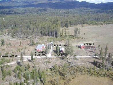
If you are approaching the cabin from the north (McCall), drive approximately 9 miles south on State Highway 55. Paddy Flat Road will be a left turn (east). This is Forest Road #388. Follow road #388 approximately 5 miles to Paddy Flat Summit. At the summit take Forest Road #389, which is a slight turn to the right. Follow Forest Road #389 approximately 3 miles to the Paddy Flat Guard Station.
If you are driving from the south, Paddy Flat Road will be a right turn approximately 3 miles north of the town of Donnelly. Again, this will be Forest Road #388 heading east. Follow #388 to Paddy Flat Summit, veer right onto Forest Road #389 and continue on to the guard station.
Phone
208-634-0400
Activities
CAMPING
Keywords
PADDY FLAT GUARD STATION,PADDY FLAT
Related Link(s)
Overview
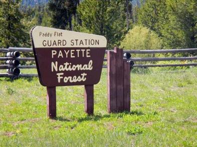
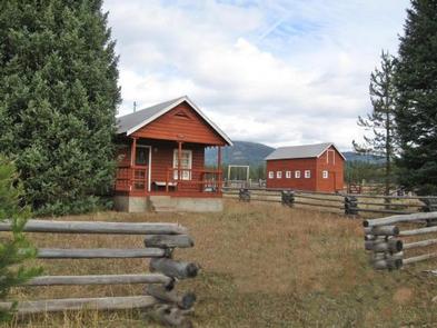
The Paddy Flat Guard Station is located in the Payette National Forest of central Idaho. Guests enjoy the remote area for its hunting opportunities and abundance of hiking, biking, horseback riding and off-highway vehicle roads and trails. Abundant streams and numerous alpine lakes within travel distance offer fantastic fishing opportunities.
Recreation
The Paddy Flat Guard Station serves as an excellent jumping-off point for adventures via horseback, motorcycle, ATV or hiking. Numerous trailheads within a few miles allow access to alpine lakes for fishing, meadows for watching birds and wildlife, as well as peaks ranging as high as 8,681 foot elevation for excellent views of the South Fork of the Salmon River drainage.
Facilities
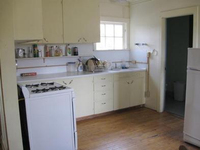
There is adequate room on site for two RVs, as well as up to two tents. Parking is available for one, four-horse stock trailer if you bring your horses (up to four head of pack and saddle stock are allowed). Kitchen utensils such as a coffee pot, frying pans, and silverware are not provided, so please bring your own. Firewood gathering is available in the forest areas surrounding the Paddy Flat Guard Station, although none is available on site.
Natural Features
This cabin sits at an elevation of 5,250 feet and is situated within a scenic meadow surrounded by a dense conifer forest. The Payette National Forest contains some of Idaho’s most beautiful and diverse country. Located in west-central Idaho, north of Boise, the 2.2 million-acre forest extends 100 miles west to east, from Hells Canyon to the Middle Fork of the Salmon River, and 70 miles north to south, from the Salmon River to the Weiser River.
Nearby Attractions
While the Paddy Flat Guard Station is located within some of the most scenic forest areas of Idaho, you may find a desire to visit "civilization" during your visit. If you hanker for a pizza, hot lunch or subway sandwich, the town of Donnelly is just a bit of back-tracking away. While you are there, take some time to explore the historic town of Roseberry or take the ten mile drive to Gold Forks Hot Springs for a relaxing dip in their pools. While McCall is a bit further of a drive north, a walk through downtown is always a fun way to while away the afternoon. Spend some time on the waterfront, take in a local museum, visit Ponderosa State Park, or take a tour through the McCall Fish Hatchery.


