
Directions
From Redding, CA, drive 19 miles west on Highway 299. Turn left on Crystal Creek Road and follow it for 3.5 miles to the campground. The campground will be on the left-hand side of the road down an unpaved driveway.
Phone
530-242-3412
Activities
BIKING, BOATING, CAMPING, FISHING, HIKING
Keywords
Related Link(s)
California State Road Conditions
Overview
This tent-only campground is located in the northwest corner of Whiskeytown National Recreation Area, 19 miles west of Redding, California, and three and a half hours north of Sacramento. Crystal Creek flows alongside each campsite. The campground stays relatively cool due to the creek and to the shade given by a canopy of fir, maple and pine. Three nearby trails lead to lovely waterfalls.
The cool, clear waters of Whiskeytown Lake provide endless water activities. The picturesque mountain setting and extensive forested backcountry offer ample opportunities for hiking and biking.
Recreation
During the summer heat, swimming, kayaking, sailing, paddle boarding and water skiing are popular on the 3,200 acre lake. Year round, hiking, mountain biking, horseback riding, gold panning, fishing and picnicking attract visitors. Hunting is allowed in the appropriate season.
Facilities
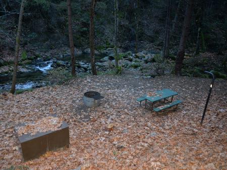
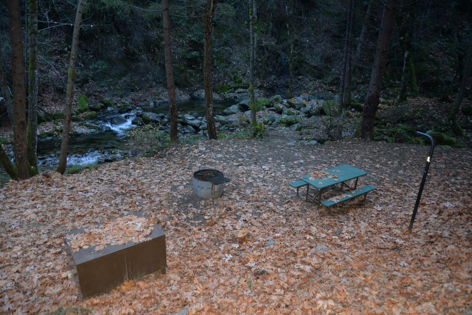
Crystal Creek is a tent-on-the-ground only campground. Each campsite is equipped with a picnic table, a large bear-resistant storage locker, a metal fire pit with a swing-arm barbecue grill and a lamp pole. The campground has two campsites both of which share one vault toilet. Drinking water and electricity are not available.
Due to a steep unpaved entrance road, towing vehicles is prohibited in this campground. The following are prohibited: all trailers, fifth wheels, pop-up campers, cab-over campers and motorhomes. Sleeping in vehicles is not allowed. No overflow parking is available.
Natural Features
The heavy forest canopy and burbling year-round creek make Crystal Creek Primitive Campground an ideal location for a peaceful retreat.
Whiskeytown National Recreation Area is located where the Klamath Mountains, Cascade and Coast Mountain Ranges, and the Sacramento Valley meet, creating a wide variety of wildlife and landscapes.
Nearby Attractions
The Tower House Historic District is located within the recreation area less than five miles from Crystal Creek Primitive Campground. Learn about the California Gold Rush history of the area by strolling among the historic buildings, water ditches, and a former gold mine, or by panning for gold or attending an interpretive program at the site.
Oak Bottom is located eight miles from the campground and features beaches, lakeside picnicking, and a full-service marina with boat rentals.