
Directions
From Las Vegas, St. George or other points south on Interstate 15: Travel north to Exit 16, towards Hurricane. Follow State Route 9 east for 12 miles to La Verkin and turn right to continue on State Route 9 towards Zion National Park. After passing through Springdale, arrive at South Entrance of Zion. Take the second right after the entrance station. Stop at campground kiosk and speak with hosts to check-in and for directions to your campsite. From Salt Lake City, Interstate 70 or other points north on Interstate 15: Travel south to Exit 27, towards Toquerville. In 6.1 miles turn left onto State Route 9 towards Zion National Park. After passing through Springdale, arrive at South Entrance. Take the second right after the entrance station. Stop at campground kiosk and speak with hosts to check-in and for directions to your campsite. From Grand Canyon National Park, Lake Powell, Kanab or other points south on U.S. 89: Travel north to State Route 9. Turn left and follow State Route 9 west for 13 miles to the East Entrance of Zion National Park. Continue straight for 12 miles, then turn left at the sign for South Campground. Stop at campground kiosk and speak with hosts to check-in and for directions to your campsite. From Bryce Canyon National Park, Panguitch or other points north on U.S. 89: Travel south to State Route 9. Turn right and follow State Route 9 west for 13 miles to the East Entrance of Zion National Park. Continue straight for 12 miles, then turn left at the sign for South Campground.Stop at campground kiosk and speak with hosts to check-in and for directions to your campsite.
Phone
435-772-3256
Activities
CAMPING, HIKING, DAY USE AREA
Keywords
None
Related Link(s)
Overview
Reservations for South Campground are available up to 14 days before your arrival and may extend up to two days beyond this 14-day booking window.
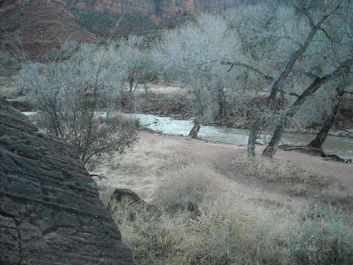
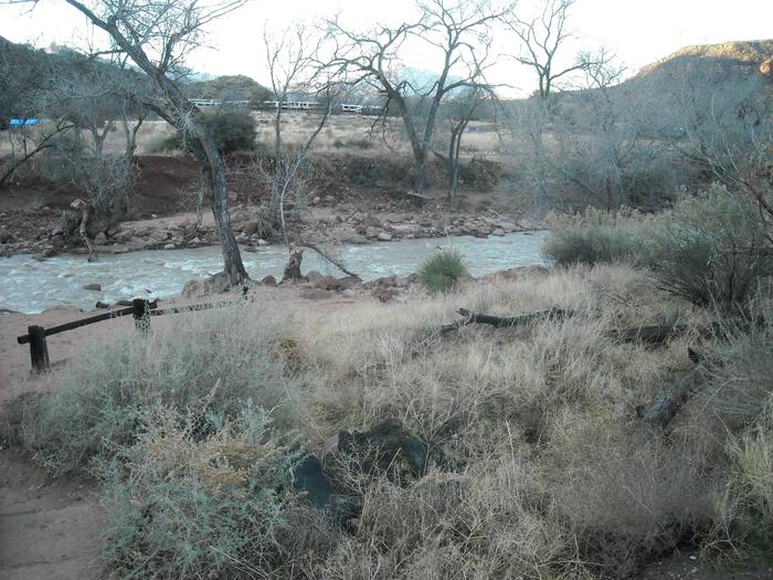
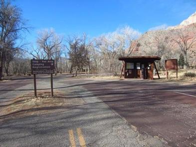
For visitors to Zion National Park, South Campground is an ideal place to stay. Located near the park’s south entrance, the campground is just a short walk from the main visitor center, the Zion Canyon Shuttle System and the adjacent town of Springdale. The canyon and most of the park’s trails are only accessible by shuttle bus from approximately the end of February until the end of November each year.
Season Dates: South Campground is open from early March to the end of October. Reservations are available up to 14 days before your arrival. For example, if you want to make a reservation for March 14 to 16, you may book this reservation beginning on March 1. Reservations that extend beyond the 14 day booking window cannot be altered.
For reservations more than 14 days ahead of arrival, please check Watchman Campground which offers reservations six months in advance of arrival.
Recreation
Hikers can access three trails directly from the facility: the Watchman Trail, a moderate trail that ascends the peak behind the campground; the Archeology Trail, which offers a light hike to an archeological site; and the Pa’rus Trail, a paved walking and biking trail that runs alongside the river, and the only trail in the park that allows dogs. The Zion visitor center and the park shuttles are a short walk from the campground. Many popular rock climbing routes are within a short shuttle bus ride into the main canyon. Use of OHVs and ATVs is prohibited in Zion National Park.
Facilities
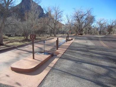
Flush toilets, drinking water, picnic tables, firepits and a dump station are provided at this facility. Four group sites are available that can accommodate RVs and tents. There are no hook-ups in this campground. Generators can be used during specific hours.
Natural Features
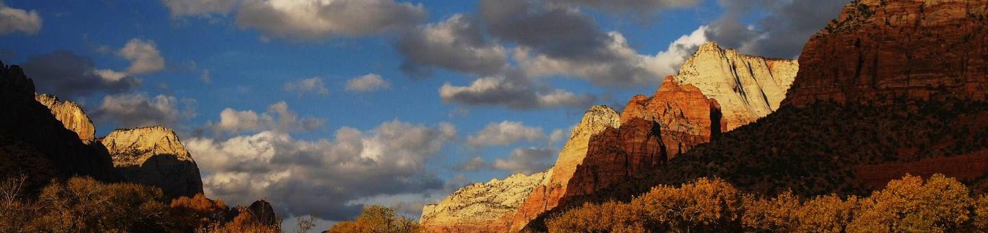
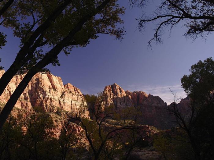
Zion is known for its dynamic geologic history. The South Campground and Amphitheater were built by the Civilian Conservation Corp in the early 1930s. The project was completed and opened to the public in the spring of 1935. The Virgin River, a narrow but powerful river that has carved out the canyon over time, runs adjacent to the site. Cottonwood trees surrounding the campsite turn golden in the fall. Although the campground is moderately forested, most of the campsites are in partial to full sun but visitors can cool off in the cold river when temperatures peak during summer. Be Advised: The months of April and May bring an unusual infestation of Tent Caterpillars, which fall from trees onto tents, tables, and unsuspecting campers and can make it quite uncomfortable to sit outside. The months of July and August in particular bring a higher concentration of ants in the campsites, which seem to come out especially after the monsoons, but are present all summer long. August and September bring yellowjackets. Insecticidal treatment by visitors is not permitted.
Nearby Attractions
The town of Springdale has shopping, art galleries, shower facilities, restaurants. equipment rental businesses, gas stations, markets, bike rentals, library and health clinic.
Charges & Cancellations
A $10.00 service fee will apply if you change your reservation. Cancellations more than 48 hours in advance of arrival date incur a $10 cancellation fee. Within 48 hours of arrival, a $10 cancellation fee and the first night’s fee are charged.