
Directions
From Watersmeet, Michigan: Travel approximately 3.5 miles west on US Highway 2 to Country Road 535. Turn left (south) onto County Road 535 and travel approximately 4 miles to the Sylvania Recreation Area entrance. From the Sylvania Recreation Area entrance, follow the signs to the Clark Lake day use area.
Phone
906-358-4724
Activities
PICNICKING
Keywords
Related Link(s)
Michigan State Road Conditions
Overview
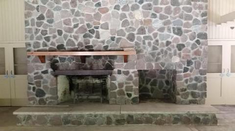
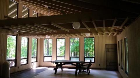
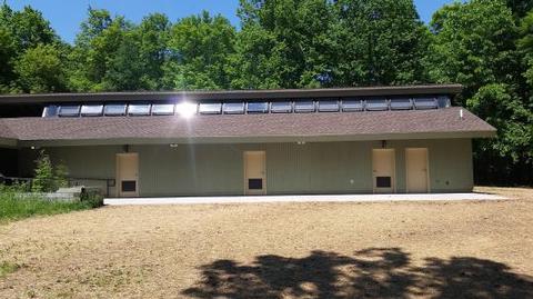
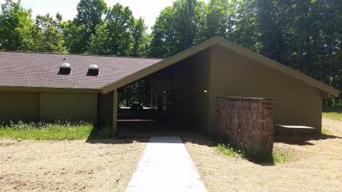
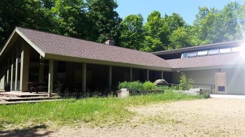
The Clark Lake Pavilion, located within the Clark Lake day use area, sits in a beautiful north woods setting; at the north end of Clark Lake. The pavilion provides a large indoor gathering area complete with picnic tables, limited seating and a fireplace.
Recreation
Clark Lake day use area, Clark Lake campground, and the Sylvania Wilderness provide visitors with a multitude of opportunities to enjoy picnicking, paddling, fishing, hiking, swimming, camping and the solitude of wilderness. With more than 30 named lakes, 26 miles of hiking trails, and 50 backcountry campsites on the wilderness landscape there are no shortage of hiking, paddling, and camping opportunities throughout the area. The Clark Lake campground is just a short drive from the pavilion and provides an overnight camping option for those wishing to camp in the area.
Facilities
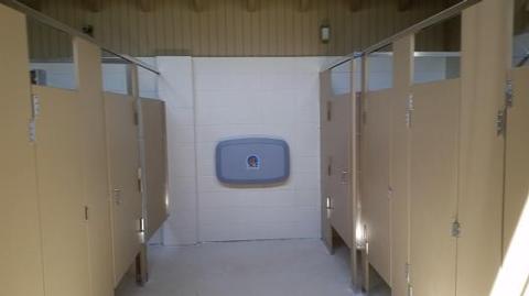
The Clark Lake day use area offers a large outdoor picnic area complete with picnic tables and grills, a beautiful sandy beach, as well as an enclosed pavilion with a fireplace. Co-located within the pavilion are flush toilets and shower facilities. Nearby, the Clark Lake campground offers four camping loops with a total of 48 campsites, paved access roads, pressurized water system, flush toilets and a trailer dump station. There are canoe access landings at the north end of Crooked Lake and Clark Lake to access paddling opportunities within the wilderness.
Natural Features
The Clark Lake pavilion sits just outside the Sylvania Wilderness boundary at the north end of Clark Lake. Clark Lake is a crystal clear lake with a natural sandy shoreline, providing excellent swimming and outdoor picnic opportunities just a short walk from the pavilion.
Sylvania Wilderness encompasses 18,327 acres of primitive lands and is part of the National Wilderness Preservation System. With its untouched, virgin timber still standing tall, Sylvania looks and feels today like it did when it was first discovered. Sylvania Wilderness welcomes the new and returning visitor with towering, ancient trees, the lonesome call of loons and soft pine needles underfoot. A staggering 4,000 acres of this wilderness is covered by water.
Nearby Attractions
The Wilderness Lakes Trails system encompasses 38 miles of bike and pedestrian trails that traverse Michigan and Wisconsin, as well as encircling Sylvania Wilderness. This trail system provides a multitude of riding and pedestrian opportunities and has something for everyone. The Land O’ Lakes cross country ski trails, adjacent to Sylvania Wilderness, offer approximately 6.5 miles of groomed ski trail. Whether you are an expert skier, or a beginner, you’re sure to find a favorite trail that lets you enjoy the great outdoors all winter long. The almost one million acres of the Ottawa National Forest are located in the Western Upper Peninsula of Michigan. The forest extends from the south shore of Lake Superior to the Wisconsin border. The area is rich in wildlife viewing opportunities; breathtaking views of rolling hills dotted with lakes, rivers and waterfalls; and spectacular fall colors.