OUTLET PARK (KS), KS Campground Reservation, Info, Images, Map, Directions

OUTLET PARK (KS), Kansas Campground Images, Info & Reservations

Listen

Directions

Take I-70 to exit 295, then 4.5 miles north to Hwy. 57, then east approximately 3.2 miles to park entrance.

Phone

785-238-5714

Activities

CAMPING, WILDLIFE VIEWING, SWIMMING SITE

Keywords

Related Link(s)

Rec Area Info & Images

Kansas State Road Conditions

Kansas State Tourism

Overview

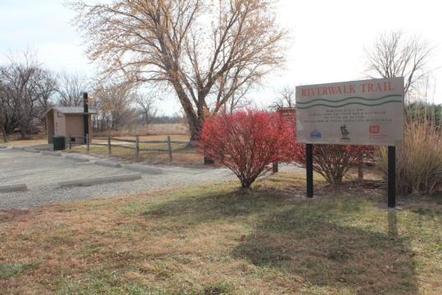
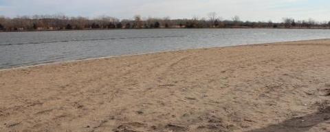
Outlet Park is a day use park at Milford Lake located just below the Milford Dam. With one shelter available for reservation, those visitors interested in angling and wildlife observation will enjoy its location near the Outlet Pond, a popular fishing pond and wildlife attractor. Inside the park is also a swim beach, great fishing areas and access to the Riverwalk Trail.

Click here for the Milford Lake Virtual Tour.

Recreation

Activities at Milford Lake include boating, swimming, fishing, hunting, hiking, wildlife viewing and biking. Milford Lake is known to have great sail boating opportunities as well.

Facilities

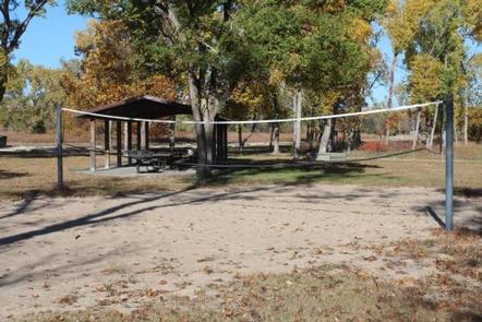
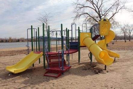
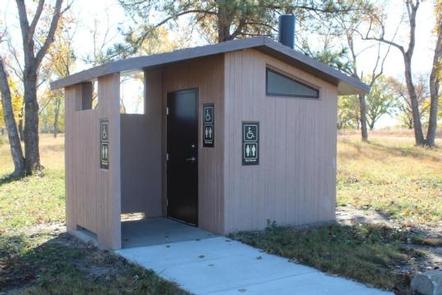
The shelter has a vault toilet and grill available for use and also has a playground, horseshoe pit and sand volleyball court nearby. The shelter is located by a fishing pier which offers great fishing access.

Natural Features

Milford Lake is nestled on the edge of the Kansas Flint Hills and is fed by the Republican River. Milford Lake stands as the largest man-made lake in Kansas, with a surface area of 15,700 acres and 163 miles of shoreline. Milford Lake is also the home of the states third largest wetland and is known to a variety of wildlife.

Nearby Attractions

The Milford Nature Center and Fish Hatchery is nearby just below the dam. There you can find live animal exhibits as well as learn about the ecosystems of Kansas. A golf course is adjacent to the nature center on the north end of the Dam and the town of Junction City is approximately five miles from North Overlook Shelter.

Reservation

More from CampingHiking.net:

DELTA, Oregon Campground Images, Info & Reservations

Listen Directions Located 51 miles from Eugene OR on HWY 126 to the Cougar Reservoir turn off. Take a right turn (south) on Aufderheide Drive and cross the McKenzie River, turn right on to the campground entrance road Forest Road 400. Follow the road approximately 1 mile to the campground.

Lone Mesa Group Sites, Utah Campground Images, Info & Reservations

Listen Directions From Moab, drive nine miles north on Hwy 191 to the intersection with Hwy 313. Turn west on Hwy 313 and drive eight miles then turn right on the Dubinky Road and go approximately 200 yards to the campground entrance road. Turn right and proceed up a small

LITTLE SHAHEEN CABIN, Alaska Campground Images, Info & Reservations

Listen Directions Access to the cabin is by float plane or canoe with portage. It is about a 45-minute flight from Juneau. By canoe and portage, it is about 10 miles from Mole Harbor. Click here for for information about Admiralty Island Canoe Route and portage. This cabin is in

ZIPS PLACE CABIN, Montana Campground Images, Info & Reservations

Listen Directions From Hungry Horse, travel east on U.S. Highway 2 for 48 miles, to mile marker 191. Travel south on Geifer Greek/Lodgepole Lane (a gravel road that veers left initially). Follow the signs to the cabin. During the winter months or when the road conditions are impassable, renters must

SOUTH CAMPGROUND, Oregon Campground Images, Info & Reservations

Listen Directions From Bend, travel 35.5 miles southwest on Cascade Lakes Hwy (46), then 1.3 miles east on Forest Road 4625. South Campground will come up on the right side first and then Mallard Marsh. Phone 541-323-1746 Activities CAMPING Keywords Related Link(s) Rec Area Info & Images Oregon State Tourism