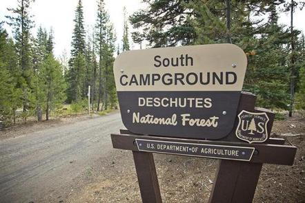
SOUTH CAMPGROUND, Oregon Campground Reservation, Info, Images, Map, Directions

SOUTH CAMPGROUND, Oregon Campground Images, Info & Reservations

Directions

From Bend, travel 35.5 miles southwest on Cascade Lakes Hwy (46), then 1.3 miles east on Forest Road 4625. South Campground will come up on the right side first and then Mallard Marsh.

Phone

541-323-1746

Activities

CAMPING

Keywords

Related Link(s)

Rec Area Info & Images

Oregon State Tourism

Oregon State Road Conditions

Overview

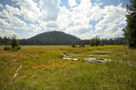
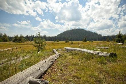
Located WITHIN OREGON on Hosmer Lake, South Campground provides visitors with access to flyfishing, paddling and hiking.

Recreation

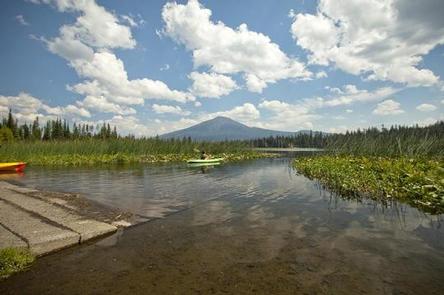
Nearby Hosmer Lake offers opportunities for fly fishing and boating as well as spectacular views. There are also trails and other opportunities for hiking and horseback riding.

Facilities

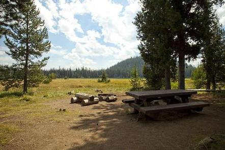
This facility has vault toilets and each site is equipped with a picnic table and fire pit with grill. Please note campers will need to bring their own water supply. There is also a boat ramp that provides access to Hosmer Lake. Boat launch parking is for day use only and requires a recreation fee separate from camping fees.

Natural Features

At the north end of Hosmer Lake, water drains into a porous rim of lava. Hosmer is a fly fishing only lake well known for its breath taking views of Mt. Bachelor, South Sisters, Broken Top as well as wildlife viewing and the big Atlantic salmon, brook trout and rainbows that are quite visible in this shallow clear lake. The best way to experience this lake is by canoe or kayak as shore access is limited due to marshy vegetation.

Nearby Attractions

Visitors enjoy traveling the Cascade Lakes Scenic Byway which climbs 66-miles through the Cascade Range, weaving past snow-capped peaks and alpine lakes.

Reservation

More from CampingHiking.net:

DAM SITE RIVER (BEAVER LAKE), Arkansas Campground Images, Info & Reservations

Directions From Eureka Springs, Arkansas, take Highway 62 West and travel just over 4 miles. Turn left on Highway 187 and continue for about 6 miles. Take the first right after crossing the dam and follow signs to the campground. Phone 479-253-9865 Activities BOATING, CAMPING, FISHING, HIKING, WATER SPORTS, SWIMMING

COUGAR PEAK LOOKOUT, Montana Campground Images, Info & Reservations

Directions From Thompson Falls, Montana, travel west on Highway 200 for about a mile. Before crossing the Clark Fork River bridge, turn right onto Blue Slide Road and continue about 8 miles, to the junction with Forest Road 403. Turn right and travel about 14 miles to the lookout. Maps

WHEELER GORGE, California Campground Images, Info & Reservations

Directions From Ventura, take Highway 33 north about 14 miles. Turn left, continuing on Highway 33 for another 8 miles to the campground. From Los Angeles, take I-5 north, then turn west onto Highway 126 for about 28 miles, to Santa Paula. Continue north on Highway 150 for 16 miles.

CROCKER GUARD STATION, California Campground Images, Info & Reservations

Directions From Portola, CA, travel east on Highway 70 for five miles to Beckwourth, CA. Travel north on County Road 111 (Beckwourth-Genesee Road) for six miles. Crocker Guard Station is on the left. Phone 530-832-1076 Activities CAMPING, FISHING, HIKING Keywords Related Link(s) Rec Area Info & Images California State Road

SALT LICK CREEK, Tennessee Campground Images, Info & Reservations

Directions From Carthage, go 4 miles west on SR-25, then north on SR-80, then east on SR-85 to Gladice. Turn right on Smith Bend Road and follow signs. Phone 931-678-4718 Activities BOATING, CAMPING, INTERPRETIVE PROGRAMS, FISHING, WILDLIFE VIEWING, WILDERNESS, SWIMMING SITE, PHOTOGRAPHY, PADDLING, SWIMMING, MOTOR BOAT, PADDLE BOATING, WATER ACTIVITIES,