PELICAN POINT LANDING AND CAMPGROUND, ND Campground Reservation, Info, Images, Map, Directions

PELICAN POINT LANDING AND CAMPGROUND, North Dakota Campground Images, Info & Reservations

Listen

Directions

From Interstate 94, take Highway 281/52 north for 6 miles. Watch for Pelican Point Landing signs.

Physical address:
8310 28th Street SE, Jamestown ND.

Phone

701-368-1365

Activities

CAMPING

Keywords

Smokey’s Landing and Campground

Related Link(s)

Rec Area Info & Images

North Dakota State Tourism

North Dakota State Road Conditions

Overview

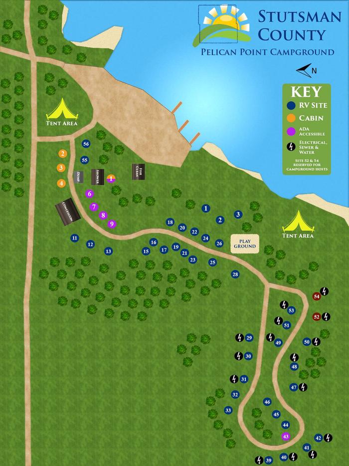
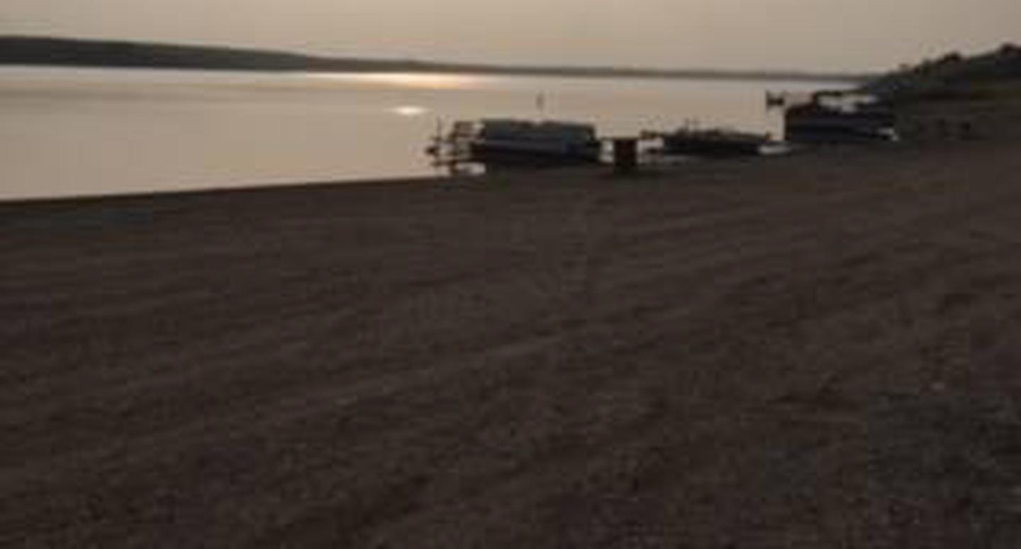
Pelican Point Landing and Campground is located on the west shore of picturesque Jamestown Reservoir. This lake provides opportunities for all types of water activities in a native prairie setting.

Recreation

Jamestown Reservoir offers numerous recreational opportunities. Water enthusiasts can enjoy boating, water skiing, canoeing, fishing and swimming. This family-friendly area also has playground equipment, sand volleyball, a fishing pier and covered picnic shelters.

Facilities

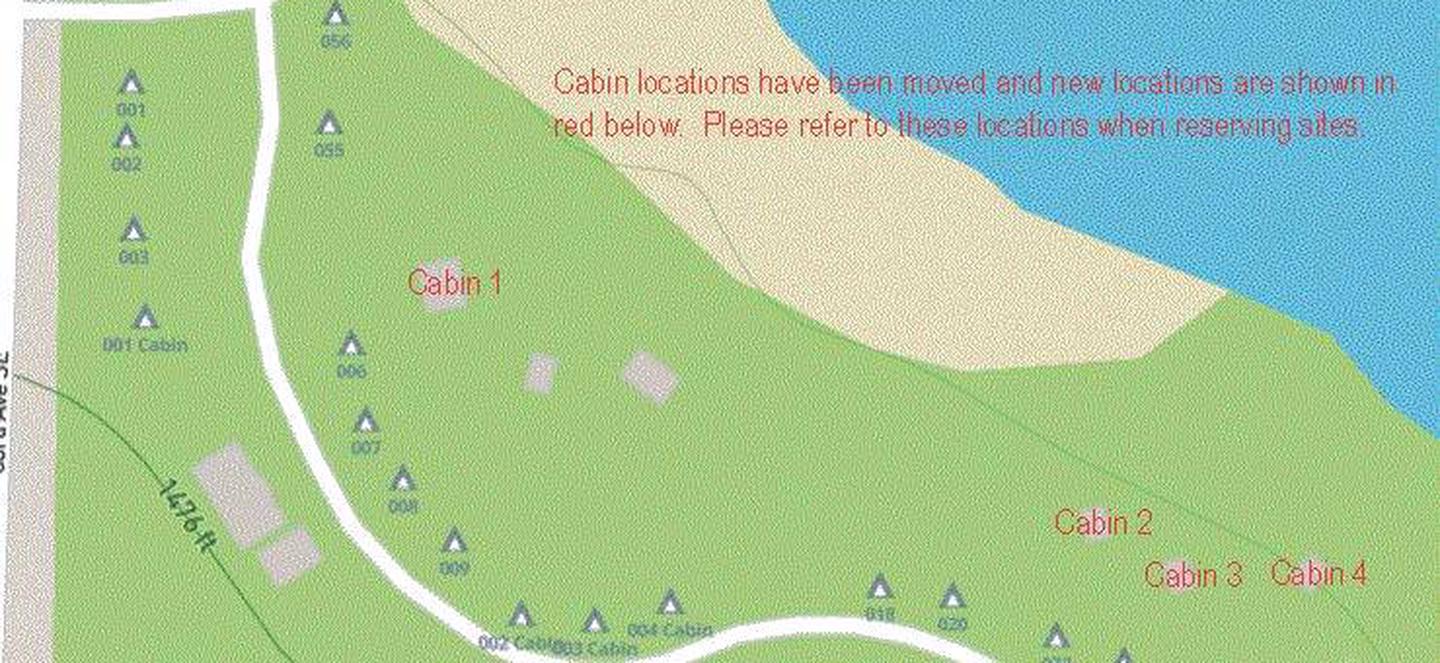
Pelican Point campground has 56 RV sites all with electrical and water hook-ups. Some sites also have sewer hook-ups. There are four sites with concrete pads and parking for visitors with accessibility needs. Picnic tables and campfire rings are available at all sites. In addition to the RV sites, there are many primitive tent locations as well as four sleeping cabins.

Pit toilets are located throughout the campground. The bathhouse has flush toilets and shower facilities. A fish cleaning station is available. Two covered shelters can be used for group activities.

The full-service concession building offers home-cooked meals, snacks, fuel, ice, bait, firewood, “off-sale” beer and other supplies. Visitors can enjoy a meal indoors or outside on the patio. The building also has public restrooms.

Natural Features

Facing the shoreline of Jamestown Reservoir, the campground is nestled in woody draws which are a unique feature of the North Dakota landscape and support naturally growing trees and shrubs. The woody draws meld into grasslands of the North American Plains providing habitat for many wildlife species.

Nearby Attractions

A short drive is all it takes to access other recreation opportunities. Hikers and mountain bikers will find over 28 miles of trails. There is a 2-mile long paved multi-use path, Little Britches Fishing Pond and an OWLS trail at the south end of Jamestown Reservoir.

The City of Jamestown is just 6 miles away and offers restaurants, movie theaters, tourist attractions and shopping.

Reservation

More from CampingHiking.net:

SANTIAM FLATS CAMPGROUND, Oregon Campground Images, Info & Reservations

Listen Directions Travel 2.6 miles northeast of Detroit, Oregon. From Detroit, follow Highway 22 east for 2.6 miles to Blowout Road/Forest Service Road 10 on the right. Santiam Flats Campground in on the right. Phone 503-854-3366 Activities BOATING, FISHING, HIKING, SWIMMING, WATER ACTIVITIES Keywords Related Link(s) Rec Area Info &

ST LUCIE SOUTH, Florida Campground Images, Info & Reservations

Listen Directions From I-95, take Exit 101 (Stuart/Indiantown), following SR 76 W for 0.5 miles to Locks Road. Turn right onto Locks Road for 1.3 miles to SW Canal Street and turn left into the campground. Phone 772-287-1382 Activities BOATING, CAMPING, FISHING, HIKING, VISITOR CENTER, DAY USE AREA, CANOEING, BIRDING

BUCKHORN, California Campground Images, Info & Reservations

Listen Directions From Interstate 5, take the Black Butte Lake exit at Orland, CA. Travel west on County Road 200/Newville Road for 12 miles. Turn left on Buckhorn Road and enter the Buckhorn Recreation area. Phone 530-865-4781 Activities BIKING, BOATING, CAMPING, FISHING, HIKING, WILDLIFE VIEWING, SWIMMING SITE Keywords BHOR,BLACK BUTTE

Webb Creek Park, Missouri Campground Images, Info & Reservations

Listen Directions From Ellington, MO, travel south on MO 21 for 2.6 miles to Route H. Route H ends in the park. Phone 573-223-7777 (CLEARWATER LAKE PROJECT OFFICE) 573-461-2282) Activities BOATING, CAMPING Keywords Related Link(s) Rec Area Info & Images Missouri State Tourism Missouri State Road Conditions Overview Webb Creek

CLARK LAKE PAVILION, Michigan Campground Images, Info & Reservations

Listen Directions From Watersmeet, Michigan: Travel approximately 3.5 miles west on US Highway 2 to Country Road 535. Turn left (south) onto County Road 535 and travel approximately 4 miles to the Sylvania Recreation Area entrance. From the Sylvania Recreation Area entrance, follow the signs to the Clark Lake day

LEWIS CANYON, Arizona Campground Images, Info & Reservations

Listen Directions Drive to Pinedale, Arizona, on State Highway 260, approximately 14 miles northwest of Show Low. Turn south on Forest Road 130 and continue approximately 2.3 miles to Junction 130A. Turn right to the group site, following the signs.  Phone 928-368-2100 Activities BIKING, CAMPING, HIKING Keywords LEWI,APACHE-SITGREAVES NF-FS Related