Grandview Playground Shelter, WV Campground Reservation, Info, Images, Map, Directions

Grandview Playground Shelter, West Virginia Campground Images, Info & Reservations

Directions

To reach Grandview from Beckley follow I-64 East five miles to Exit 129 B. From Lewisburg follow I-64 West forty miles to Exit 129. From either exit, turn right and follow Route 9 North six miles to Grandview.

Phone

304-465-0508

Activities

HIKING, PICNICKING, DAY USE AREA

Keywords

.

Related Link(s)

Rec Area Info & Images

West Virginia State Tourism

West Virginia State Road Conditions

Overview

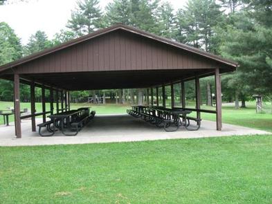
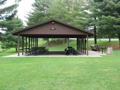
The Playground Picnic Shelter is the main shelter at Grandview. It is closest to the main playground and ball fields, located just past the amphitheater.

Recreation

The Grandview area of New River Gorge National River features five hiking trails, overlooks, a seasonal visitor center, ranger-led activities, summer outdoor dramas (Theatre West Virginia), playgrounds, volleyball court, baseball field, and basketball court.

Facilities

The Playground Picnic Shelter at Grandview is the largest and can accommodate up to 200 people. It is ideal for large family reunions or picnics. It offers a covered eating area, three charcoal grills, and six electrical outlets. Restrooms and drinking fountain are nearby.

Natural Features

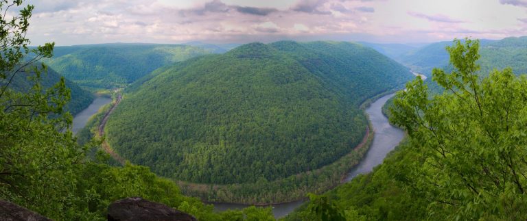
Grandview became part of New River Gorge National River in 1990, after more than 50 years as one of West Virginia’s most popular day use state parks. The area offers spectacular views of the New River and stunning displays of rhododendron. At the Main Overlook, 1,400 feet above the river, you see an active railway and the town of Quinnimont, where coal companies first shipped coal out of the gorge in 1873.

Nearby Attractions

The city of Beckley is approximately 12 miles from Grandview and offers a wide variety of shopping, restaurants, and hotels. Popular attractions include a children’s museum and Exhibition Coal Mine.

Reservation

More from CampingHiking.net:

ELK CREEK CAMPGROUND (SAWTOOTH NF), Idaho Campground Images, Info & Reservations

Directions From Stanley, Idaho, take State Highway 21 west approximately 8 miles. Turn north at milepost 123 onto Forest Road 892 and follow the road to the campground. Phone 928-537-8888 Activities BIKING, CAMPING, FISHING, HIKING, WILDLIFE VIEWING Keywords ELK2,ELK CREEK CAMPGROUND IDAHO,SAWTOOTH NF – FS Related Link(s) Rec Area Info

Simax Group Camp, Oregon Campground Images, Info & Reservations

Directions From Highway 58, turn south at Crescent Lake Junction on Forest Service Road 60. Travel 2.2 miles to the junction with Forest Service Road 6005. Continue a mile south, following signs. Phone 541-323-1746 Activities CAMPING Keywords SIMA,DESCHUTES NF – FS Related Link(s) Rec Area Info & Images Oregon State

MOUNTAIN PARK, Colorado Campground Images, Info & Reservations

Directions From Fort Collins, travel west on Colorado Highway 14, to Ted’s Place, and continue up the Poudre Canyon to mile marker 98.8. Phone 970-295-6700 Activities BIKING, BOATING, CAMPING, FISHING, HIKING, WATER SPORTS, WILDLIFE VIEWING, BIRDING, RAFTING, WHITEWATER RAFTING Keywords MOUT,POUDRE RIVER,CACHE LA POUDRE RIVER,ARAPAHO AND ROOSEVELT NF – FS

Windwhistle Group Site, Utah Campground Images, Info & Reservations

Directions From Moab, drive 32 miles south on 191 to the junction with the Needles Overlook road. Turn right and travel 6 miles on this road. The campground is on the left hand side of the road. Phone 435-259-2100 Activities AUTO TOURING, CAMPING, STAR GAZING Keywords Related Link(s) Rec Area

SHELL CREEK, Wyoming Campground Images, Info & Reservations

Directions Located 32 miles east of Greybull, Wyoming, on U.S. Highway 14. Turn off onto Paintrock Lakes Road (Forest Road 17). Shell Creek Campground is 1.5 miles from the turnoff. Phone 406-587-9054 Activities BIKING, CAMPING, FISHING, HIKING, HORSEBACK RIDING, WILDLIFE VIEWING Keywords SHEL,BIGHORN NF – FS Related Link(s) Rec Area