West Virginia Camping - Campground Reservations ⋆ CampingHiking.net
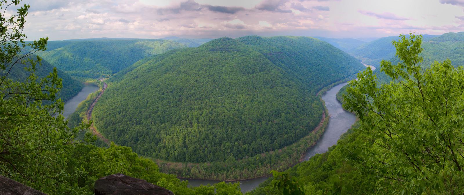
West Virginia Camping – Campground Reservations

Grandview Playground Shelter

Want to go camping in West Virginia? View West Virginia campgrounds below, listed in alphabetical order. Each West Virginia campsites listing has an image gallery, location map, directions, nearby activities, phone number, and access to online West Virginia camping reservations.

BATTLE RUN, West Virginia Campground Images, Info & Reservations

Directions From U.S. Highway 19, turn west on State Route 129 and travel 3 miles to the campground. Phone 304-872-3459 Activities BIKING, BOATING, CAMPING, FISHING, HIKING, PHOTOGRAPHY, MOTOR BOAT, KAYAKING Keywords BATT,SUMMERSVILLE LAKE,SUMMERSVILLE LAKE Related Link(s) Rec Area Info & Images West Virginia State Road Conditions West Virginia State Tourism Overview Battle Run Campground is conveniently located just south of Summersville, West Virginia, on the shores of the largest lake in the state. Superb water quality and sheer sandstone cliffs

BIG BEND (WV), West Virginia Campground Images, Info & Reservations

Directions Follow 28/55 from Petersburg, West Virginia, for 8 miles. Turn left onto Smoke Hole Road, Route 28/11, and travel for 13 miles to County Route 2. Turn left onto the Smoke Hole Road, County Route 2, and follow for approximately 3 miles to Big Bend Campground. Phone 304-358-3253 Activities BOATING, CAMPING, FISHING, HIKING, HUNTING, KAYAKING, CANOEING Keywords BIGB,JESS JUDY CAMPGROUND,JESS JUDY GROUP CAMP,MONONGAHELA NF -FS Related Link(s) Rec Area Info & Images West Virginia State Tourism Forest Service Concessionaire

BLUE BEND REC AREA, West Virginia Campground Images, Info & Reservations

Directions From White Sulphur Springs, travel 8 miles north on State Route 92. Turn left (west) at Alvon, West Virginia, onto State Route 16. Travel 4 miles to the recreation area. Phone 304-536-2144 FOR DISTRICT OFFICE AND 304-536-1440 FOR CAMPGROUND FROM MAY TO AUGUST Activities CAMPING, FISHING, HIKING, WILDLIFE VIEWING, SWIMMING SITE Keywords BLUE,MONONGAHELA NF -FS Related Link(s) Rec Area Info & Images West Virginia State Tourism West Virginia State Road Conditions Overview Blue Bend Recreation Area is a quaint

BLUE MEADOW, West Virginia Campground Images, Info & Reservations

Directions From White Sulphur Springs, travel 8 miles north on State Route 92. Turn left (west) at Alvon, West Virginia, onto State Route 16. Travel 4 miles to the recreation area. Phone 304-536-2144 Activities CAMPING, FISHING, HIKING, WILDLIFE VIEWING, SWIMMING SITE Keywords BLUM,MONONGAHELA NF -FS Related Link(s) Rec Area Info & Images West Virginia State Road Conditions West Virginia State Tourism Overview Blue Meadow is a group campground. In the event that this campground has not been reserved, it may

BLUESTONE LAKE PICNIC SHELTER, West Virginia Campground Images, Info & Reservations

Directions From Beckley, West Virginia, take Interstate 64 east to exit 139. Go south on State Route 20 to Hinton and turn right at the first stoplight. Follow Route 20 south and turn left across the New River Bridge. Turn right at the end of the bridge on State Route 3E. Make another right onto Miller Avenue and follow the road to Bluestone Dam. Phone 304-466-1234 Activities BIKING, BOATING, CAMPING, FISHING, HUNTING, WATER SPORTS Keywords BLUL,BELLPOINT PARK,AREA 1,BLUESTONE DAM,BALL PARK,BELLPOINT

BULLTOWN CAMP, West Virginia Campground Images, Info & Reservations

Directions From North of Charleston, WV and I-79, take Exit 67 (Flatwoods) and travel north on U.S. Highway 19 for 10 miles. Follow signs into campground. From Clarksburg, WV and I-79, take Exit 91 (Roanoke), travel south on U.S. 19 for 28 miles. Follow signs into campground. Physical Address: Bulltown Campground 1183 Bulltown Campground Road Napier, WV 26631 USA Phone (304) 452-8006 Activities BIKING, BOATING, CAMPING, HIKING, HUNTING, WATER SPORTS, WILDLIFE VIEWING, SWIMMING SITE Keywords BULT,BURNSVILLE LAKE,BURNSVILLE LAKE Related Link(s)

BURNSVILLE LAKE SHELTERS, West Virginia Campground Images, Info & Reservations

Directions To reach Picnic Shelters 1-4: From Clarksburg, drive south on I-79 to Exit 79 (Burnsville). Turn left and proceed through town until you reach a junction. Turn right onto Route 5 East. Follow approximately 2.5 miles. Turn right and enter the downstream area. For Shelter 1: Turn right and enter the downstream area; shelter is next to the restroom. For Shelter 2: Turn right and enter the downstream area; shelter is next to the playground and ball field directly

EAST FORK (WV), West Virginia Campground Images, Info & Reservations

Directions From I-64 in Huntington, WV take Exit 8, south on HWY 152 to Wayne, WV. Travel east on Route 37 for 19 miles and follow signs into the campground. Phone 304-849-5000 / 304-849-2355 Activities BIKING, BOATING, CAMPING, INTERPRETIVE PROGRAMS, FISHING, HIKING, HUNTING, SWIMMING, KAYAKING, CANOEING, WATER ACCESS, AMPHITHEATER Keywords EAFO,East Lynn Lake,EAST LYNN LAKE,East Fork Campground,EAST FORK CAMPGROUND Related Link(s) Rec Area Info & Images West Virginia State Tourism West Virginia State Road Conditions Overview East Fork Campground is

GERALD FREEMAN CAMPGROUND, West Virginia Campground Images, Info & Reservations

Directions From I-79, take exit 67. Turn right on WV-4 and go 1 mile. Turn left on WV-15 and travel 12 miles to the campground. Campground will be on your right. NOTE: GPS directions are not always accurate. Call for additional information. Phone 304-765-7756 OR 304-765-2816 Activities BIKING, BOATING, CAMPING, FISHING, HIKING, HUNTING, WILDLIFE VIEWING, WILDERNESS, SWIMMING, MOTOR BOAT, WATER ACTIVITIES, KAYAKING, WATER ACCESS, JET SKIING, WATER SKIING Keywords GERA,SUTTON LAKE,KANAWHA RUN,FREEMAN,SUTTON LAKE,GERALD FREEMAN CAMP Related Link(s) Rec Area Info

Grandview Playground Shelter, West Virginia Campground Images, Info & Reservations

Directions To reach Grandview from Beckley follow I-64 East five miles to Exit 129 B. From Lewisburg follow I-64 West forty miles to Exit 129. From either exit, turn right and follow Route 9 North six miles to Grandview. Phone 304-465-0508 Activities HIKING, PICNICKING, DAY USE AREA Keywords . Related Link(s) Rec Area Info & Images West Virginia State Tourism West Virginia State Road Conditions Overview The Playground Picnic Shelter is the main shelter at Grandview. It is closest to

Grandview Shelter 1, West Virginia Campground Images, Info & Reservations

Directions To reach Grandview from Beckley follow I-64 East five miles to Exit 129 B. From Lewisburg follow I-64 West forty miles to Exit 129. From either exit, turn right and follow Route 9 North six miles to Grandview. Phone 304-465-0508 Activities HIKING, PICNICKING, DAY USE AREA Keywords Grandview State Park Related Link(s) Rec Area Info & Images West Virginia State Tourism West Virginia State Road Conditions Overview Grandview Shelter #1 is a smaller shelter located on a hill just

Grandview Shelter 2, West Virginia Campground Images, Info & Reservations

Directions To reach Grandview from Beckley follow I-64 East five miles to Exit 129 B. From Lewisburg follow I-64 West forty miles to Exit 129. From either exit, turn right and follow Route 9 North six miles to Grandview. Phone 304-465-0508 Activities HIKING, PICNICKING, DAY USE AREA Keywords Grandview State Park Related Link(s) Rec Area Info & Images West Virginia State Road Conditions West Virginia State Tourism Overview Grandview Shelter #2 is a larger shelter located under the canopy of

Grandview Shelter 3, West Virginia Campground Images, Info & Reservations

Directions To reach Grandview from Beckley follow I-64 East five miles to Exit 129 B. From Lewisburg follow I-64 West forty miles to Exit 129. From either exit, turn right and follow Route 9 North six miles to Grandview. Phone 304-465-0508 Activities HIKING, PICNICKING, DAY USE AREA Keywords Grandview State Park Related Link(s) Rec Area Info & Images West Virginia State Tourism West Virginia State Road Conditions Overview Grandview Shelter #3 is a small shelter shaded by the canopy of

Grandview Shelter 4, West Virginia Campground Images, Info & Reservations

Directions To reach Grandview from Beckley follow I-64 East five miles to Exit 129 B. From Lewisburg follow I-64 West forty miles to Exit 129. From either exit, turn right and follow Route 9 North six miles to Grandview. Phone 304-465-0508 Activities PICNICKING, DAY USE AREA Keywords Grandview State Park Related Link(s) Rec Area Info & Images West Virginia State Tourism West Virginia State Road Conditions Overview Grandview Shelter #4 is a medium size shelter located under the canopy of

HORSESHOE RECREATION AREA, West Virginia Campground Images, Info & Reservations

Directions From Parsons, take State Route 72 northeast to State Route 5 to St. George. In St. George, turn south on State Route 1. Follow State Route 1 to the intersection of State Route 7. Turn left on State Route 7 and continue past the YMCA Camp Horseshoe to the Horseshoe Recreation Area entrance. Phone 304-478-2481 Activities CAMPING, FISHING, HUNTING Keywords HORR,MONONGAHELA NF -FS Related Link(s) Rec Area Info & Images Forest Service Concessionaire West Virginia State Tourism West Virginia

Howell Run Picnic Area, West Virginia Campground Images, Info & Reservations

Directions From Cumberland, MD, take US 220 south to US 50W, go west to WV 42N, go north to WV 46E. Follow the signs to the Howell Run Picnic Area. Phone 304 355-2346 Activities BOATING, CAMPING, FISHING, HIKING, PICNICKING, SWIMMING SITE, OTHER RECREATION CONCESSION SITE Keywords Jennings Randolph Lake,Picnic Area Related Link(s) Rec Area Info & Images West Virginia State Road Conditions West Virginia State Tourism Overview The Howell Run Picnic Area is a day use facility overlooking Jennings Randolph

JESS JUDY, West Virginia Campground Images, Info & Reservations

Directions Follow 28/55 from Petersburg, WV, for 8 miles. Turn left onto Smoke Hole Road, Route 28/11, and travel for 13 miles to County Route 2. Turn left onto Smoke Hole Road, County Route 2, and follow for approximately 2 miles. Jess Judy Campground will be on the right. Phone 304-358-3253 Activities BIKING, BOATING, CAMPING, FISHING, HIKING, MOUNTAIN BIKING Keywords JESS,MONONGAHELA NF -FS Related Link(s) Rec Area Info & Images West Virginia State Tourism Forest Service Concessionaire West Virginia State

ROBERT W CRAIG, West Virginia Campground Images, Info & Reservations

Directions From Cumberland, MD: Take US 220 south to US 50W, go west to WV 42N, go north to WV 46E. Follow the signs to the Robert W. Craig Campground. Phone 304-355-2346 Activities BOATING, CAMPING, FISHING, HIKING, WATER SPORTS, DAY USE AREA, OTHER RECREATION CONCESSION SITE Keywords ROBE,JENNING RANDOLPH LAKE,JENNINGS RANDOLPH Related Link(s) Rec Area Info & Images West Virginia State Road Conditions West Virginia State Tourism Overview The Robert W. Craig Campground is located off West Virginia State Highway

SENECA SHADOWS, West Virginia Campground Images, Info & Reservations

Directions From Elkins WV, take US 33 east 34 miles. Turn right into the campground. From Petersburg, WV, take State Hwy 28 south 22 miles. Turn right into the campground. From Franklin, WV, take US 33 west 24 miles. Turn left into the campground. Phone 304-567-3082 Activities BOATING, CLIMBING, CAMPING, FISHING, DAY USE AREA, SWIMMING SITE Keywords SENE,JESS JUDY,THE BIG BEND GROUP SITES,MONONGAHELA NF -FS Related Link(s) Rec Area Info & Images West Virginia State Tourism Forest Service Concessionaire West

STUART RECREATION AREA, West Virginia Campground Images, Info & Reservations

Directions From Elkins, West Virginia: Take Highway 219 to Highway 33. Travel east for approximately 4 miles, turn north on old Route 33 and travel for 2 miles. Turn left at Highway 6 (at the Stuart Recreation Area directional sign) and drive .25 miles to entrance. Phone 304-636-5070 Activities CAMPING, FISHING, HIKING, HUNTING, SWIMMING SITE Keywords STUA,STEWART PARK,STEWARTS PARK,STUART PARK,STUARTS PARK,MONONGAHELA NF -FS Related Link(s) Rec Area Info & Images Forest Service Concessionaire West Virginia State Road Conditions West Virginia

SUTTON LAKE PICNIC SHELTERS, West Virginia Campground Images, Info & Reservations

Directions Shelters 1, 2 and 3 are located at the Sutton Dam. From I-79, take Exit 62 toward Sutton/Gassaway. Turn left on SR-4, approximately 2 miles into Sutton. Turn right at the stop sign, cross the Elk River, and turn left to the dam. Shelters 4 and 5 are located in the Bee Run Day-Use Area. From I-79, take Exit 67 toward Flatwoods. Turn right on SR-4. Go 1 mile to SR-15 and turn left. Continue a mile to Bee

Trout Pond Recreation Area, West Virginia Campground Images, Info & Reservations

Directions From Strasburg, VA, follow State Route 55 west for 18 miles to Wardensville, WV. Turn left on SR 23/10, and travel for about 6 miles. Turn right on CR 16, and travel for 6 miles. Turn left onto Forest Service Road 500, and drive about 1 mile to the Trout Pond Recreation Area entrance. Phone 1(304)897-6450 Activities CAMPING, FISHING, HIKING, SWIMMING SITE Keywords TROP,GEORGE WASHINGTON/JEFFERSON NF-FS,Trout Pond Related Link(s) Rec Area Info & Images West Virginia State Road Conditions