
Directions
The Many Glacier Campground is located on the east side of Glacier National Park, near the end of the Many Glacier Road. Take Montana State Highway 89 to the town of Babb, Montana (located approximately 8 miles north of the town of St. Mary, which is 40 miles north of the town of Browning, Montana and 10 miles south of the Alberta, Canada border). At the town of Babb, Montana turn west on the Many Glacier Road. Drive approximately 12 miles west following the signs for Many Glacier Campground. The campground is located about 1/4 mile before the road ends at the Swift Current Motor Inn parking lot.
Phone
406-732-7740 EXT 2
Activities
BOATING, CAMPING, INTERPRETIVE PROGRAMS, FISHING, HIKING, HORSEBACK RIDING, VISITOR CENTER, WILDLIFE VIEWING, DAY USE AREA, OTHER RECREATION CONCESSION SITE
Keywords
Related Link(s)
Overview
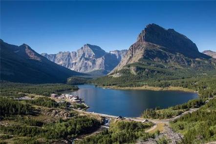
The Many Glacier Campground is located on the east side of Glacier National Park, at an elevation of approximately 4,500 feet. The campground is located about 22 miles from the town of St. Mary and the east entrance to Glacier National Park. The St. Mary Entrance allows access to the spectacular 50 mile-long Going-to-the-Sun Road, and traverses the high point at Logan Pass with an elevation of 6,646 feet. Babb, Montana, is the closest community to the Many Glacier Campground and is located approximately 12 miles east of the campground. Babb has a general store, gas station, several restaurants and an U.S. Post Office. Cell phone coverage is not available in the campground. However, limited coverage is available in Babb.
Recreation
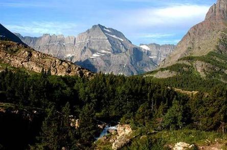
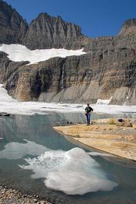
Many Glacier Campground is located on the east side of the Continental Divide, and has excellent trails available for day hiking and overnight backpacking. Trailheads start at a higher elevation than those on the west side of the park, resulting in a shorter ascent to reach scenic vistas. Trails traverse areas frequented by grizzly and black bears, so take these safety precautions — hike in groups, make lots of noise to avoid surprise encounters and carry bear pepper spray (know how to use it).
Facilities
Potable water at shared spigots is available throughout the campground. Restroom facilities provide flush toilets and sinks with cold running water. Camper utility sinks are available to dispose of gray water. Each campsite has a picnic table. The campground is located in a forested area so most campsites have some shade. Some sites are “generator free” for a more quiet camping experience. Other sites have limited hours for generator use. Within walking distance of the campground is the Swiftcurrent Motor Inn, a concession facility with a restaurant, camp store, gift shop, limited groceries, and coin operated showers. Please read the individual site descriptions carefully to ensure your vehicle and camping equipment (including RVs) will be accommodated in the campsite. Most campsites and driveways are very small and will not accommodate towed units over 21 feet. A limited number of sites can accommodate towed units 26 to 30 feet. Many campsites will not accommodate camper “slide-outs”. If you must use slide-outs, please make a reservation at St. Mary Campground, located 22 miles from Many Glacier and 1/2 mile along the Going-to-the-Sun Road.
Natural Features
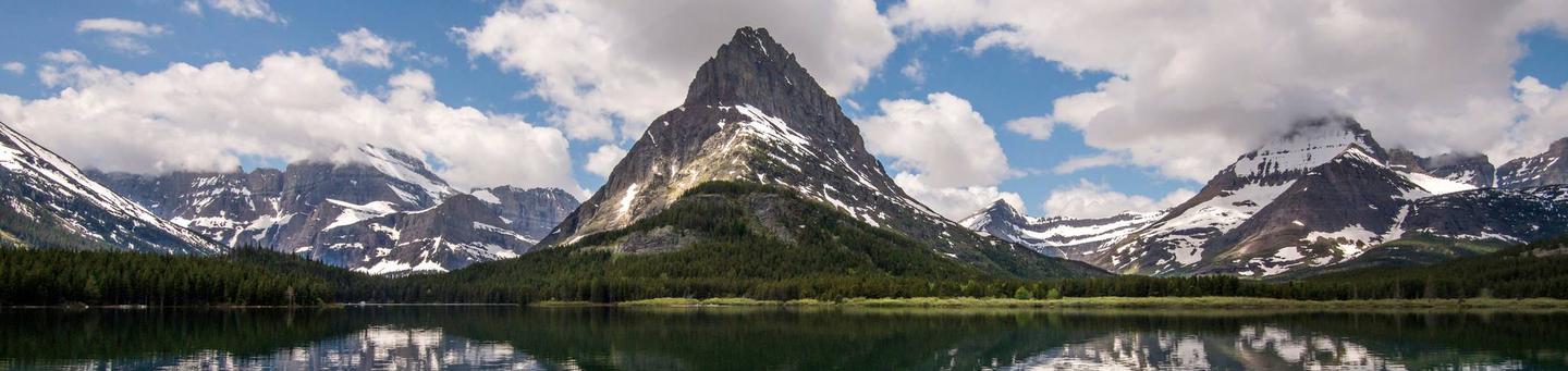
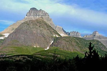
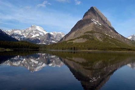
Many Glacier Campground is situated in a mature Douglas fir, lodgepole pine and quaking aspen forest. Vegetation is dense and provides partial shade for almost all campsites. Occasional strong wind gusts occur, however, with tree cover, most sites have some protection from the weather. Nearby natural features include Swiftcurrent Creek and Lake, and mountain views of Altyn, Henkel, Wilber, Grinnell Point, Allen and Wynn.
Nearby Attractions
If you have the time and a current passport, be sure to visit Waterton Lakes National Park in Alberta, Canada. Waterton Lakes National Park is a sister park to Glacier and both are known collectively as “Waterton-Glacier International Peace Park” — the first international peace park in the world and designated in 1932. Waterton Lakes National Park offers fantastic hiking, scenic boat cruises and several short drives to view wildlife and access numerous hiking trails. Waterton Lakes National Park is located approximately 45 miles north of the town of Babb, Montana. Take Montana highway # 89 north to the intersection of Highway#17 or the Chief Mountain International Peace Park Highway. Continue north to the Chief Mountain international border crossing, where the road number changes to highway #6 and then highway # 5 into Waterton Lakes National Park.