WATAUGA POINT RECREATION AREA, TENNESSEE Campground Reservation, Info, Images, Map, Directions

WATAUGA POINT RECREATION AREA, Tennessee Campground Images, Info & Reservations

Directions

From Elizabethton, take US 19E/321 south for five miles to Hampton. Turn left on US 321/TN 67 south for six miles, then turn left into Watauga Point. 

Phone

423-735-1500

Activities

BOATING, FISHING, HIKING, KAYAKING, CANOEING, STAR GAZING, NON-MOTORIZED BOATING, WATER ACCESS, SCENIC DRIVE

Keywords

WATAUGA POINT RECREATION AREA PAVILION AND SHADY AREA PICNIC AREA

Related Link(s)

Rec Area Info & Images

Overview

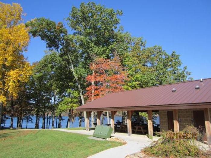
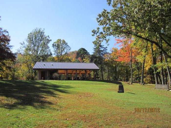
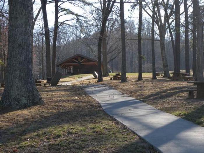
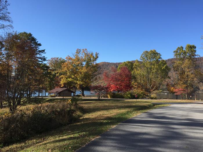
Watauga Point Recreation Area is located on the southern shore of Watauga Lake in Carter County. Large shade trees scattered throughout grassy areas provide a park setting for picnicking and sunbathing. In addition to picnic facilities, there is a lake and a gravel trail that loops through the nearby forest. Flush toilets, sinks, and drinking fountain are turned off and winterized for the season.  

Recreation

Boaters, anglers, and picnickers all enjoy Watauga Point. There is a wooded trail on site, as well.

Facilities

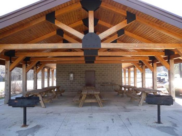
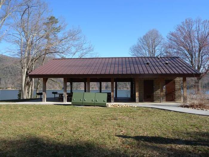
Watauga Point Recreation Area has one pavilion with accessible flush toilets. There are six picnic tables and two large grills at the pavilion. The shady area has five picnic tables and two grills. There is electricity at the pavilion.

Natural Features

At more than 1,900 feet in elevation, Watauga is the highest reservoir in Tennessee. This scenic 6,400-acre reservoir is managed for flood management, power generation, aquatic ecology and recreation. Watauga Point overlooks the reservoir and the Big Laurel Branch Wilderness Area on the opposite shore. 

Nearby Attractions

Both water-based and land-based recreation activities abound near Watauga Point Recreation Area. Forest Service facilities within three miles include Cardens Bluff Campground, Rat Branch Boat Ramp, and Pond Mountain Shooting Range.

Reservation

More from CampingHiking.net:

ELK CREEK CAMPGROUND, Colorado Campground Images, Info & Reservations

Directions Elk Creek is located off of US Hwy 50 between Gunnison and Montrose, along Blue Mesa reservoir. Phone 970-641-2337 Activities BIKING, BOATING, CAMPING, INTERPRETIVE PROGRAMS, FISHING, HIKING, HUNTING, VISITOR CENTER, WATER SPORTS, WILDLIFE VIEWING, DAY USE AREA, SWIMMING SITE Keywords ELKC,CURECANTI NATIONAL RECREATION,ELK CREEK CURECANTI NRA,CURECANTI Related Link(s) Rec

GRANT RIVER, Wisconsin Campground Images, Info & Reservations

Directions From WI-133, Turn East on River Lane (two miles south of Potosi) and follow the directional signs approximately two miles to the campground. From US-61/WI-35, Turn S on River Lane and follow directional signs to campground. Phone RANGER OFFICE – 563-582-0881 / CAMPGROUND ENTRANCE STATION – 608-763-2140 Activities CAMPING,

MILLER CABIN, Montana Campground Images, Info & Reservations

Directions From Townsend, Montana: Turn east from US Highway 287 onto US Highway 12 for approximately 3 miles. Turn north on State Highway 284 for approximately 15 miles. Turn northeast onto Forest Road 287, Confederate Gulch, travel on Forest Rd 287 for approximately 8 miles. Arrived at location. Junction of

STANLEY LAKE CAMPGROUND, Idaho Campground Images, Info & Reservations

Directions Travel 4.5 miles west of Stanley, Idaho on State Highway 21. Turn on paved Stanley Lake Road and drive 3 miles to the campground. Phone 928-537-8888 Activities BIKING, BOATING, CAMPING, FISHING, HIKING, WILDLIFE VIEWING, SWIMMING SITE Keywords STNL,SAWTOOTH NF – FS Related Link(s) Rec Area Info & Images Idaho

RUJADA CAMPGROUND, Oregon Campground Images, Info & Reservations

Directions From Cottage Grove, take exit 174 on Interstate 5, then take Row River Road #2400 east 19 miles to Layng Creek Road #17. Turn left (northeast) on Road #17 and continue for 2 miles until you reach Rujada Campground, located on the right, across Layng Creek. Phone 541-767-5000 Activities