Tennessee Camping - Campground Reservations ⋆ CampingHiking.net
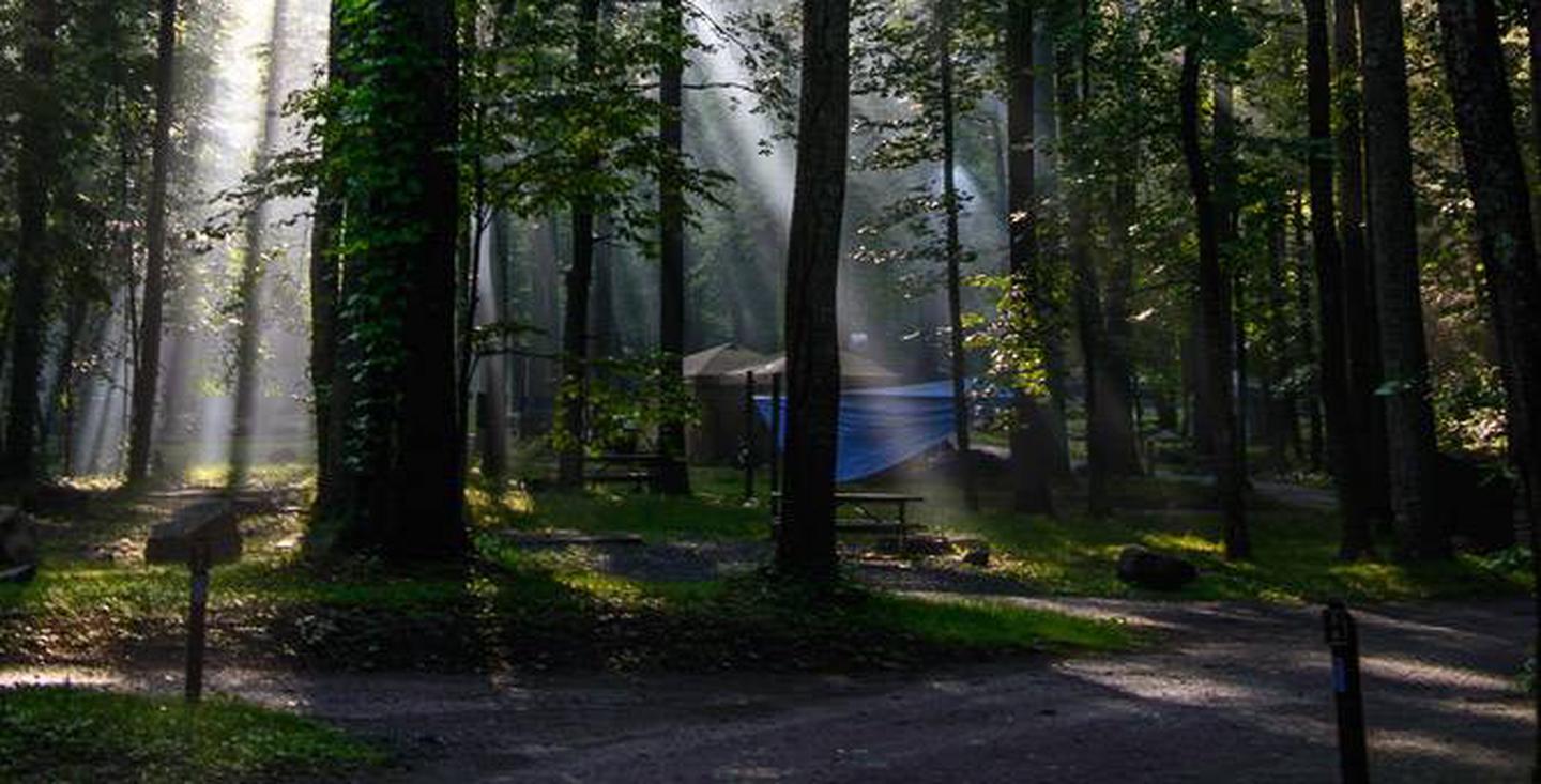
Tennessee Camping – Campground Reservations

ABRAM'S CREEK CAMPGROUND

Want to go camping in Tennessee? View Tennessee campgrounds below, listed in alphabetical order. Each Tennessee campsites listing has an image gallery, location map, directions, nearby activities, phone number, and access to online Tennessee camping reservations.

ABRAM’S CREEK CAMPGROUND, Tennessee Campground Images, Info & Reservations

Directions There is no street address for this campground North: From I-40 take US-129/Alcoa Highway through Maryville, TN. Continue South on US-129 until mile marker 14.3 (Foothills Parkway exit). Proceed .5 miles beyond Foothills Parkway turning left onto Happy Valley Road. Turn Right onto Abram’s Creek Road passing the Abram’s Creek Ranger Station. The campground is approximately .5 miles beyond the ranger station. South: Continue North on US-129 where US-19/74/129 split, heading towards Robbinsville, NC. Near mile marker 14 in

ANDERSON ROAD, Tennessee Campground Images, Info & Reservations

Directions From downtown Nashville, TN, take I-40 east for 5 miles to exit 219. Turn right on Stewarts Ferry Pike and continue straight on Bell Road for 5 miles. Turn left on Smith Springs Road, then left on Anderson Road. The campground is ahead about 1 mile on the left or continue straight on Anderson Road to access the day use area and shelter. Phone 615-361-1980 Activities BOATING, CAMPING, FISHING, HIKING, WILDLIFE VIEWING, SWIMMING SITE Keywords ANDR,J.PERCY PRIEST,PERCY PRIEST LAKE,J

ANTHONY CREEK HORSE CAMP, Tennessee Campground Images, Info & Reservations

Directions From Maryville, TN: Take U.S. 321 North (you’ll actually be driving south!) from Maryville to Townsend, TN (about 22 miles). At the traffic light in Townsend, continue straight on TN 73 and follow signs to Cades Cove. From Pigeon Forge, TN take US 321 South (you’ll be driving westerly) to Townsend, TN. Turn left (south) at Townsend onto TN 73. Follow signs to Cades Cove. The horse camp is accessed through the back of the Cades Cove picnic area,

APPALACHIAN CLUBHOUSE, Tennessee Campground Images, Info & Reservations

Directions Proceed south from Gatlinburg, TN on Newfound Gap Road (aka US 441) 1.7 miles and turn right onto Little River Road towards Cades Cove. Proceed 5 miles to the Elkmont (Campground) Road and turn left. Go. 1.4 miles and turn left just before the campground office (sign says: Elkmont Nature Trail 0.3, Little River Trail 0.6 and Jakes Creek Trail.). Follow the road to Jakes Creek and continue on around the one-way loop to the Appalachian Club. (Nearest street

AVONDALE, Tennessee Campground Images, Info & Reservations

Directions From Nashville, TN, take I-65 N to TN-386/Vietnam Veterans Blvd. Take exit 9 from TN-386/Vietnam Veterans Blvd, turn right onto Shute Lane. Continue straight onto Avondale Access Road. Follow signs into recreation area. Phone (615) 822-4846 Activities BOATING, CAMPING, FISHING, KAYAKING, CANOEING, WATER ACCESS Keywords AVON,OLD HICKORY LAKE,OLD HICKORY LAKE Related Link(s) Rec Area Info & Images Tennessee State Tourism Tennessee State Road Conditions Overview Avondale is a wonderful destination for people looking to launch a boat or have

BACKBONE ROCK CAMPGROUND, Tennessee Campground Images, Info & Reservations

Directions Highway TN 133 north from Highway 91. The campsite is on Highway 133, just north of Backbone Rock. Phone 423-735-1500 Activities BIKING, CAMPING, FISHING, HIKING, HUNTING, WILDLIFE VIEWING, SWIMMING, STAR GAZING, SCENIC DRIVE, BACKPACKING, ROCK CLIMBING Keywords Related Link(s) Rec Area Info & Images Tennessee State Road Conditions Tennessee State Tourism Overview Backbone Rock Campground will close for the season on Monday, October 14, 2019. Backbone Rock Campground is a small campground situated along the beautiful Beaverdam Creek at

BACKBONE ROCK RECREATION AREA PAVILIONS, Tennessee Campground Images, Info & Reservations

Directions From Bristol, TN take US 421 south for 20 miles to Shady Valley. Turn left onto TN 133 for eight miles to the recreation area. From Abingdon, VA, take US 58 east for 15 miles to Damascus. Turn right onto VA 716 for five miles to the recreation area (VA 178 becomes TN 133 at the state line). Phone 423-735-1500 Activities FISHING, HIKING, WILDLIFE VIEWING, SWIMMING, STAR GAZING, WATER ACCESS, SCENIC DRIVE Keywords BACKBONE ROCK RECREATION AREA PAVILIONS,BACKBONE ROCK,BACKBONE

BANDY CREEK, Tennessee Campground Images, Info & Reservations

Directions For detailed directions, please visit: http://www.nps.gov/biso/planyourvisit/directions.htm Phone (423) 286-7275 Activities BIKING, CAMPING, INTERPRETIVE PROGRAMS, FISHING, HIKING, HORSEBACK RIDING, HUNTING, PICNICKING, VISITOR CENTER, WILDLIFE VIEWING, DAY USE AREA, PHOTOGRAPHY, SWIMMING, MOUNTAIN BIKING, KAYAKING, STAR GAZING, BIRDING, NON-MOTORIZED BOATING, EVENING PROGRAMS, RAFTING, BACKPACKING, AMPHITHEATER, ACCESSIBLE SWIMMING Keywords CG02,BANDY,BIG SOUTH FORK NATIONAL PARK,BIG SOUTH FORK,SOUTH FORK,BIG FORK Related Link(s) Rec Area Info & Images Tennessee State Tourism Tennessee State Road Conditions Overview Bandy Creek is a spacious and modern campground, situated in

Bear Creek Horse Camp, Tennessee Campground Images, Info & Reservations

Directions From 1-75 Northbound, take exit 141 for Oneida/Huntsville and turn left. Follow Highway 63 to the intersection of US-27 in Huntsville. Turn right and continue north on US-27 through Oneida for 18 miles. Turn onto KY-92 West and travel approximately 1.3 miles. Bear left onto Highway 1651. Travel about .5 miles then turn right onto KY-741. This road is narrow, and if you have a big rig it is suggested that you continue on 1651 for another three-quarter miles

BIG CREEK CAMPGROUND (GREAT SMOKY MOUNTAINS NATIONAL PARK), Tennessee Campground Images, Info & Reservations

Directions Campground is at the end of Big Creek Entrance Rd. Waterville, NC, 28785 (Haywood County) The campground is located off I-40 Exit 451 (Waterville). It sixteen miles east of Newport, TN. Follow Waterville road, crossing over the Pigeon River, past the Walters Power Generating Station and continue one mile to the 4-way intersection at Mt Sterling Gap.   Follow the signs to Big Creek. GPS coordinates are 35°45’00.3″N 83°06’38.6″W The 4 way intersection is composed of Big Creek Campground Road

BLUE HERON CAMPGROUND, Tennessee Campground Images, Info & Reservations

Directions From 1-75 Northbound, take exit 141 for Oneida/Huntsville and turn left. Follow Highway 63 to the intersection of US-27 in Huntsville. Turn right and continue north on US-27 through Oneida for 18 miles. Turn onto KY-92 West and travel approximately 1.3 miles. Bear left onto Highway 1651. Travel about .5 miles then turn right onto KY-741. This road is narrow, and if you have a big rig it is suggested that you continue on 1651 for another three-quarter miles

BUMPUS MILLS, Tennessee Campground Images, Info & Reservations

Directions From Nashville, Tenn: Take I-24 west to Clarksville, TN. Follow Highway 79 South for 20 mi. to Highway 120. Follow Highway 120 for 10 mi. to Bumpus Mills, turn left onto Tobaccoport Road (Hwy. 1830) for 2.8 mi., turn left onto Oak Hill Road for . 9 mi., turn left onto Forest Trail then turn right into the campground. From I-24 East Cadiz KY: Take 68 west for 6.2mi., turn left on to HWY. 139 south for 15.3mi., continue

CADES COVE CAMPGROUND, Tennessee Campground Images, Info & Reservations

Directions From Maryville, TN: Take U.S. 321 North (you’ll actually be driving south!) from Maryville to Townsend, TN (about 22 miles). At the traffic light in Townsend, continue straight on TN 73 and follow signs to Cades Cove. From Pigeon Forge, TN take US 321 South (you’ll be driving westerly) to Townsend, TN. Turn left (south) at Townsend onto TN 73. Follow signs to Cades Cove. Phone 865-448-4103 FOR AVAILABILITY AND TO MAKE A RESERVATION 877-444-6777 Activities HISTORIC & CULTURAL

CADES COVE GROUP, Tennessee Campground Images, Info & Reservations

Directions Cades Cove Campground 10042 Campground Drive Townsend, TN 37882 865-448-2472 Lat/Long: N35.6009 W083.7742 From Maryville, TN: Take U.S. 321 North (you’ll actually be driving south!) from Maryville to Townsend, TN (about 22 miles). At the traffic light in Townsend, continue straight on TN 73 and follow signs to Cades Cove. From Pigeon Forge, TN take US 321 South (you’ll be driving westerly) to Townsend, TN. Turn left (south) at Townsend onto TN 73. Follow signs to Cades Cove. Phone

CAGES BEND, Tennessee Campground Images, Info & Reservations

Directions From Nashville, TN, travel North on I-65 and take TN-386/Vietnam Veterans Blvd. Continue to exit 12, Big Station Camp Blvd. Turn right onto Big Station Camp Bldvd. Continue staight across Nashville Pike onto Cages Bend Road. Take Cages Bend Road to Benders Ferry Road. The recreation area will be ahead on the left. Phone 615-824-4989 Activities BOATING, CAMPING, FISHING Keywords CAGE,OLD HICKORY LAKE,OLD HICKORY LAKE Related Link(s) Rec Area Info & Images Tennessee State Tourism Tennessee State Road Conditions

CARDENS BLUFF CAMPGROUND, Tennessee Campground Images, Info & Reservations

Directions From Elizabethton, TN take US 19E/321 south 5 miles to Hampton. Turn left on 321/67 travel approx. 4 miles to the campground entrance on the left.  Phone 423-735-1500 Activities AUTO TOURING, BIKING, BOATING, FISHING, HIKING, SWIMMING, MOUNTAIN BIKING, KAYAKING, CANOEING, BIRDING, NON-MOTORIZED BOATING, SCENIC DRIVE Keywords Related Link(s) Rec Area Info & Images Overview Cardens Bluff Campground will close for the season on Monday, October 14, 2019. At nearly 2,000 feet elevation, Cardens Bluff Campground is located on a

CEDAR CREEK (TN), Tennessee Campground Images, Info & Reservations

Directions From Nashville, TN. Travel East on I-40 to exit 221A. Continue onto TN-45/Old Hickory Blvd. Turn right onto US-70/Lebanon Pike. Turn left onto Nonaville Road and travel until reaching a 4-way stop. Turn right at the 4-way stop onto Saundersville Road. The recreation area will be at the end of the road. Phone 615-754-4947 Activities BOATING, CAMPING, FISHING, SWIMMING Keywords CED1,OLD HICKORY LAKE,OLD HICKORY LAKE Related Link(s) Rec Area Info & Images Tennessee State Road Conditions Tennessee State Tourism

CHILHOWEE CAMPGROUND, Tennessee Campground Images, Info & Reservations

Directions The campground is located on FDR 77/Oswald Dome Road. Be Aware; Do not use GPS directions: GPS coordinates will direct you up Benton Springs Rd. This route is not recommended. We recommend using Forest Service Road 77 to reach the recreation area. It’s important to note, this facility requires driving 7 miles up to Chilhowee Campground on a narrow, winding road. Do not use the Benton Springs Access Road to the campground as this is an unpaved and dangerous

CHILHOWEE GROUP CAMP, Tennessee Campground Images, Info & Reservations

Directions From Highway 64/411 intersection, travel east 7 miles, turn onto Forest Road 77, drive 7.5 miles to campground/recreation area. Phone 423-338-3300 Activities BIKING, CAMPING, FISHING, HIKING, WILDLIFE VIEWING, MOUNTAIN BIKING, KAYAKING, CANOEING, WATER ACCESS, SCENIC DRIVE, RAFTING, RIVER TRIPS, WHITEWATER RAFTING, AMPHITHEATER, ACCESSIBLE SWIMMING Keywords CHILHOWEE GROUP CAMP,CHILHOWEE Related Link(s) Rec Area Info & Images Tennessee State Road Conditions Tennessee State Tourism Overview Located in the Chilhowee Recreation Area, Chilhowee Group Camp offers camping for up to 75 individuals.

COOK DAY USE AREA, Tennessee Campground Images, Info & Reservations

Directions From downtown Nashville, TN, take I-40 east for 7 miles to exit 221B. Turn right on Old Hickory Boulevard, left on Bell Road, right on New Hope Road and right on Stewarts Ferry Pike. Follow the signs to the picnic shelters. Phone 615-889-1975 Activities BOATING, HIKING, PICNICKING, WILDLIFE VIEWING, SWIMMING SITE Keywords COOK,J PERCY PRIEST LAKE,PERCY PRIEST LAKE,J PERCY PRIEST DAM Related Link(s) Rec Area Info & Images Tennessee State Tourism Tennessee State Road Conditions Overview Cook Day Use

COSBY CAMPGROUND, Tennessee Campground Images, Info & Reservations

Directions From Cosby, TN, proceed south on TN 32 about 1.5 miles south of the junction with US 321. Turn right at Cosby sign. Campground is another 2 miles. Phone 423-487-2683 Activities HISTORIC & CULTURAL SITE, CAMPING, FISHING, HIKING, HORSEBACK RIDING, VISITOR CENTER, WILDLIFE VIEWING, DAY USE AREA, EVENING PROGRAMS, AMPHITHEATER Keywords CG30,Great Smokey Mountains National Park,Great Smoky Mountains National Park,Cosby Related Link(s) Rec Area Info & Images Tennessee State Tourism Tennessee State Road Conditions National Park Services Concessionaire Overview

COSBY GROUP CAMP, Tennessee Campground Images, Info & Reservations

Directions From Cosby, TN, proceed south on TN 32 about 1.5 miles from junction with US 321. Turn right at Cosby sign. Group camp is another 2.2 miles. Phone 423-487-2683 Activities HISTORIC & CULTURAL SITE, CAMPING, FISHING, HIKING, WILDLIFE VIEWING, DAY USE AREA Keywords Great Smokey Mountains National Park,Great Smoky Mountains National Park,Cosby Related Link(s) Rec Area Info & Images Tennessee State Road Conditions National Park Services Concessionaire Tennessee State Tourism Overview Tucked in the mountains under a canopy of

COSBY PICNIC PAVILION, Tennessee Campground Images, Info & Reservations

Directions Seasonal phone is 423-487-2683 From Cosby, TN, proceed south on TN 32 about 1.5 miles from junction with US 321. Turn right at Cosby sign. Group camp is another 2.2 miles. Phone 423-487-2683 Activities HISTORIC & CULTURAL SITE, CAMPING, FISHING, HIKING, HORSEBACK RIDING, VISITOR CENTER, WILDLIFE VIEWING, DAY USE AREA Keywords Great Smokey Mountains National Park,Great Smoky Mountains National Park,Great Smokey Park Related Link(s) Rec Area Info & Images Tennessee State Tourism Tennessee State Road Conditions National Park Services

DALE HOLLOW DAMSITE, Tennessee Campground Images, Info & Reservations

Directions From Celina, Tennessee, take Highway 53 North for 2 miles. Turn right on Dale Hollow Dam Road, then take the second right on Campground Road. Follow signs to Dale Hollow Dam Recreation Area. It is recommended that visitors do not rely soley on GPS or Mapquest to reach the park. Phone 931-243-3554 CAMPGROUND; 931-243-3136 RESOURCE MANAGEMENT OFFICE, DALE HOLLOW LAKE Activities BIKING, CAMPING, FISHING, HIKING, FISH HATCHERY, DAY USE AREA Keywords DALH,DALE HOLLOW LAKE,DALE HOLLOW DAM CAMPGROUND,BELOW THE DAM,DAMSITE,NEAR

DALE HOLLOW LAKE – PRIMITIVE CAMPING, Tennessee Campground Images, Info & Reservations

Directions Camping locations are dispersed throughout Dale Hollow Lake. Reference primitive camping map or site details for information on how to get to the specific site. Mailing and contact information is for the Resource Manager’s Office. Phone DALE HOLLOW LAKE RESOURCE MANAGERS OFFICE-931-243-3136. SHERIFF’S DEPARTMENT EMERGENCY CONTACTS: CLAY COUNTY 931-243-3266 OVERTON COUNTY 931-823-5404 PICKETT COUNTY 931-864-3210 CLINTON COUNTY 606-387-5111 CUMBERLAND COUNTY 270-864-4141 Activities CAMPING, FISHING, WATER SPORTS, SWIMMING Keywords DALE HOLLOW LAKE – PRIMITIVE CAMPING,DALE HOLLOW LAKE,DALE HOLLOW,PRIMITIVE CAMPING,SHORELINE CAMPING,REMOTE

DEFEATED CREEK PARK, Tennessee Campground Images, Info & Reservations

Directions From Carthage, Tennessee, take SR-25 west for 4 miles. Turn north on SR-80, then east on SR-85. Follow signs to campground. Phone 615-774-3141 Activities BIKING, BOATING, CAMPING, INTERPRETIVE PROGRAMS, FISHING, HIKING, WILDERNESS, SWIMMING SITE, ENVIRONMENTAL EDUCATION, PHOTOGRAPHY, PADDLING, SWIMMING, PADDLE BOATING, WATER ACTIVITIES, KAYAKING, STAR GAZING, WATER ACCESS, WATER SKIING, EVENING PROGRAMS, AMPHITHEATER, TUBING Keywords DEFE,CORDELL HULL LAKE,DEFEATED CREEK CAMPGROUND,SHELTER BY THE PLAYGROUND,CORDELL HULL DAM Related Link(s) Rec Area Info & Images Tennessee State Tourism Tennessee State Road Conditions

DENNIS COVE CAMPGROUND, Tennessee Campground Images, Info & Reservations

Directions Take US 321/TN 67 East out of Hampton, TN. Turn right onto Dennis Cove Road and drive approximately 5 miles. Dennis Cove Road is steep with hairpin turns, so plan to drive slowly.  Phone 423-735-1500 Activities CAMPING, FISHING, HIKING, HUNTING, WILDLIFE VIEWING, SWIMMING, MOUNTAIN BIKING, WATER ACCESS, BACKPACKING, EMERGENCY SERVICES Keywords Related Link(s) Rec Area Info & Images Tennessee State Road Conditions Tennessee State Tourism Overview Dennis Cove Campground will close for the season on Monday, October 14, 2019.

DONALDSON PARK, Tennessee Campground Images, Info & Reservations

Directions From Celina, TN (Highway 52), travel East Lake Avenue. Turn onto Jefferson Street. Follow signs into the park. Phone 931-243-3136 Activities BOATING, FISHING, PICNICKING, DAY USE AREA, PHOTOGRAPHY, KAYAKING, CANOEING, WATER ACCESS Keywords DONA,CELINA PARK,DALE HOLLOW LAKE,DALE HOLLOW,DONALDSON,CORDELL HULL DAM Related Link(s) Rec Area Info & Images Tennessee State Tourism Tennessee State Road Conditions Overview Donaldson Park is day use area located within the city limits of Celina, Tennessee, next to the Obey River Tailwater. It is a part

DONLEY CABIN, Tennessee Campground Images, Info & Reservations

Directions From Tellico Plains, Tenn., travel east on Highway 165 (Cherohala Skyway) for 5 miles. Turn right onto Forest Road 210 and continue 9 miles to the intersection of Forest Road 217 (North River Road). There will be a sign for the Donley Cabin and North River Campground. Turn left onto Forest Road 217 and proceed for 5.5 miles to the parking area on the right. The condition of the road may require slow travel. Follow the quarter-mile trail over

DOVER, Tennessee Campground Images, Info & Reservations

Directions From Nashville, or St.Louis , take I-24 Clarksville, take Exit 8 for TN 237 W. 2.4 Mi., Right onto Warfield Blvd 1.6 Mi. continue onto 101st Airborne PKWY for 6.3 Mi. contine onto TN 347 -PKWY for 4.5 Mi. Turn right onto US 79 S. for 24.2 Mi. Turn right on W. Spring St. for 466 feet, Turn right at the 1st cross street onto Hood ST. for 500 feet. Turn right on to Forrest St 200 FT. Phone

DYERS CREEK, Tennessee Campground Images, Info & Reservations

Directions From Nashville, Tenn, take I-24 West to the Clarksville Exit 8. Take US-79S for 46 miles to Dyers Creek Recreation Area. Phone 931-232-7724 DOVER OFFICE; 270-362-4236 LAKE BARKLEY RESOURCE MANAGERS OFFICE Activities BOATING, HISTORIC & CULTURAL SITE, FISHING, VISITOR CENTER, DAY USE AREA Keywords DYER,LAKE BARKLEY,BARKLEY LOCK & DAM Related Link(s) Rec Area Info & Images Tennessee State Road Conditions Tennessee State Tourism Overview Dyer’s Creek boasts fantastic views of on the sparkling Lake Barkley in the wooded rolling

ELKMONT CAMPGROUND, Tennessee Campground Images, Info & Reservations

Directions From Cherokee, NC: Take Newfound Gap Road (aka U.S. 441) North through the park into Tennessee. Turn left at Sugarlands Visitor Center. Follow Little River Road approx. 4.5 miles. Turn left at the Elkmont Campground sign and proceed 1.5 miles to the campground office. From Gatlinburg,TN: Take Newfound Gap Road (aka U.S. 441) South into the Park. (If coming from Pigeon Forge, take the Bypass into the park.) Turn a right at Sugarlands Visitor Center. Proceed 4.5 miles to

ELKMONT GROUP CAMP, Tennessee Campground Images, Info & Reservations

Directions From Cherokee, NC: Take Newfound Gap Road (aka U.S. 441) North through the park into Tennessee. Turn left at Sugarlands Visitor Center. Follow Little River Road approx. 4.5 miles. Turn left at the Elkmont Campground sign and proceed 1.5 miles to the campground office. From Gatlinburg, TN: Take Newfound Gap Road (aka U.S. 441) South into the Park. (If coming from Pigeon Forge, take the Bypass into the park.) Turn a right at Sugarlands Visitor Center. Proceed 4.5 miles

FLOATING MILL PARK, Tennessee Campground Images, Info & Reservations

Directions From I-40, take exit 273. Merge onto US-56 south and continue for 3.5 miles to Floating Mill Road. After about a mile, turn right to stay on Floating Mill Road, and follow signs into the campground. Phone 931-858-4845 Activities BOATING, CAMPING, FISHING, HIKING, HUNTING, WATER SPORTS, DAY USE AREA, SWIMMING SITE Keywords FLOM,BIG PUCKETTS CAMP,PUCKETTS,CENTER HILL LAKE,CENTER HILL LAKE Related Link(s) Rec Area Info & Images Tennessee State Tourism Tennessee State Road Conditions Overview Floating Mill Park is located

GREENBRIER PICNIC PAVILION, Tennessee Campground Images, Info & Reservations

Directions There is no street address for the picnic pavilion. From Gatliinburg, TN: Proceed east on U.S. 321 North about 6 miles. Turn right (south) at the Greenbrier sign. Picnic pavilion is about 3.5 miles from U.S. 321. Phone 865-436-1261 Activities HISTORIC & CULTURAL SITE, CAMPING, FISHING, HIKING, WILDLIFE VIEWING Keywords CG34,Great Smokey Mountain National Park,Great Smoky Mountain National Park,Great Smoky Mountains National Park Related Link(s) Rec Area Info & Images Tennessee State Tourism National Park Services Concessionaire Tennessee State

HARPETH RIVER BRIDGE CAMPGROUND (TN), Tennessee Campground Images, Info & Reservations

Directions From Ashland City, Tennessee, head northwest on S Main Street toward Cumberland Street. Take the first left on TN-49W/ Cumberland Street and continue to follow TN-49W for 5 miles. Campground will be on your right directly before the Harpeth River Bridge. Phone 615-792-4195 Activities CAMPING Keywords Related Link(s) Rec Area Info & Images Tennessee State Road Conditions Tennessee State Tourism Overview The relaxing family friendly atmosphere at Harpeth River Campground will have campers wanting to return as often as

HORSE CREEK PAVILION, Tennessee Campground Images, Info & Reservations

Directions From Greeneville, take TN 107 north for six miles. Turn right at Horse Creek Road and follow the signs for about two miles to the recreation area. Phone (423)638-4109 Activities CAMPING, FISHING, HIKING, PICNICKING, WILDERNESS, FISH VIEWING SITE, DAY USE AREA, WATER ACTIVITIES, BIRDING, WATER ACCESS, BACKPACKING Keywords Related Link(s) Rec Area Info & Images Overview Horse Creek Pavilion is located eight miles from Greeneville, Tennessee. It is nestled into a hardwood cove beside its namesake, Horse Creek. The

HOUSTON VALLEY, Tennessee Campground Images, Info & Reservations

Directions From Greeneville, TN take TN 70 south about 10 miles. Turn right onto TN 107 west, travel nine miles. Houston Valley is located on the left. From Newport, TN, travel on US25/70 south, turn left onto TN 107 east and travel five miles to Houston Valley. It will be located on the right. Phone (423) 638-4109 Activities CAMPING, HIKING, HORSEBACK RIDING, PICNICKING, WILDLIFE VIEWING, DAY USE AREA, MOUNTAIN BIKING, STAR GAZING, SCENIC DRIVE, LOOKOUT TOWER Keywords Related Link(s) Rec

HURRICANE BRIDGE, Tennessee Campground Images, Info & Reservations

Directions From I-40, take exit 273. Merge onto US-56 south and continue for approximately 7 miles to the Hurricane Bridge Recreation Area entrance on the right. Phone 931-858-3125 Activities BOATING, CAMPING, FISHING, HIKING, WATER SPORTS Keywords HURB,LITTLE PUCKETTS,CENTER HILL LAKE,CENTER HILL LAKE Related Link(s) Rec Area Info & Images Tennessee State Road Conditions Tennessee State Tourism Overview Hurricane Bridge Recreation Area is located on the shores of the scenic Center Hill Lake on central Tennessee’s Highland Rim. The lake stretches

JEFFERSON SPRINGS, Tennessee Campground Images, Info & Reservations

Directions From downtown Nashville, TN, take I-24 east to Sam Ridley Parkway. Turn left onto Jefferson Pike and the Recreation Area will be on the left. Phone 615-889-1975 Activities BOATING, FISHING, HIKING, WILDLIFE VIEWING Keywords JEFS,J. PERCY PRIEST,PERCY PRIEST LAKE,J PERCY PRIEST DAM Related Link(s) Rec Area Info & Images Tennessee State Tourism Tennessee State Road Conditions Overview Jefferson Springs Recreation Area is a lakeside oasis in the hills of middle Tennessee, providing visitors with countless recreational activities on the

KATY BRANCH, Tennessee Campground Images, Info & Reservations

Directions From Greeneville travel east to 11E to TN State Road 107. Travel approximately 14.5 miles to the gate at Katy Branch located on the right. (Landmarks will include Clark Creek Road on the right and Jackson Bridge Road on the left.) Unlock the gate and travel about .5 miles to the pavilion. Phone (423) 638-4109 Activities WILDLIFE VIEWING, STAR GAZING, CULTURAL ACTIVITIES, RECREATION PROGRAMS, BADMINTON, SOCCER FIELDS Keywords KATY BRANCH Related Link(s) Rec Area Info & Images Overview Katy

LAGUARDO, Tennessee Campground Images, Info & Reservations

Directions From Nashville, take I-40 East to exit 232-B. Continue North on Hwy. 109 approximately 7.5 miles. Entrance to the park will be on the left. Phone 615-449-6544 Activities BOATING, CAMPING, FISHING, SWIMMING, KAYAKING, CANOEING Keywords LAGU,OLD HICKORY LAKE,OLD HICKORY LAKE Related Link(s) Rec Area Info & Images Tennessee State Tourism Tennessee State Road Conditions Overview Not far from Nashville, Laguardo is a great day-trip destination for kids and families. It offers a playground, boat ramp, and sandy beach to

LILLYDALE CAMPGROUND AND DAY USE, Tennessee Campground Images, Info & Reservations

Directions From Byrdstown, Tennessee, take Highway 111 south for about 13 miles. Turn north on 294/Willow Grove Road (at Big Springs Market) and continue for another 13 miles, then turn right onto Lillydale Road and continue to the entrance. It is recommended that visitors do not rely soley on GPS or Mapquest to reach the park. Phone 931-823-4155 CAMPGROUND; 931-243-3136 RESOURCE MANAGER’S OFFICE, DALE HOLLOW LAKE Activities BOATING, CAMPING, FISHING, HIKING, PICNICKING, WATER SPORTS, DAY USE AREA, SWIMMING SITE, BIRDING,

LITTLE OAK CAMPGROUND, Tennessee Campground Images, Info & Reservations

Directions From Bristol, take US 421 south for 12 miles, and turn right onto paved Camp Tom Howard Road. After 0.5 miles, this road becomes Forest Road #87. Continue on Road #87 for six miles. Turn right on Road #87G for 1.5 miles to Little Oak. Phone 423-735-1500 Activities BIKING, BOATING, FISHING, HIKING, HORSEBACK RIDING, WILDLIFE VIEWING, SWIMMING, MOUNTAIN BIKING, WATER ACTIVITIES, KAYAKING, CANOEING, STAR GAZING, BIRDING, NON-MOTORIZED BOATING, WATER ACCESS, JET SKIING, WATER SKIING, SCENIC DRIVE, TUBING, BADMINTON Keywords

LOCK A, Tennessee Campground Images, Info & Reservations

Directions From Ashland City, Tennessee, take US 12 and go eight miles west to Cheap Hill. Turn left on Cheatham Dam Road traveling west four miles. Turn left into the campground. Phone 615-792-3715 Activities CAMPING, HIKING, WATER SPORTS Keywords LOCA,CHEATHAM LAKE,CHEATHAM DAM,CHEATHAM L & D Related Link(s) Rec Area Info & Images Tennessee State Road Conditions Tennessee State Tourism Overview The relaxing yet activity-rich Lock A Campground has something to offer everyone from horseshoe pits to volleyball courts and hiking

LONE BRANCH, Tennessee Campground Images, Info & Reservations

Directions From Nashville, TN, take I-40 East to exit 229-B/Golden Bear Gateway. Continue straight on Golden Bear Gateway for approximately 9 miles. Entrance to the recreation area will be on your left just passed Cedar Creek Club. * Golden Bear Gateway turns into Benders Ferry Road at the US-70/Lebanon Road intersection. Phone (615) 822-4846 Activities BOATING, PICNICKING, DAY USE AREA Keywords LONE,OLD HICKORY LAKE,OLD HICKORY LAKE Related Link(s) Rec Area Info & Images Tennessee State Tourism Tennessee State Road Conditions

LONG BRANCH, Tennessee Campground Images, Info & Reservations

Directions From I-40, take exit 268 and merge onto US-96 west. Continue for 5 miles to the end of Center Hill Dam, then turn right on SR-141. Follow signs into campground. Phone 615-548-8002 Activities BOATING, CAMPING, FISHING, KAYAKING, CANOEING Keywords LONB,CENTER HILL LAKE,DAMSITE,CENTER HILL LAKE Related Link(s) Rec Area Info & Images Tennessee State Tourism Tennessee State Road Conditions Overview Long Branch Campground is located below Center Hill Dam on the scenic Caney Fork River in central Tennessee’s Highland Rim.

METCALF BOTTOMS PICNIC PAVILION, Tennessee Campground Images, Info & Reservations

Directions There is no street address for the picnic pavilion Pavilion is 15 miles west of Gatlinburg, TN on Little River Road. Take Newfound Gap Road (akaUS441) south from Gatlinburg and turn west on Little River Road (TN73) at the Sugarlands Visitors Center. Go 10 miles and turn right at picnic area sign. Picnic pavilion is on west side of picnic area. Phone 865-436-1261 Activities HISTORIC & CULTURAL SITE, CAMPING, FISHING, HIKING, WILDLIFE VIEWING Keywords CG32,Great Smokey Mountain National Park,Great

NAT CALDWELL PARK, Tennessee Campground Images, Info & Reservations

Directions From Nashville, take I-65 North to TN-386/Vietnam Veterans Blvd. Continue East on TN-386/Vietnam Veterans Boulevard to exit 9. Merge onto US-31E N/Johnny Cash Pkwy/E Main St. and continue approximately 2.5 miles. Nat Caldwell Park will be on your left just before crossing over Station Camp Creek. Phone (615) 822-4846 Activities FISHING, PICNICKING, KAYAKING, CANOEING Keywords NATC,OLD HICKORY LAKE,OLD HICKORY LAKE Related Link(s) Rec Area Info & Images Tennessee State Tourism Tennessee State Road Conditions Overview Nat Caldwell Park is

OBEY RIVER PARK, Tennessee Campground Images, Info & Reservations

Directions From Byrdstown, Tennessee, take Highway 111 south for 3 miles. After crossing the bridge turn right and follow the signs into the campground and day-use area, located to the left of Sunset Marina (2040 Sunset Dock Road, Monroe, TN 38573). From Livingston, Tennessee, take Highway 111 north for 15 miles. Follow the signs and turn left into the campground and day-use area. It is recommended that visitors do not rely soley on GPS or Mapquest to reach the park.

OLD HICKORY BEACH, Tennessee Campground Images, Info & Reservations

Directions From Nashville, take I-65 North to exit 92, TN-45/Old Hickory Blvd toward Madison, continue until you cross over the Cumberland River then take the 2nd left onto Bridgeway Ave., travel approximately 0.2 miles and turn left onto Ensley Ave., continue approximately 0.3 miles and turn left onto Swinging Bridge Road, continue approximately 0.4 miles and turn right onto Burnett Road. The entrance to the park will be at the end of the road. Phone 615-847-8091 Activities CAMPING, FISHING, HIKING,

PARKSVILLE LAKE RV CAMPGROUND, Tennessee Campground Images, Info & Reservations

Directions From Highway 64/411 intersection, travel Hwy. 64 east approximately 9.5 miles, turn onto Highway 30 for 0.25 mile. RV sites are located on the left, group tent camping on the right. Phone 423-338-3300 Activities BOATING, CAMPING, FISHING, HIKING, SWIMMING, MOUNTAIN BIKING, KAYAKING, CANOEING, NON-MOTORIZED BOATING, WATER ACCESS, RAFTING, RIVER TRIPS, WHITEWATER RAFTING Keywords PARKSVILLE LAKE RV CAMPGROUND Related Link(s) Rec Area Info & Images Tennessee State Tourism Tennessee State Road Conditions Overview Located near Parksville Lake, Parksville Lake RV

PLEASANT GROVE RECREATION AREA, Tennessee Campground Images, Info & Reservations

Directions From Celina, Tennessee, turn northeast on Route 53 and continue for 4 miles. Turn right on Old Route 53 at the Cedar Hill/Pleasant Grove exit and follow signs to the park. It is recommended that visitors do not rely on GPS or Mapquest to reach the park. Phone CONTACT PLEASANT GROVE DIRECTLY AT 931-243-3555. CONTACT THE RESOURCE MANAGER’S OFFICE AT 931-243-3136. Activities BOATING, FISHING, PICNICKING, DAY USE AREA, SWIMMING, WATER ACTIVITIES, BIRDING, WATER ACCESS Keywords PLEA,DALE HOLLOW LAKE,SWINGING BRIDGE,DALE

POOLE KNOBS, Tennessee Campground Images, Info & Reservations

Directions From downtown Nashville, TN, take I-40 east to I-24 east. After 15 miles take exit 66B and turn right onto Sam Ridley Parkway. Turn right onto Highway 41 north, and after about 1.5 miles turn right onto Fergus Road. Make another right onto Jones Mill Road and follow the signs to the campground after 4 miles. Phone 615-459-6948 Activities BOATING, CAMPING, FISHING, HIKING, HORSEBACK RIDING, WILDLIFE VIEWING, ARCHERY Keywords POOK,J. PERCY PRIEST,PERCY PRIEST LAKE,J PERCY PRIEST DAM Related Link(s)

QUINN SPRINGS PAVILION, Tennessee Campground Images, Info & Reservations

Directions The Quinn Springs Pavilion is located on Highway 30 about 6 miles south of Etowah, TN, and 6 miles north of Benton, TN. From Highway 411, turn on to Highway 30; pavilion is 0.3 miles on the right. Phone 423-338-3300 Activities CAMPING, FISHING, HIKING, WILDLIFE VIEWING, KAYAKING, CANOEING, NON-MOTORIZED BOATING, SCENIC DRIVE, RAFTING, RIVER TRIPS, WHITEWATER RAFTING Keywords Related Link(s) Rec Area Info & Images Tennessee State Road Conditions Tennessee State Tourism Overview The Quinn Springs Pavilion offers a

RAGLAND BOTTOM, Tennessee Campground Images, Info & Reservations

Directions From Smithville, Tennessee, take US-70 east for 8 miles. Turn left on Ragland Bottom Road and follow signs to the campground, located one mile from Sligo Bridge. Phone 931-761-3616 Activities BOATING, CAMPING, FISHING, HIKING, SWIMMING, WATER ACCESS, WATER SKIING Keywords RAGL,CENTER HILL LAKE,CENTER HILL LAKE Related Link(s) Rec Area Info & Images Tennessee State Road Conditions Tennessee State Tourism Overview Ragland Bottom Campground is located on the shores of the scenic Center Hill Lake on central Tennessee’s Highland Rim.

Right Bank Recreation Area, Tennessee Campground Images, Info & Reservations

Directions Right Bank Recreation Area is located approximately 11 miles northwest of Ashland City, Tenn. To reach the area, take Cheatham Dam Road off State Route 12 in the Cheap Hill Community. Right Bank Recreation Area is on the right bank of the lake, just upstream from Cheatham Lock and Dam. Phone 615-792-5697 Activities BIKING, BOATING, CAMPING, FISHING, WATER SPORTS, WILDLIFE VIEWING, DAY USE AREA, SWIMMING SITE Keywords Cheatham Dam Related Link(s) Rec Area Info & Images Tennessee State Road

ROARING RIVER PARK, Tennessee Campground Images, Info & Reservations

Directions From I-40, take HWY 53 north through Gainesboro, TN. Turn east on HWY 135 and follow signs into recreation area. Phone (931) 268-2540 Activities FISHING, PICNICKING, WILDLIFE VIEWING, DAY USE AREA, SWIMMING SITE, PHOTOGRAPHY, SWIMMING, MOTOR BOAT, PADDLE BOATING, KAYAKING, WATER ACCESS Keywords RORN,CORDELL HULL LAKE,ROARING RIVER SHELTER,CORDELL HULL DAM Related Link(s) Rec Area Info & Images Tennessee State Road Conditions Tennessee State Tourism Overview Roaring River Park is located on Cordell Hull Lake on the Cumberland River System,

Rock Creek Campground (TN), Tennessee Campground Images, Info & Reservations

Directions From the East: Take State Route 62 West, then veer to the right onto State Route 27. Make a left onto Kingston Street, and follow the brown Obed road signs to the visitor center on North Maiden Street. To continue on to the campground, stay on North Maiden Street until reaching an intersection. Stay straight on North Maiden Street crossing Main Street/Old Hwy 27 until you reach Spring Street. Turn right onto Spring Street and continue on to the

ROCK CREEK RECREATION AREA, Tennessee Campground Images, Info & Reservations

Directions From I-26 take exit 34 to Main Street (TN107) in Erwin, take TN 395 east for 3.5 miles to Rock Creek Recreation Area. Phone 423-638-4109 Activities BIKING, HISTORIC & CULTURAL SITE, CAMPING, FISHING, HIKING, PICNICKING, RECREATIONAL VEHICLES, WILDLIFE VIEWING, FISH HATCHERY, WILDERNESS, DAY USE AREA, PLAYGROUND PARK SPECIALIZED SPORT SITE, SWIMMING, MOUNTAIN BIKING, CANOEING, STAR GAZING, EVENING PROGRAMS, RECREATION PROGRAMS, SCENIC DRIVE, RAFTING, RIVER TRIPS, WHITEWATER RAFTING, BACKPACKING, LOOKOUT TOWER, EMERGENCY SERVICES, MUSEUM Keywords Rock Creek Park. Related Link(s)

ROCKLAND RECREATION AREA, Tennessee Campground Images, Info & Reservations

Directions From Nashville, TN, take I-65 North to TN-386/Vietnam Veterans Blvd. Continue East on TN-386/Vietnam Veterans Blvd. to exit 3 for US-31E toward Hendersonville. Turn right onto Rockland Road (1st red light you come to), travel approximately 0.6 miles. Turn right onto Power Plant Road. Turn left onto Overlook Circle. You are now in Rockland Recreation Area. Phone 615-822-4846 Activities BOATING, FISHING, PICNICKING, ARCHERY Keywords Related Link(s) Rec Area Info & Images Tennessee State Road Conditions Tennessee State Tourism Overview

SALT LICK CREEK, Tennessee Campground Images, Info & Reservations

Directions From Carthage, go 4 miles west on SR-25, then north on SR-80, then east on SR-85 to Gladice. Turn right on Smith Bend Road and follow signs. Phone 931-678-4718 Activities BOATING, CAMPING, INTERPRETIVE PROGRAMS, FISHING, WILDLIFE VIEWING, WILDERNESS, SWIMMING SITE, PHOTOGRAPHY, PADDLING, SWIMMING, MOTOR BOAT, PADDLE BOATING, WATER ACTIVITIES, KAYAKING, CANOEING, BIRDING, NON-MOTORIZED BOATING, WATER ACCESS, EVENING PROGRAMS Keywords SALT,CORDELL HULL LAKE,SALT LICK CAMPGROUND,SALT LICK SHELTER,CORDELL HULL DAM Related Link(s) Rec Area Info & Images Tennessee State Tourism Tennessee

SEVEN POINTS (TN), Tennessee Campground Images, Info & Reservations

Directions From downtown Nashville, TN, take I-40 east for 7 miles and to exit 221B. Turn right onto Old Hickory Boulevard, then left on Bell Road, right on New Hope Road and left on Stewarts Ferry Pike. Follow the signs to the campground. Phone (615)-889-5198 Activities BOATING, CAMPING, FISHING, HIKING, WILDLIFE VIEWING, SWIMMING SITE, KAYAKING, CANOEING Keywords SEVE,J. PERCY PRIEST,PERCY PRIEST LAKE,SEVEN POINTS TN,J PERCY PRIEST DAM Related Link(s) Rec Area Info & Images Tennessee State Tourism Tennessee State Road

SHUTES BRANCH, Tennessee Campground Images, Info & Reservations

Directions From downtown Nashville get on I-40 E/I-65 S for .9 miles. Follow I-40 E for 12.2 miles and then take exit 221A from I-40 E. Take Andrew Jackson Pkwy which turns into Saundersville Rd for 6.5 miles. Shutes Branch Recreation Area will be located on the right side of the road. Phone 615-754-4847 Activities BIKING, BOATING, CAMPING, FISHING, HIKING, PICNICKING, DAY USE AREA, PADDLE BOATING, WATER ACTIVITIES, KAYAKING, WATER ACCESS, SAILING Keywords SHUT,OLD HICKORY LAKE,OLD HICKORY LAKE Related Link(s)

SMITH SPRINGS, Tennessee Campground Images, Info & Reservations

Directions From downtown Nashville, TN, take I-40 east 5 miles to exit 219. Turn right on Stewarts Ferry Pike, then left on Smith Springs Road. The recreation area is on the left after about 2 miles. Phone 615-889-1975 Activities BOATING, FISHING, PICNICKING, WILDLIFE VIEWING Keywords SMSP,J. PERCY PRIEST,PERCY PRIEST LAKE,J PERCY PRIEST DAM Related Link(s) Rec Area Info & Images Tennessee State Tourism Tennessee State Road Conditions Overview Smith Springs Recreation Area is a lakeside oasis in the hills of

SPENCE CABIN, Tennessee Campground Images, Info & Reservations

Directions Spence Cabin is located near Elkmont Campground. Drive south from Gatlinburg, TN on Newfound Gap Road (U.S. 441) for 1.7 miles and turn right onto Little River Road toward Cades Cove. Proceed 5 miles to Elkmont Campground road and turn left. Go 1.4 miles and turn left just before the campground office (sign says Elkmont Nature Trail 0.3, Little River Trail 0.6 and Jakes Creek Trail). After crossing the bridge, take the second left into the parking lot. Parking

TAILWATER REC AREA, Tennessee Campground Images, Info & Reservations

Directions From I-40, take Exit 258, travel north on HWY 53/25, turn right on SR-26 and travel for 2 miles. Turn right on Corps Lane and follow signs into recreation area. Phone 615-735-1034 Activities BOATING, PICNICKING, WILDLIFE VIEWING, DAY USE AREA, MOTOR BOAT, WATER ACCESS Keywords TARA,CORDELL HULL LAKE,SHELTER AT THE DAM,SHELTER BELOW THE DAM,THE DAM SHELTER,SHELTER ON THE DAM ROAD,CORDELL HULL DAM Related Link(s) Rec Area Info & Images Tennessee State Road Conditions Tennessee State Tourism Overview Tailwater Recreation

THE LAURELS PICNIC AREA PAVILIONS, Tennessee Campground Images, Info & Reservations

Directions The Laurels is located on TN Hwy 361 near Sciota Road in Carter County. From Johnson City, take I-26 E to Okalona exit. Turn left, drive under I-26 to TN 359. Turn right onto TN 359. Travel 1.4 miles, then turn right onto TN 361 for 3.7 miles to The Laurels.  Phone 423-735-1500 Activities HIKING, WILDLIFE VIEWING, WATER ACCESS Keywords THE LAURELS PICNIC AREA PAVILIONS Related Link(s) Rec Area Info & Images Overview The Laurels Picnic Area Pavilions will

THUNDER ROCK CAMPGROUND, Tennessee Campground Images, Info & Reservations

Directions From the Ocoee Ranger Station, turn left onto Highway 64 eastbound and travel 10.9 miles to the TVA Ocoee Powerhouse Number 3. Turn right and cross the bridge to reach the campground on the right. Phone 423-338-3300 Activities BOATING, CAMPING, FISHING, HIKING, MOUNTAIN BIKING, KAYAKING, CANOEING, NON-MOTORIZED BOATING, SCENIC DRIVE, RAFTING, RIVER TRIPS, WHITEWATER RAFTING, BACKPACKING Keywords Related Link(s) Rec Area Info & Images Tennessee State Tourism Tennessee State Road Conditions Overview Thunder Rock Campground is located 1.8 miles

TWIN CREEKS PICNIC PAVILION, Tennessee Campground Images, Info & Reservations

Directions From downtown Gatlinburg Tennessee, Turn south at stoplight #8 in Gatlinburg. Follow Historic Nature Trail Road to 4-way junction at access road to Park Vista Hotel. Go straight and continue 1.4 miles into the Park. turn right at Twin Creeks sign. Phone 865-436-1261 Activities CAMPING, FISHING, HIKING, WILDLIFE VIEWING, BIRDING, AMPHITHEATER, HISTORIC SITES Keywords CG33,Great Smoky Mountain National Park,Great Smoky Mountains National Park,Great Smoky National Park,Great Smokey National Park Related Link(s) Rec Area Info & Images Tennessee State Tourism

WARTRACE CK REC AREA, Tennessee Campground Images, Info & Reservations

Directions From Carthage, go 4 miles west on SR-25, then north on 80, and east on 85 past Gladice; park is on the right. Phone (931) 678-4801 Activities BOATING, FISHING, PICNICKING, WILDLIFE VIEWING, DAY USE AREA, SWIMMING SITE, PADDLING, SWIMMING, MOTOR BOAT, PADDLE BOATING, KAYAKING, CANOEING, WATER ACCESS Keywords WART,CORDELL HULL LAKE,WARTRACE PARK,WARTRACE SHELTER,WARTRACE BEACH,CORDELL HULL DAM Related Link(s) Rec Area Info & Images Tennessee State Road Conditions Tennessee State Tourism Overview Wartrace Creek Recreation Area is located on Cordell

WATAUGA POINT RECREATION AREA, Tennessee Campground Images, Info & Reservations

Directions From Elizabethton, take US 19E/321 south for five miles to Hampton. Turn left on US 321/TN 67 south for six miles, then turn left into Watauga Point.  Phone 423-735-1500 Activities BOATING, FISHING, HIKING, KAYAKING, CANOEING, STAR GAZING, NON-MOTORIZED BOATING, WATER ACCESS, SCENIC DRIVE Keywords WATAUGA POINT RECREATION AREA PAVILION AND SHADY AREA PICNIC AREA Related Link(s) Rec Area Info & Images Overview Watauga Point Recreation Area is located on the southern shore of Watauga Lake in Carter County. Large

WILLOW GROVE CAMPGROUND, Tennessee Campground Images, Info & Reservations

Directions From Byrdstown, Tennessee, take Highway 111 south for about 13 miles. Turn north on 294/Willow Grove Road (at Big Springs Market) and continue for about 16 miles, then turn right into the camp entrance, just before Willow Grove Marina. It is recommended that visitors do not rely soley on GPS or Mapquest to reach the park. Phone 931-823-4285 CAMPGROUND; 931-243-3136 RESOURCE MANAGER’S OFFICE, DALE HOLLOW LAKE Activities BOATING, CAMPING, FISHING, HIKING, WATER SPORTS, SWIMMING, WATER ACCESS, AMPHITHEATER Keywords WIGR,DALE