Directions
From Interstate 40 at Mulberry, Arkansas, take exit 24, turn north onto Arkansas 215 and continue for approximately 12.3 miles. Turn left onto Forest Service Road 1505 toward Shores Lake/White Rock and follow for approx. 5.3 miles. Turn left onto Forest Service Road 1505 and follow for approx. 2.2 miles. Turn right onto Forest Service Road 1505 and follow for 0.5 miles. Turn right onto Forest Service Road 1535 and continue for approximately 0.5 miles to White Rock Mountain. For alternative directions and/or GPS navigation enter “White Rock Mountain Recreation Area” into Google Maps. If you need further assistance with directions, please call us at (479) 369-4128.
Phone
479-369-4128
Activities
CAMPING, FISHING, HIKING, HUNTING, WILDLIFE VIEWING, WILDERNESS, DAY USE AREA, OBSERVATION SITE, HOTEL/LODGE/RESORT FS OWNED, PHOTOGRAPHY, MOUNTAIN BIKING, OFF ROAD VEHICLE TRAILS, KAYAKING, CANOEING, BERRY PICKING, STAR GAZING, BIRDING, SCENIC DRIVE, RAFTING, BACKPACKING, MUSHROOM PICKING
Keywords
Related Link(s)
Arkansas State Road Conditions
Overview
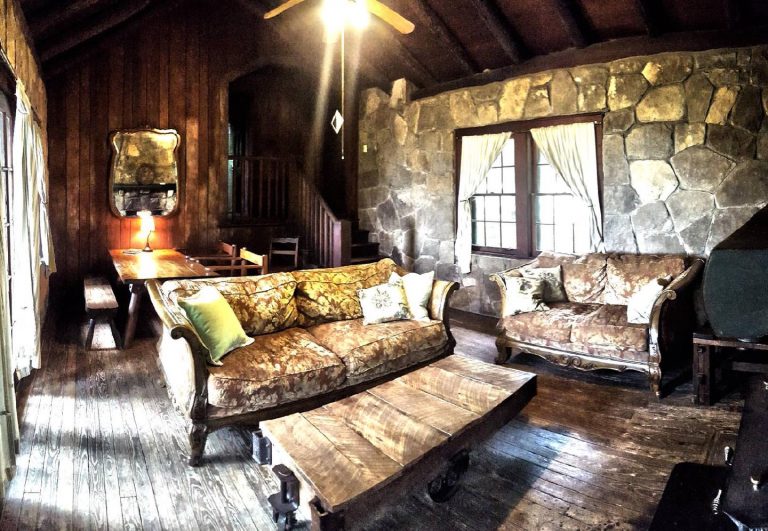
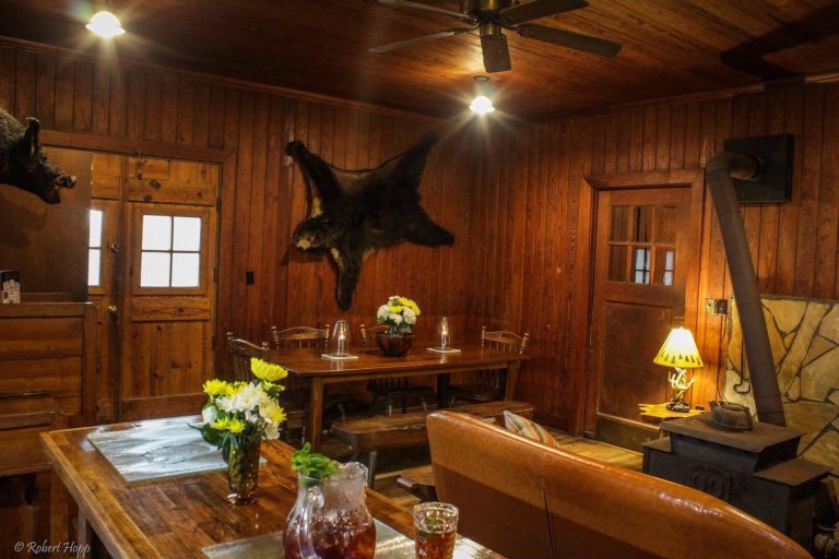
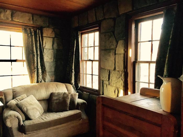
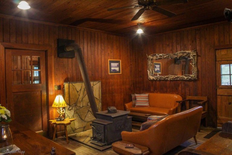
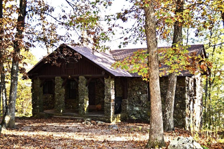
Experience nature and adventure at historic White Rock Mountain! This National Forest Recreation Area features three unique and rustic natural stone cabins and a large natural stone lodge built in the 1930s by the Civilian Conservation Corps (CCC). Each features a stone fireplace new, antique, and original wood furniture handcrafted by the CCC. Wind, rain and natural elements had caused the deterioration of the buildings over the years. In 1987 a volunteer group, Friends of White Rock, began a project to renovate the historic structures. With a lot of commitment and hard work, the lodge and cabins were restored to their original state in 1991. White Rock Mountain also offers nine primitive family camping sites. These easily accessible shaded campsites include tents pads, fire rings, grills, picnic tables and access to restrooms and water. Small RVs or pop-up campers can be accommodated at a few sites.
Recreation
White Rock Mountain is the hub of several national forest hiking trail systems including the easy 2 mile trail around the mountain top rim, the 17 mile Shores Lake/White Rock loop trail, and the renowned 170 mile Ozark Highlands Trail. Other recreational activities include swimming, boating (non-motorized) or fishing at Shores Lake Recreation Area; swimming, floating or fishing the National Scenic Mulberry River; Mill Creek and other National Forest ATV trails; mountain biking, hunting and more.
Facilities
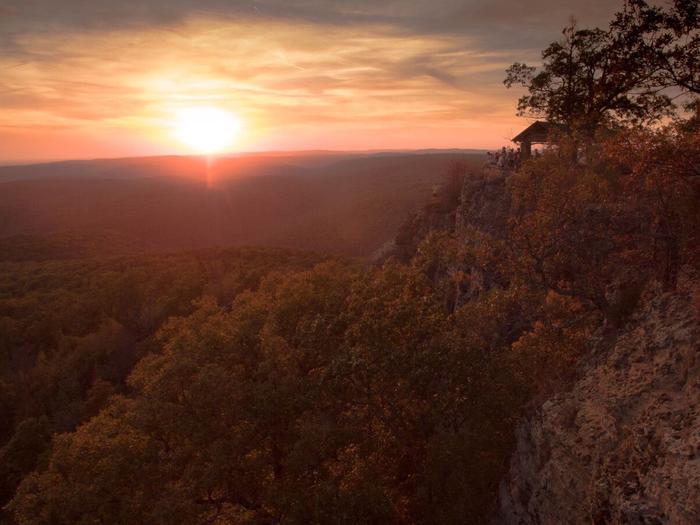
The grounds at White Rock Mountain are open year-round. There is a gravel parking area, clean vault toilets, and eight family picnic units with grills and tables. The facility features four CCC crafted shelters along the White Rock Rim Trail that offer spectacular views. Overnight parking for the Ozark Highlands Trail access is available onsite.
The lodge and three cabins are available for rent at White Rock Mountain. The lodge and cabins have electricity and running water. All units are equipped with bathrooms and a full kitchen. Each kitchen includes a stove, refrigerator, microwave, coffee pot, crock pot, dishes, cooking utensils, and cooking pots and pans. The furnishings feature new, antique, and original CCC furnishings. Each building has a large private patio with a charcoal grill and fire pit. There is no air conditioning; the stone lodge and cabins stay cool in the summer months. Heat is provided by wood burning stoves during the winter and firewood is provided. Linens, towels and bedding are not provided. Guests should pack food, towels, pillows, blankets or sleeping bags, and all other necessary overnight supplies.
There are nine family campsites at White Rock. The sites do not have electric or water hookups. Sites are equipped with tent pads, picnic tables, fire rings, grills and lantern poles. There is access to drinking water and an accessible vault toilet within close proximity to all sites. Firewood is available for purchase onsite.
Visit the onsite General Store for information, souvenirs, snacks, pizza, beverages, maps, firewood and other backcountry supplies.
Natural Features
White Rock Mountain is 2,309 feet above sea level and received its name from the appearance of the lichen on the sheer bluffs that appear white from a distance. Guests at White Rock can enjoy incredible scenic views from the lodge, cabins, campground and bluffs. The forest is home to a large variety of wildlife including deer, bear, bald eagles, turkey and more. In the fall season White Rock Mountain offers unrivaled opportunities for taking in the bright red, orange and yellow autumn foliage that sweeps across the Ozark National Forest. The forest around White Rock is also a waterfall hunter’s paradise featuring several great falls located in the surrounding area.
Nearby Attractions
Ozark Highlands Trail, Shores Lake Recreation Area, National Scenic Mulberry River, Mill Creek and other ATV Trails, Waterfalls, Scenic Drives, Mountain Biking, Wineries (Altus, AR) and more.
Charges & Cancellations
Rules & Reservation Policies As you make travel plans that include reservations on Recreation.gov, there are standard policies that apply to most locations of which you should be aware. Do keep in mind, however, that there are many exceptions, so it is best to review reservation information listed on individual facility pages for those policies and procedures that pertain to your specific locations. Booking Window For most locations, you can reserve six months in advance of your stay for individual sites and 12 months in advance for group sites. There are some exceptions, so it is best to check with each facility. Change and Cancellation Policies and Fees Overnight and Day Use Facilities: To ensure fairness, reservation arrival or departure dates may not be changed beyond the booking window until 18 days after booking the reservation. Camping / Day Use: A $10.00 service fee will apply if you change or cancel your reservation (including campsites, cabins, lookouts, group facilities, etc.). The $10.00 service fee will be deducted from the refund amount. You can cancel or change reservations through Recreation.gov or by calling 1-877-444-6777. Late Cancellations Overnight and Day Use Facilities: Late cancellations are those cancelled between 12:01 a.m. (Eastern) on the day before arrival and check out time on the day after arrival. Individual Campsites: If a customer cancels a reservation the day before or on the day of arrival they will be charged a $10.00 service fee and will also forfeit the first night’s use fee (not to exceed the total paid for the original reservation). Cancellations for a single night’s reservation will forfeit the entire use fee but no cancellation fee will apply. Cabins / Lookouts: Customers will be charged a $10.00 cancellation fee and forfeit the first night’s use fee if a cabin or lookout reservation is cancelled within 14 days of the scheduled arrival date. Cancellations for a single night’s use will not be assessed a service fee. Group Facility: If a customer cancels a group overnight facility reservation within 14 days of the scheduled arrival date they will be charged the $10.00 service fee and forfeit the first night’s use fee. Cancellations for a single night’s use will not be assessed a service fee. Group Day Use Area: If a customer cancels a group day use facility reservation within 14 days of the scheduled arrival date, they will forfeit the total day use fee with no service fee charge. No-Shows Camping / Day Use: A camping no-show customer is one who does not arrive at a campground and does not cancel the reservation by check-out time on the day after the scheduled arrival date. Reserved campsites and group overnight facilities will be held until check-out time on the day following your scheduled arrival. Group day-use facilities will be held until check-in time on your scheduled arrival date. If a customer does not arrive at the campground or group facility by check-out time the day after arrival or does not cancel the reservation by the times listed under “Late Cancellations” above, the customer may be assessed a $20.00 service fee and forfeit use fees.

