Corbin's Island Picnic Shelter, PA Campground Reservation, Info, Images, Map, Directions

Corbin’s Island Picnic Shelter, Pennsylvania Campground Images, Info & Reservations

Directions

From Huntingdon follow Route 22 eastbound and turn right onto Point Road just past the Giant Food Store. Continue on Point Road (staying left) approximately 6.3 miles. The Corbin’s Island access will be on your left.

Phone

814-658-3405

Activities

BOATING, CAMPING, FISHING, HUNTING, WATER SPORTS, SWIMMING SITE

Keywords

Corbin’s Island

Related Link(s)

Rec Area Info & Images

Pennsylvania State Tourism

Pennsylvania State Road Conditions

Overview

Corbin’s Island Recreation Area is located at the northern end of Raystown Lake, just downstream from the Raystown Dam. The recreation area is easily accessible from US Route 22 and offers a great location for picnicking, fishing, and floating down the river.

Recreation

Raystown Dam, Ridenour Overlook and Hawn’s Overlook are three beautiful overlook areas that are within a 10 minute drive from Corbin’s Island. A boat ramp within the facility provides access for small fishing boats, kayaks, canoes and tubes.

Facilities

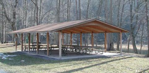
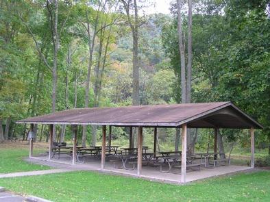
Corbin’s Island offers one group shelter with approximately 10 tables and 20-amp electrical service. It is fully accessible and comfortably accommodates up to 80 people in a lovely river setting.

Natural Features

Corbin’s Island is situated along the shady banks of the Raystown Branch of the Juniata River. Nearby access to the cool, flowing waters of the Raystown Branch makes this shelter a great place to picnic, fish and float the river all in one day.

Nearby Attractions

The area offers Snyder’s Run Boat Launch, Seven Points Recreation Area, Seven Points Marina and access to downtown Huntingdon.

Reservation

More from CampingHiking.net:

OWEN CREEK, Wyoming Campground Images, Info & Reservations

Directions From Dayton, Wyoming: Travel 27 miles on U.S. Highway 14 west, turn left (south) at Burgess Junction and continue on Hwy 14 for 5 miles until you reach Forest Road 236. Take a right on Forest Road 236 and continue about .2 miles to the campground. Phone 406-587-9054 Activities

SALMON LAKE CABIN SITKA, Alaska Campground Images, Info & Reservations

Directions Accessible nearly year round, depending on mode of access. Located 11 miles southeast of Sitka on Baranof Island, approximately 10 minutes by floatplane. Access by boat from Sitka to Silver Bay is 10 miles, and a 2-mile trail leads to the cabin. Trail begins near mooring buoy at the

SHRODE LAKE CABIN, Alaska Campground Images, Info & Reservations

Directions Access by float plane is 45 minutes from Anchorage and 55 minutes from Cordova. By boat the trip is 25 miles from Whittier into Long Bay, then an additional one-mile hike on a trail to reach the lake. The trailhead at Long Bay is very tidal dependent and best

CULTUS CORRAL HORSE CAMP, Oregon Campground Images, Info & Reservations

Directions From Bend, OR: Travel about 46 miles southwest on Cascade Lakes Highway (46); take a right onto Forest Road 4635 and travel about a mile; take a right onto Forest Road 4630. The campground is near the end of the road. Phone 541-323-1746 Activities CAMPING Keywords Related Link(s) Rec

Holter Lake Campground, Montana Campground Images, Info & Reservations

Directions From Great Falls, Montana take Interstate-15 South towards Helena. Take exit 234 to Craig. Turn left heading to Craig and cross river. Will come to a “T” and then take a right on Recreation Road. Travel approximately 5 miles. Before crossing the river/steel bridge, turn left onto Beartooth Road.

ACORN VALLEY, Iowa Campground Images, Info & Reservations

Directions From I-35/80 north of Des Moines, Iowa, take exit 131 toward Johnston/Saylorville Lake. Turn north on Merle Hay Road and continue for 2.8 miles. At the four-way stop, turn left on Northwest Beaver Drive and continue for 3.7 miles. Turn right onto Northwest Coryden Drive and follow signs into