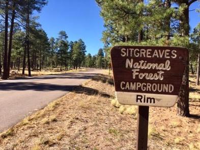
Rim Campground, AZ Campground Reservation, Info, Images, Map, Directions

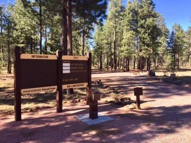
Rim Campground, Arizona Campground Images, Info & Reservations

Directions

Located on Road 300 approximately 1 mile off of High 260.

Phone

928-535-9859

Activities

BOATING, CAMPING

Keywords

Related Link(s)

Rec Area Info & Images

Arizona State Road Conditions

Arizona State Tourism

Overview

Rim Campground is situated close to the edge of the Mogollon Rim. Spectacular 100-mile views are seen from many vantage points along the rim.

Recreation

Fishing and boating are available at Woods Canyon Lake which is approximately 3 miles from the campground.

Facilities

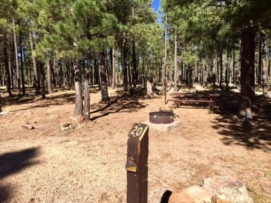
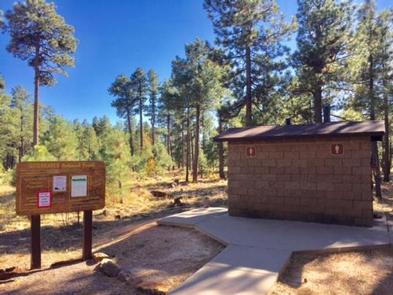
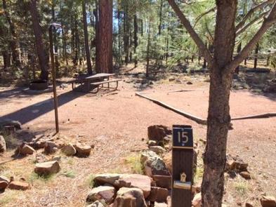
Rim Campground has 26 sites (of which sites 14 through 26 are available for advanced reservation). All sites are pull-outs and approximately 40 feet. Sites can accommodate tents, pop-up campers, trailer and motorhomes. There are two loops which have 13 sites per loop. Each campsite offers a campfire ring with grill and picnic table. Additional amenities include accessible vault toilets, drinking water and trash service. A camp host is available at the site.

Natural Features

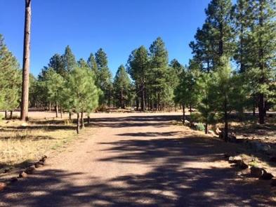
Rim Campground is surrounded by ponderosa pines and located in an area that is relatively flat. Once in a while a few elk will walk through the campsites.

Nearby Attractions

Some groceries are available at the Marina Store at Woods Canyon Lakes which is approximately three miles from the campground. The store also offers boat and kayak rentals. This lake is a great location for fishing.

Reservation

More from CampingHiking.net:

GORDON REESE CABIN, Montana Campground Images, Info & Reservations

Directions From Wisdom, travel west on Highway 43 for 26 miles, the parking area is located at the top of Chief Joseph Pass. The route has many signs. Maps of the area may be purchased by calling the Wisdom Ranger District. Phone 406-689-3243 Activities BIKING, HISTORIC & CULTURAL SITE, CAMPING,

BALD MOUNTAIN LOOKOUT, Idaho Campground Images, Info & Reservations

Directions From Coeur d’Alene, Idaho, drive 70 miles south on U.S. Highway 95 to State Highway 6. Turn left on State Highway 6, White Pine Scenic Byway, travel through Potlatch and continue on for 22 miles. Turn right on Forest Road 377, Palouse Divide Road. This is a single lane,

MOOSE LAKE, Wisconsin Campground Images, Info & Reservations

Directions From Hayward, Wisconsin, drive east on State Highway 77 about 28 miles. Turn right onto Forest Service Road 174 and continue about a mile, then turn right onto Forest Service Road 176. After about 5 miles turn right again and drive less than 2 miles to the campground. Phone

GREENS LAKE, Utah Campground Images, Info & Reservations

Directions Located on Forest Road 095/Red Canyon Road off Highway 44, approximately 40 miles north of Vernal, Utah. Phone 435-784-3445 Activities BIKING, BOATING, CAMPING, FISHING, HIKING, WILDLIFE VIEWING, BIRDING Keywords GRLK,RED CANYON COMPLEX,FLAMING GORGE,ASHLEY NF – FS,Flaming Gorge National Recreation Area Related Link(s) Rec Area Info & Images Utah State

SIERRA, California Campground Images, Info & Reservations

Directions From Sierra City travel north on Highway 49, in about 7 miles turn right into the campground. Phone (530)478-6253 Activities CAMPING, FISHING, HIKING, HUNTING, WATER ACCESS, SCENIC DRIVE, GOLD PANNING Keywords SRRA,TAHOE NF – FS Related Link(s) Rec Area Info & Images California State Road Conditions California State Tourism