ASPEN GLADE, CO Campground Reservation, Info, Images, Map, Directions

ASPEN GLADE, Colorado Campground Images, Info & Reservations

Directions

From Antonito, Colorado, go west on Highway 17 for approximately 15 miles to the Aspen Glade Campground.

Phone

435-245-6521

Activities

CAMPING, FISHING

Keywords

ASGL,RIO GRANDE NF- FS

Related Link(s)

Rec Area Info & Images

Colorado State Road Conditions

Colorado State Tourism

Overview

Aspen Glade Campground sits on the Conejos River in southern Colorado, providing a premium setting for fly fishing and peaceful nature watching.

Recreation

Forest Road 250 provides an unforgettable scenic drive, where visitors are met with sweeping views of the Conejos Canyon and River.

Just upstream of the campground is a section of "Gold Medal" trout fishing, offering top-tier fishing for large quality trout. Just 168 miles of the 9,000 miles of trout streams in Colorado are designated with this title.

The nearby Sheep Creek Trail is also highly recommended for avid hikers.

Facilities

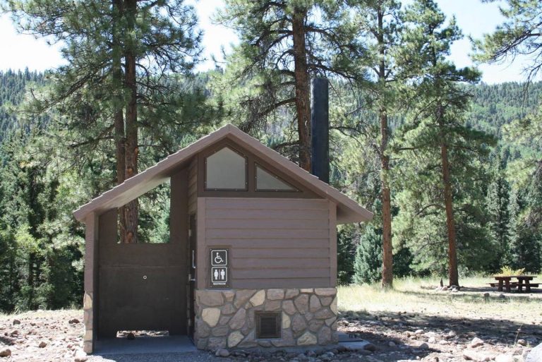
The 32 spacious, reservable campsites are considerably quiet, allowing for the sounds of birds overhead. Drinking water and vault toilets are provided.

Natural Features

Within the campground, Loop A and B are lightly wooded with Ponderosa pines. Loop C is heavily wooded with tall, mature spruce, aspen and fir trees. It lies along the fast-flowing Conejos River. The understory for all campsites is grass topped with pine needles.

Aspen Glade sits near the border of New Mexico at 8,500 feet. It is situated between the Carson and Rio Grande National Forests.

Wildlife in the region includes bear, deer, elk and a variety of birds.

Nearby Attractions

Visitors can ride a traditional steam engine at the Cumbres and Toltec Scenic Railroad on a 64-mile journey through abandoned mining towns.

Reservation

More from CampingHiking.net:

GROUP LANDING, Florida Campground Images, Info & Reservations

Directions From the intersection of Hwy 441 and Hwy 90 in Lake City, FL, drive east on Hwy 90 for 12.6 miles. Turn left at the flashing light onto Pine Street. Cross over the railroad tracks. After about half a mile, you will see a sign directing you to turn

DOLL MT. CAMPGROUND, Georgia Campground Images, Info & Reservations

Directions From Atlanta, take I-75 north to Exit 293, then Highway 411 north to Highway 136. Turn right on Highway 136 and follow to Highway 382. Turn left on Highway 382 and look for signs to the campground– access road is directly across from the volunteer fire station. Physical address

SUPPLY PARK, Oklahoma Campground Images, Info & Reservations

Directions From Woodward, Oklahoma, travel 9 miles northwest on Highway 3/270 to Fort Supply Lake sign. Turn west and follow for 3 miles, crossing Fort Supply Dam. Continue 3/4 mile to the four-way stop; turn left and follow access road into the campground. Phone 580-766-2001 Activities BOATING, CAMPING, HUNTING, SWIMMING

BLIND PASS CABIN, Alaska Campground Images, Info & Reservations

Directions The cabin is located approximately 40 air miles north of Ketchikan on the northwest shore of Hassler Island, across from Black Island. Accessible by float plane or by boat. Mooring buoy in front of cabin is first-come, first-serve. Refer to USGS topographic map, Ketchikan D-5, and check local tide

PINEKNOT, California Campground Images, Info & Reservations

Directions From I-10 in Redlands, take Highway 330 to Highway 18 in Running Springs. Continue east on Highway 18 at Big Bear Lake Dam, go straight at the dam and follow Highway 18. Turn onto Summit Boulevard and continue to a block wall. Turn left into the campground. Phone 909-866-8550