UPPER FIR GROUP AREA, NM Campground Reservation, Info, Images, Map, Directions

UPPER FIR GROUP AREA, New Mexico Campground Images, Info & Reservations

Listen

Directions

From Alamogordo, take US 82 east 17 miles through Cloudcroft. Turn left onto NM 244 towards Ruidoso and go 1/2 mile. Upper Fir Group Area is on Forest Road 422 at the end of the road.

Phone

575-682-7570

Activities

CAMPING

Keywords

FIRG,LINCOLN NF – FS

Related Link(s)

Rec Area Info & Images

Forest Service Concessionaire

New Mexico State Tourism

New Mexico State Road Conditions

Overview

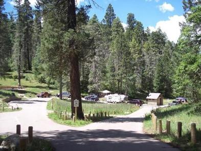
Upper Fir Group Area is one of the most popular campsites in the Sacramento Mountain area. Unique to its neighboring campgrounds, it’s set far back from public roads, allowing for true peace and quiet.

The campground is on the northwestern portion of the Lincoln National Forest, a protected area spanning an incredible 1.1 million acres of land. Spend your days exploring the mountains, or head west for a day trip to explore White Sands National Monument, the world’s largest dune field of pure, white gypsum sand.

Recreation

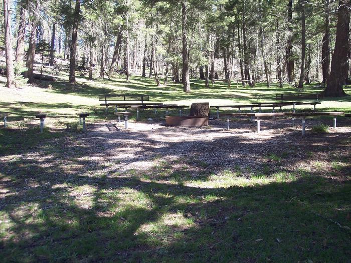
An open meadow, perfect for sports like ultimate Frisbee or horseshoes, is connected to the campground. The Rim Trail is a short hike or drive away, offering epic views, rocky inclines, and switchbacks for adventurous mountain bikers, hikers, and horse-back riders. Further down, the same trail opens up to motorcyclists as well.

Facilities

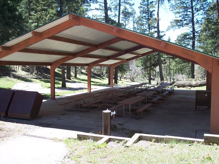
This is one of the only group sites with water access. Upper Fir comfortably fits groups as large as 120, and it’s connected to Lower Fir Group if your party has a need for an additional group of up to 70 campers.

Natural Features

Set 9,000 feet above sea level in the Sacramento Mountains, Upper Fir Group Area is close to breathtaking scenic overlooks, spanning the far-reaching desert valley of the Tularosa Basin. The high-elevation region offers a mixture of pine, fir, aspen, and oak trees, with high mountain meadows full of wildflowers and blossoming plants.

Nearby Attractions

The campground is a mile from the town of Cloudcroft, a quaint tourist village with New Mexico’s only standing railroad trestle.

Reservation

More from CampingHiking.net:

GRAHAM CORRAL HORSE CAMPGROUND, Oregon Campground Images, Info & Reservations

Listen Directions From Sisters, OR: Travel 4.2 miles west on Highway 242 (McKenzie Pass Highway), then 2.0 miles north on Forest Road 1012, and then 0.8 miles northwest on Forest Road 1012 300. Phone 541-323-1746 Activities CAMPING, HORSEBACK RIDING, HORSE CAMPING Keywords Related Link(s) Rec Area Info & Images Oregon

NORTH FORK CAMPGROUND, Colorado Campground Images, Info & Reservations

Listen Directions Take I-70 west of Denver, Colorado, to Rifle. Take Highway 13 to Meeker, and turn on Country Road 8 for 32 miles. Turn left into North Fork Campground. Phone 970-927-0107 Activities BIKING, CAMPING, FISHING, HIKING, HORSEBACK RIDING, HUNTING, WILDLIFE VIEWING Keywords NOR2,MEEKER,WHITE RIVER,NORTH FORK CAMPGROUND,WHITE RIVER NF -FS

WESTCLIFF, Texas Campground Images, Info & Reservations

Listen Directions From Interstate 35 in Belton, Texas take the 294 exit (6th Avenue or Farm-to-Market Road 93) west. Turn north onto 317 (Main Street) and drive for two miles. Turn west on FM 439 (Lake Road) and go four miles. Turn right on Sparta Road, then take a right

COWHIDE COVE, Arkansas Campground Images, Info & Reservations

Listen Directions From Hot Springs, Arkansas, take Highway 70 west for 41 miles to Kirby. Continue onto Route 27 south for 5 miles to Cowhide Cove Access Road. Turn right on the access road and drive 2 miles to the campground. Phone 870-285-2151 Activities BOATING, CAMPING, FISHING, HUNTING, SWIMMING SITE

EASTSIDE, Idaho Campground Images, Info & Reservations

Listen Directions From Horseshoe Bend, Idaho, take Highway 52 for 9 miles west to the junction with the Sweet/Ola Highway. Turn north and travel 16 miles to Ola, Idaho. Travel north through Ola and follow 10 miles northeast on FS Rd 618, then make a right on FS Rd 626