BLACK CANYON, NM Campground Reservation, Info, Images, Map, Directions

BLACK CANYON, New Mexico Campground Images, Info & Reservations

Listen

Directions

From downtown Santa Fe, New Mexico, travel north on Washington Avenue to Artist Road (Hyde Park Road/State Route 475) and turn right. Continue for 7 miles to Black Canyon.

Phone

505-753-7331

Activities

BIKING, CAMPING, HIKING

Keywords

BOYD,SANTA FE NF – FS

Related Link(s)

Rec Area Info & Images

New Mexico State Tourism

New Mexico State Road Conditions
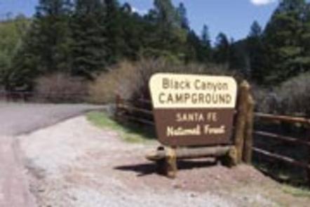
Overview

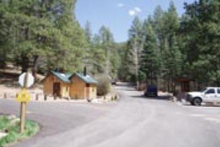
Black Canyon Campground is in a great location to experience some of the finest mountain scenery the Southwest has to offer. The facility is newly renovated and provides access to a variety of outdoor recreational activities.

Recreation

Hikers enjoy a pleasant hiking 1.5-mile trail that loops around the campground and into the surrounding forest. Several additional hiking, mountain biking and horseback riding trails are located nearby.

The Pecos Wilderness can be accessed eight miles from the campground, with many trails leading to majestic peaks and through valleys, canyons and forested groves.

Many recreation opportunities exist along Highway 475, both above and below Black Canyon Campground, including hiking and biking trails and picnic areas. In the winter, the area offers both Nordic and alpine skiing.

Facilities

The campground offers many single and double-family sites, most of which are accessible. Some sites are designated as walk-to sites for tent camping only. A few are available on a first-come, first-served basis.

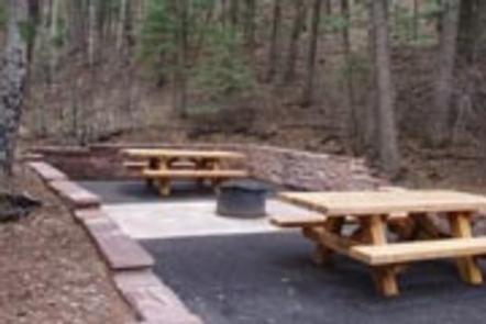
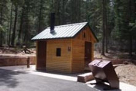
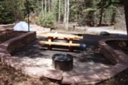
Each site is equipped with a table and campfire ring with grill. Accessible vault toilets and drinking water are provided. The highway to the campground is paved.

The campground is adjacent to New Mexico’s Hyde State Park, where a dump station is available.

Natural Features

The campground is situated in a forest of pine, aspen and fir trees. A good mix of sun and shade is found throughout the area. Many beautiful views are found in the surrounding forest.

Nearby Attractions

The campground is located about seven miles northeast of the town of Santa Fe, New Mexico. This unique town is known for its cultural heritage, art galleries and museums.

Reservation

More from CampingHiking.net:

Eight Fathom Cabin, Alaska Campground Images, Info & Reservations

Listen Directions Eight Fathom Cabin is located 15 miles southwest of the City of Hoonah, Alaska on the north shore of Eight Fathom Bight at the head of Port Frederick. Access is by float plane or boat only. It is a 45-minute boat ride from Hoonah and approximately a 30-minute

ANAN BAY CABIN, Alaska Campground Images, Info & Reservations

Listen Directions This cabin is on the mainland at Anan Bay, across Ernest Sound from the southeast corner of Wrangell Island. The site is 27 miles by air from Wrangell, and is accessible by boat and float plane. There is a 40-foot mooring float anchored in the bay for use

CANTON CREEK CAMPGROUND, Oregon Campground Images, Info & Reservations

Listen Directions From Roseburg, Oregon, travel east on OR-138 (North Umpqua Highway) for 39 miles to Steamboat Creek Rd., Forest Road 38 and turn left. Canton Creek Campground is 1/4 mile on the right. Phone 541-496-3532 Activities BIRDING Keywords Related Link(s) Rec Area Info & Images Oregon State Road Conditions

LITTLE MILL, Utah Campground Images, Info & Reservations

Listen Directions From Salt Lake City or Provo, take I-15 to the Alpine-Highland exit 284. Travel 8 miles east on Utah Highway 92 to the mouth of American Fork Canyon. Stay on 92 for 4 miles to the campground. Phone PLEASANT GROVE RANGER DISTRICT 801-785-3563 OR UTAH RECREATION COMPANY 385-273-1100

GOOSE MEADOWS, California Campground Images, Info & Reservations

Listen Directions From Truckee, Calif., take Highway 89 south for 5 miles to the campground. Phone (530)587-3558. FOR RESERVATIONS, PLEASE CALL: 1 (877) 444-6777. Activities BIKING, CAMPING, FISHING, HIKING, SWIMMING, WATER ACCESS Keywords GOOM,TAHOE NF – FS Related Link(s) Rec Area Info & Images California State Road Conditions California State

LONG POINT (CA), California Campground Images, Info & Reservations

Listen Directions Located 30 miles northeast of Taylorsville, on the Genesee-Antelope Lake Road. From Janesville, take County Road 208 for 4 miles and turn onto Forest Service road 28N01 for 9 miles, then turn right on Forest Service road 28N03 and continue for 2 miles. Phone 530-283-0555 Activities BIKING, CAMPING,