FRYING PAN, UT Campground Reservation, Info, Images, Map, Directions

FRYING PAN, Utah Campground Images, Info & Reservations

Directions

From Highway 24 northwest of Loa, Utah, take Highway 25 northeast approximately 15 miles to the campground.

Phone

435-836-2811

Activities

BIKING, BOATING, CAMPING, FISHING, HIKING, WILDLIFE VIEWING

Keywords

FRYI,FISHLAKE NF – FS

Related Link(s)

Rec Area Info & Images

Utah State Road Conditions

Utah State Tourism

Overview

Frying Pan Campground is located on the Fishlake Scenic Byway in central Utah, just 3 miles north of Fish Lake, at an elevation of 9,000 feet. Visitors enjoy boating, fishing and exploring local trails.

Recreation

Fish Lake is Utah’s largest natural mountain lake and covers 2,500 acres. It is famous for its 20-40 pound Mackinaw lake trout. Anglers also enjoy fishing for rainbow trout and splake. Boating, canoeing, swimming and scuba diving are popular activities.

The scenic Lakeshore National Recreation Trail extends around the eastern side of the lake. Hikers are rewarded with stunning lake views after climbing 900 feet in elevation.

Facilities

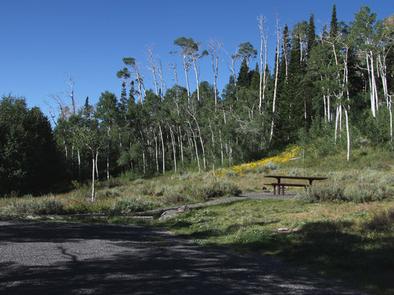
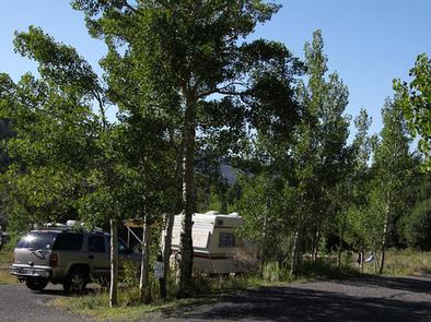
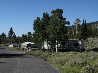
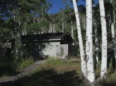
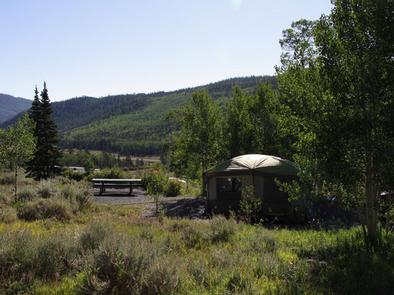
The campground contains one group site that can accommodate up to 100 people, with picnic tables, a campfire ring and large parking area. Several single-family sites are available as well. Flush toilets and drinking water are provided. Roads and parking spurs are paved.

Three resorts are located in the Fish Lake Basin, offering camping and fishing supplies, RV parks with hookups, cabin and boat rentals, marinas, gas, restaurants, groceries, laundry facilities and showers. The resorts are open from Memorial Day to Labor Day.

Natural Features

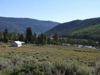
The campground sits on a sagebrush-covered hillside above the valley floor and offers views of the north end of Fish Lake Basin. Aspen trees forest the site, providing limited shade.

Nearby Attractions

Johnson Valley Reservoir is just north of Fish Lake, offering additional fishing and boating opportunities.

The 5-mile Pelican Canyon Trail begins nearby at Bowery Creek Campground. It leads through meadows and dense forests of spruce, pine and aspen as it climbs to the 11,633-foot Fish Lake Hightop.

Reservation

More from CampingHiking.net:

JACKS GULCH, Colorado Campground Images, Info & Reservations

Directions From Fort Collins, take Highway 14 northwest for 42 miles, then County Road 63 E (Pingree Park Road) south for 6 miles. Phone 970-295-6700 Activities BIKING, CLIMBING, CAMPING, FISHING, HIKING, HORSEBACK RIDING, WILDLIFE VIEWING, MOUNTAIN BIKING, BIRDING Keywords JAGU,ARAPAHO AND ROOSEVELT NF – FS Related Link(s) Rec Area Info

BUTTERMILK, Idaho Campground Images, Info & Reservations

Directions From West Yellowstone, Montana, take Highway 20 south, southwest for approximately 25 miles and from Ashton, Idaho, take Highway 20 north for approximately 27 miles. Turn west onto the Kilgore-Yale Road #030 (across from Elk Creek Gas Station) and go about 2 miles to the Buttermilk Loop Road #126.

LAKE FORK CAMPGROUND, Colorado Campground Images, Info & Reservations

Directions Lake Fork campground is located off of Hwy 50 between Gunnison and Montrose, along Blue Mesa reservoir. Phone 970-641-2337 Activities BIKING, BOATING, CAMPING, FISHING, HIKING, HUNTING, WATER SPORTS, WILDLIFE VIEWING, SWIMMING SITE Keywords LAFO,CURECANTI NATIONAL RECREATION,CURECANTI Related Link(s) Rec Area Info & Images Colorado State Road Conditions Colorado State

LONE ROCK (CA), California Campground Images, Info & Reservations

Directions Take Arlington Road off Highway 89 (near Crescent Mills) to Taylorsville Road, continuing on Genesee Road and Indian Creek Road to Antelope Lake. Phone 530-283-0555 Activities BIKING, BOATING, CAMPING, INTERPRETIVE PROGRAMS, FISHING, SWIMMING SITE Keywords LON1,ANTELOPE LAKE,SUSANVILLE,TAYLORSVILLE,JANESVILLE,PLUMAS NF – FS Related Link(s) Rec Area Info & Images California State

BURNT RANCHERIA, California Campground Images, Info & Reservations

Directions Located 50 miles east of San Diego, California. From I-8 take the Sunrise exit. Go approximately 11 miles to Milepost 23. Stop at entrance for campground information and site location. Phone 619-473-0120 Activities CAMPING, INTERPRETIVE PROGRAMS, VISITOR CENTER, DAY USE AREA Keywords BURN,CLEVELAND NF – FS Related Link(s) Rec

HANNA FLAT, California Campground Images, Info & Reservations

Directions Travel east on I10 (Highway 330) to Running Springs. Turn onto Highway 18 and continue to Big Bear Lake Dam but do not cross the dam. Highway 18 becomes Highway 38. Continue to the Fawnskin Fire Station and turn left onto Rim of the World Drive (Forest Route 3N14)