MARION MOUNTAIN, CA Campground Reservation, Info, Images, Map, Directions

MARION MOUNTAIN, California Campground Images, Info & Reservations

Listen

Directions

From Interstate 10 in Banning, take Highway 243 south for about 20 miles to Alandale. Travel east on Stone Creek Campground Road for about 2 miles to Marion Mountain Campground.

Phone

909-382-2922

Activities

BIKING, CAMPING, FISHING, HIKING, HORSEBACK RIDING, FIRE LOOKOUTS/CABINS OVERNIGHT

Keywords

MARI,SAN BERNARDINO NF – FS

Related Link(s)

Rec Area Info & Images

California State Road Conditions

California State Tourism

Overview

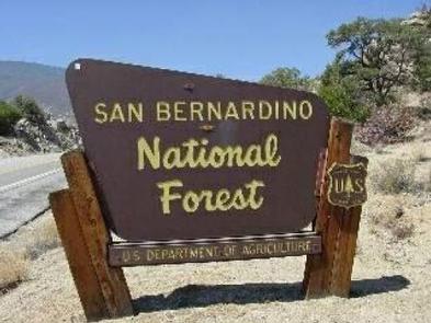
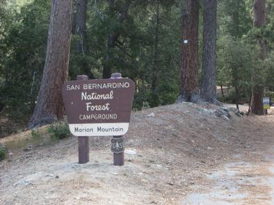
The Marion Mountain Campground offers a beautiful retreat in the San Bernardino National Forest. It provides access to a number of hiking trails that lead to some of the most spectacular views of Southern California.

Recreation

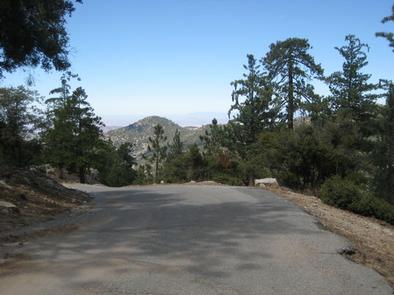
Visitors enjoy sport climbing on rocks within the campground. Hiking on the nearby Marion Mountain Trail, which leads to San Jacinto Peak, is also available. Views from the peak extend to the ocean and across the Palm Desert, as well as the San Bernardino and San Gabriel mountains on a clear day.

The 11.8-mile Marion Mountain Trail is the shortest route up the mountain, but also quite strenuous in areas. Shorter hikes can be enjoyed on other nearby trails.

Facilities

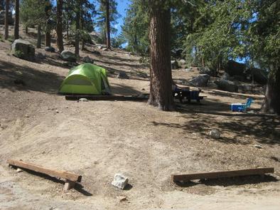
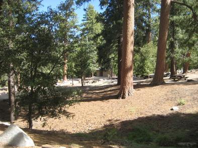
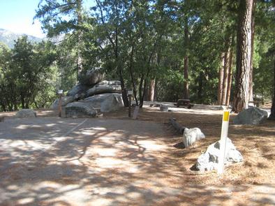
The campground offers about two dozen campsites for both tent and RV camping. All campsites are equipped with tables and campfire rings with grills. Vault toilets and drinking water are also provided.

Natural Features

The campground is located in a forested area at an elevation of 6,400 feet. Mature cedar and pine trees provide ample shade and privacy between campsites.

Nearby Attractions

The campground is located approximately 50 miles from San Bernardino, California, and seven miles north of Idyllwild, which is popular for its small-town atmosphere and variety of shops and restaurants.

Reservation

More from CampingHiking.net:

GRAYBACK, Idaho Campground Images, Info & Reservations

Listen Directions From Boise, take State Highway 21 north for 36 miles. Campground access road is located on the east side of the road, between mileposts 36 and 37. Turn right and travel a quarter-mile to the campground. Phone 208-392-6681 Activities CAMPING, FISHING, HIKING, HUNTING, VISITOR CENTER, WILDLIFE VIEWING Keywords

POCKET PICNIC SHELTER, Georgia Campground Images, Info & Reservations

Listen Directions From I-75, take Exit 320 (LaFayette/Resaca) and head west on Georgia State Route 136 for approximately 14 miles. Turn left onto Pocket Road and continue approximately 7 miles. The recreation area is on the left. The second driveway leads to the picnic shelter. Phone 706-695-6736 Activities HISTORIC &

ALLEY CREEK CAMP, Texas Campground Images, Info & Reservations

Listen Directions From Jefferson, TX, travel 3.8 miles northwest on Highway 49. Turn left onto FM 729 and continue for 12 miles to the park entrance on the left. Phone 903-755-2637 Activities BOATING, CAMPING, FISHING, HIKING, HUNTING, WATER SPORTS, WILDLIFE VIEWING, SWIMMING, BIRDING Keywords ACRC,LAKE OF THE PINES,LAKE O THE

SOUTH OVERLOOK (IA), Iowa Campground Images, Info & Reservations

Listen Directions 1105 North HWY T15 Knoxville, Iowa 50138 From Pella, Iowa, follow county road T-15 southwest for 4 miles, then follow signs to South Overlook. Phone 641-828-7522 Activities BIKING, BOATING, CAMPING, HUNTING, WILDLIFE VIEWING Keywords Related Link(s) Rec Area Info & Images Iowa State Road Conditions Iowa State Tourism