

Directions
From Asheville, North Carolina, take I-40 West to I-26 East to Exit 40 (Airport Road/Asheville Regional Airport), onto State Highway 280. Continue south 15.5 miles on 280 to Pisgah National Forest. Turn right at the intersection of Highway 280/64/276. Go north on 276 for 1 mile. Follow signs to the campground.
From Spartanburg, South Carolina, take I-26 West to Exit 40 (Airport Road/Asheville Regional Airport), onto State Highway 280. Continue south 15.5 miles on 280 to Pisgah National Forest. Turn right at the intersection of Highway 280/64/276. Go north on 276 for 1 mile. Follow signs to the campground.
From Charlotte, North Carolina, take I-85 South to Gastonia and exit at U.S. Highway 74 West. Merge with I-26 West to Exit 40 (Airport Road/Asheville Regional Airport), onto State Highway 280. Continue south 15.5 miles on 280 to Pisgah National Forest. Turn right at the intersection of Highway 280/64/276. Go north on 276 for 1 mile. Follow signs to the campground.
Phone
(828) 785-5337
Activities
CAMPING, INTERPRETIVE PROGRAMS, FISHING, HIKING, WATER SPORTS, DAY USE AREA, SWIMMING SITE
Keywords
DAVI,NFs IN NORTH CAROLINA – FS
Related Link(s)
North Carolina State Road Conditions
Overview
Davidson River Recreation Area offers camping and outdoor activities for the whole family. The campground boasts several loops of shaded campsites, as well as access to hiking trails, fishing spots, waterfalls and several nearby attractions within Pisgah National Forest. It lies just four miles west of the town of Brevard and less than an hour from the city of Asheville. The facility is open year-round.
Recreation
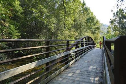
The forest is known for its hiking trails, several of which are near the campground. Hikers can challenge themselves with the 12.3-mile Art Loeb Trail, the 3.7-mile North Slope Trail or a 1.5-mile walking trail.
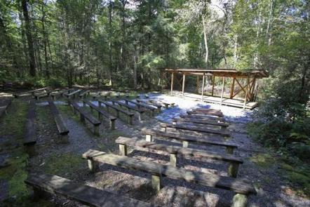
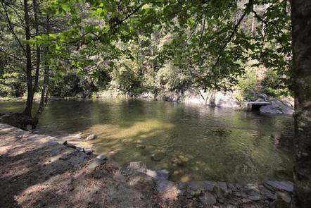
The Davidson River offers excellent trout fishing, plus tubing and swimming, which are kid-friendly favorite activities. Visitors wishing to learn more about the area can attend educational programs in summer and fall.
Facilities
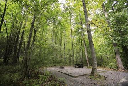
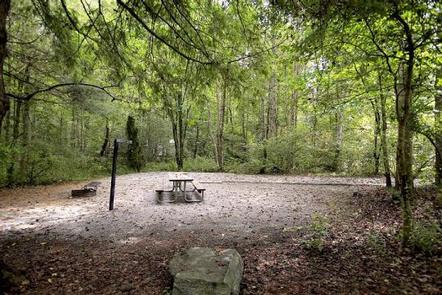
Campsites are organized into eight loops and some are adjacent to the water. Sites are mostly shaded and equipped with picnic tables, tent pads, lantern posts and campfire rings with grills. The facility also provides hot showers and restrooms with flush toilets in each loop. Campers can purchase ice and firewood on-site and rent bikes nearby.
Natural Features
The campground is located in Pisgah National Forest at an elevation of 2,150 feet. The surrounding land boasts mile-high peaks, cascading waterfalls and slopes thickly forested with hardwoods and conifers. The group camping area is adjacent to the beautiful Davidson River.
Nearby Attractions
Several natural and cultural attractions are within close proximity to the campground. Sliding Rock, Looking Glass Falls and the scenic Blue Ridge Parkway are among the more popular sites. The small town of Brevard offers various amenities and services, and visitors can take a trip to Asheville to visit art galleries, shops and restaurants.
Charges & Cancellations
Any cancellations must be taken care of directly with recreation.gov. Note that this facility does not provide refunds for No Shows or incliment weather.