


Directions
From Kane, Pennsylvania, take State Highway 321 north for 10 miles, then turn onto Longhouse Scenic Drive and continue for a mile to the campground.
From Warren, Pennsylvania, take State Highway 59 east for 13 miles, then turn south on Longhouse Scenic Drive and continue for 10 miles.
Phone
814-368-4158
Activities
CAMPING, FISHING, HIKING, VISITOR CENTER, DAY USE AREA, SWIMMING SITE
Keywords
KIAS,ALLEGHENY NF – FS
Related Link(s)
Pennsylvania State Road Conditions
Overview
Kiasutha Campground sits on the Kinzua Arm of the Allegheny Reservoir in northwest Pennsylvania, offering countless water activities.
Recreation
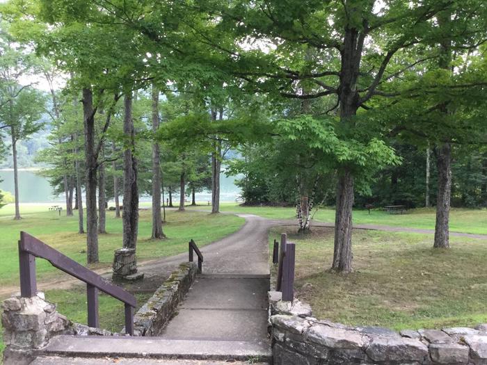
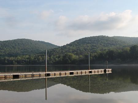
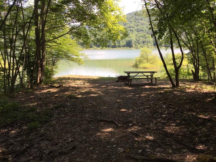
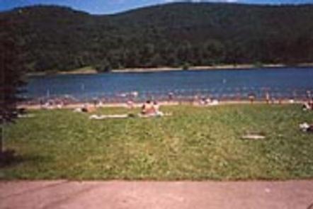
Visitors enjoy the large, grassy beach for swimming and relaxing. A boat ramp and dock allow visitors to enjoy the vast lake for boating, and a paved trail leads to an accessible fishing pier. Campsites offer a variety of views and conditions, from shaded forest to views of the reservoir, primitive walk-in camping or RV camping with electric hook-up. Some sites are back-in and some are pull-through for easier access.
Facilities
There are about 90 reservable family campsites, each containing a picnic table, fire ring and tent pad. The loop roads are paved. Amenities include flush toilets, drinking water, hot showers, a dump station and amphitheater.
The beach and picnic area have a capacity of 900 people. The grounds also include a playground, parking facilities and a bathhouse. Firewood, ice, interpretive services and 24-hour campground attendants are offered at the site.
Natural Features
The Allegheny National Forest covers nearly half a million acres and is populated primarily with black cherry, maple and other hardwoods. The Kinzua Dam, built in 1965, impounds the Allegheny River to form the 25-mile-long Allegheny Reservoir. Since Kinzua Creek flowed into the Allegheny RIver, a part of it is also impounded, creating the Kinzua Arm. It is a little narrower than the main Allegheny Reservoir, allowing for a little more intimate connection between water and shore, and is not as subject to weather as the more open main reservoir. This campground sits on forested hills off the Longhouse Scenic Byway, a 29-mile loop that circles the Kinzua Creek Arm of the Allegheny Reservoir.
Nearby Attractions
The Kinzua Dam and Bridge are within driving distance.