CHAVEZ CROSSING, AZ Campground Reservation, Info, Images, Map, Directions

CHAVEZ CROSSING, Arizona Campground Images, Info & Reservations

Listen

Directions

201 Oak Creek Cliffs Dr. Sedona, AZ 86336 If coming from Flagstaff, take I-17 south to Hwy 89A. Go south on 89A through Oak Creek Canyon to Sedona. Left to State Highway 179. Go South on Hwy 179 approximately 2 miles. Turn right on Oak Creek Cliffs Dr. to the campground on the left hand side adjacent to Poco Diablo Resort. From Phoenix get off on Sedona Exit 298 travel 12.7 miles North on HW 179, turn left on Oak Creek Cliffs Dr. to the campground on the left adjacent to The Poco Diablo Resort along Oak Creek.

Phone

928-204-0028

Activities

CAMPING

Keywords

CHAV,COCONINO NF – FS

Related Link(s)

Rec Area Info & Images

Arizona State Tourism

Forest Service Concessionaire

Arizona State Road Conditions

Overview

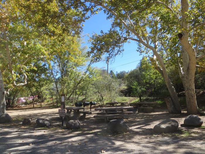
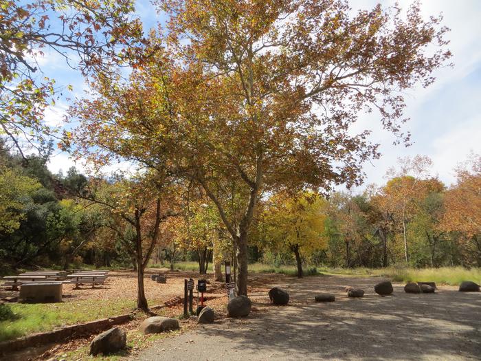
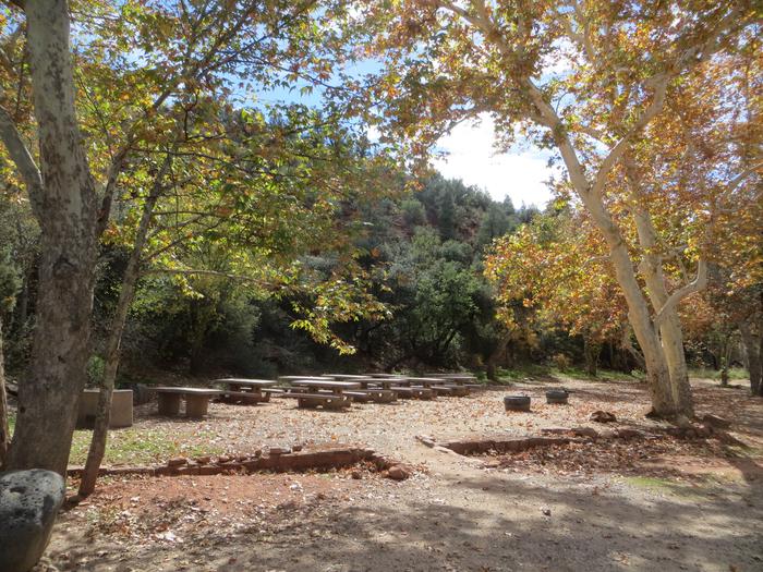
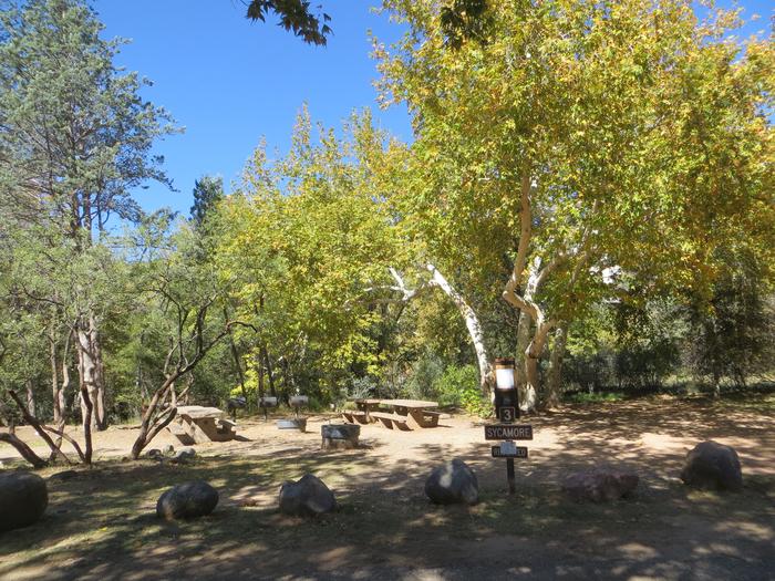
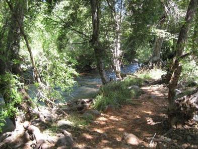
Chavez Crossing Group Campground is in the picturesque Red Rock district of Arizona, with famous red rock formations and breathtaking painted sunsets. Placed beside a creek and surrounded by sycamore and cypress groves, the campground’s location offers a fresh sense of the great outdoors. It’s also conveniently close to developed entertainment like golf courses and stylish restaurants in the resort town of Sedona. Drive through Oak Creek Canyon to view majestic red-hued cliffs, buttes, and canyons. At night, relax by the campfire at your site or take advantage of Sedona’s trendy shopping and nightlife.

Recreation

Go wading or fishing in the crystal clear waters of Oak Creek or take a stroll with your camera to photograph the unique flora, fauna and rock formations. Cathedral Rock and Bell Rock are famous nearby attractions, perfect for exploring or photographing.

Facilities

The campground’s location makes it a convenient place to mix outdoors time with shopping trips in the resort town of Sedona. Three group sites are available, and all three can be reserved for a total capacity of 110.

Natural Features

Chavez Crossing is in a high desert region situated at the base of the Mogollon Rim, a 200-mile long slope that ranges between 5,000 and 7,000 ft elevation. The unique landscape creates erosion that has shaped spectacular canyons and buttes that make the region an appealing attraction.

Nearby Attractions

A variety of hiking trails and swimming holes are a short drive away. Seek out your favorite panoramic views at Munds Mountain Wilderness, or explore the Red Rock/Secret Mountain Wilderness area in the heart of Oak Creek Canyon. Here, you can find abandoned dwellings and rock art from early inhabitants.

Reservation

More from CampingHiking.net:

UPPER TWILIGHT GROUP SITE, Arizona Campground Images, Info & Reservations

Listen Directions From Safford, Arizona: Take State Route 191 south for 6 miles. Turn right onto State Route 366/Swift Trail and travel 14.5 miles to the Twilight Campground entrance (MM 128.4), following the road for 1 mile to the Upper Twilight Group Site.  From Tucson, Arizona: Take I-10 East for

DAVIS LAKE CAMPGROUND, Mississippi Campground Images, Info & Reservations

Listen Directions From Tupelo, drive 17 miles south on the Natchez Trace Parkway to the Davis Lake Recreation Area Exit at milepost 243. Turn right on Davis Lake Road and continue 4 miles to the campground. Phone 662-285-3264 Activities BIKING, BOATING, CAMPING, FISHING, HIKING, WATER SPORTS, WILDLIFE VIEWING, SWIMMING SITE

HUNGRY GULCH, California Campground Images, Info & Reservations

Listen Directions From Bakersfield take Highway 178, to the town of Lake Isabella. From Lake Isabella, take Highway 155 North approximately four miles to the campground. Phone 760-376-1815 Activities CAMPING Keywords HUNG,LAKE ISABELLA,KERN VALLEY,SEQUOIA NF – FS Related Link(s) Rec Area Info & Images California State Road Conditions California State

THIBAUT POINT, Missouri Campground Images, Info & Reservations

Listen Directions From Highway 65, take Highway T west for 3 miles. Turn south on Georgetown Ave and follow for a mile, following signs into the park. Phone 660-428-2470 Activities BOATING, CAMPING, FISHING, FISH HATCHERY, SWIMMING SITE Keywords THIB,TRUMAN LAKE,TEBO,HARRY S TRUMAN Related Link(s) Rec Area Info & Images Missouri

BOX ELDER CAMPGROUND, Utah Campground Images, Info & Reservations

Listen Directions From Highway 89/91, travel 4.5 miles east of Brigham City, Utah. Look for highway signing at the town of Mantua. Phone LOGAN RANGER DISTRICT 435-755-3620 OR UTAH RECREATION COMPANY 385-273-1100 Activities BOATING, CAMPING, FISHING, HIKING, HORSEBACK RIDING, PICNICKING Keywords BOXI,Mantua Campground,WASATCH-CACHE NF – FS Related Link(s) Rec Area

PROSSER RANCH GROUP, California Campground Images, Info & Reservations

Listen Directions From either east bound or west bound Interstate 80 in Truckee take exit 188, Highway 89 north toward Sierraville. In aproximately 3.5 miles turn right at the sign for Prosser Recreation Sites then in about two miles the campground will be on the right. Phone 530-587-3558. FOR RESERVATIONS,