

Directions
From Gunnison, take Colorado Highway 135 north 28 miles to Crested Butte. Turn left on Gunnison County Road 12. Proceed 7 miles. Turn right on Forest Road 826 and follow signs to the campground.
Phone
970-349-6348
Activities
BIKING, BOATING, CAMPING, FISHING, HIKING
Keywords
LAKI,GUNNISON,GM,UNCOMP NF – FS
Related Link(s)
Colorado State Road Conditions
Overview
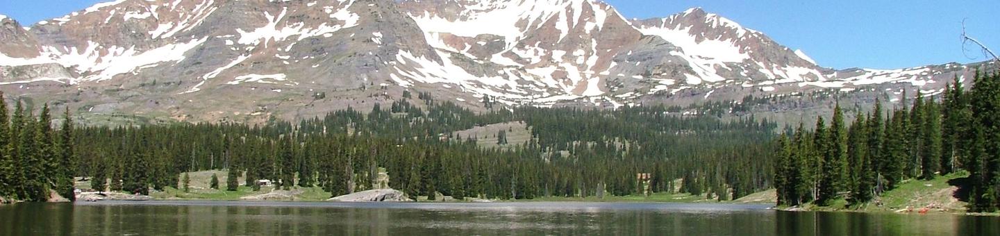
Lake Irwin Campground is situated on the western banks of its picturesque namesake lake, approximately 9 miles from Crested Butte, Colorado. Visitors enjoy the area for its abundant trail opportunities, fishing and beautiful scenery.
Recreation
Mountain biking and hiking are popular activities in this challenging, rugged terrain. Canoeing and fishing are favorite pastimes as well. The lake is usually so full of fish, one can see them rise to the calm surface.
Facilities
The campground offers several single-family campsites, some of which are accessible. Each site is equipped with a picnic table and campfire ring. Drinking water is provided.
Natural Features
The campground is set high in the Colorado Rockies at an elevation of 10,200 feet. Summer days are cool and afternoon showers are common. Nights can be chilly.
Lake Irwin borders the campground on the east, and the Ruby Mountain Range lies to the west. Vivid wildflowers fill the landscape during July and August. Most campsites are shaded by mature Englemann spruce and subalpine fir trees.
The Grand Mesa, Uncompahgre and Gunnison National Forests are located on the western slope of the Rocky Mountains. Together, the three forests cover 2.9 million acres in the central and southern Rocky Mountains, south of the Colorado River and west of the Continental Divide.
Nearby Attractions
The charming town of Crested Butte is a short drive from the campground. The former coal mining town offers a variety of outdoor activities, dining and shopping options and annual festivals, like the Crested Butte Wildflower Festival.