Lakeview Gunnison, CO Campground Reservation, Info, Images, Map, Directions

Lakeview Gunnison, Colorado Campground Images, Info & Reservations

Listen

Directions

From Gunnison, travel north on Highway 135 for approximately 10 miles to Almont. Turn right on County Road 742 and continue 25 miles to the campground entrance, which is on the right.

Phone

970-642-0566

Activities

BIKING, BOATING, CAMPING, FISHING, HIKING, HUNTING, WILDLIFE VIEWING

Keywords

LABI,LAKEVIEW TAYLOR PARK,GUNNISON,GM,UNCOMP NF – FS

Related Link(s)

Rec Area Info & Images

Colorado State Tourism

Colorado State Road Conditions

Forest Service Concessionaire

Overview

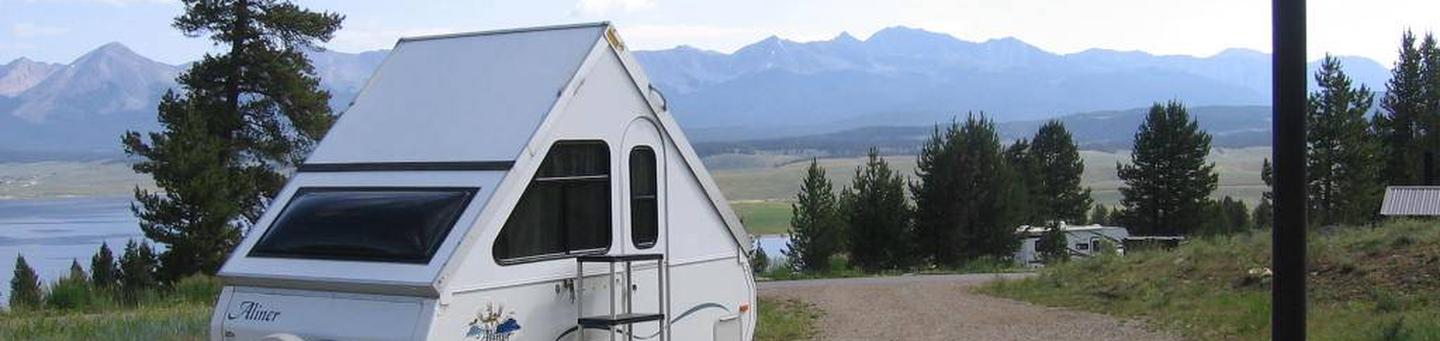
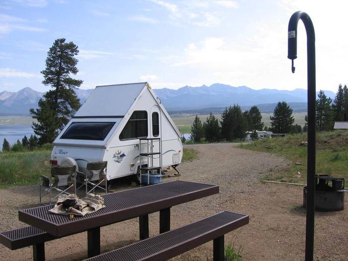
Lakeview Campground is located on Taylor Park Reservoir, at an elevation of 9,400 feet. Visitors enjoy the area for its fishing and boating, and abundant off-road and biking opportunities.

Recreation

Taylor Park Reservoir offers boating, fishing and swimming. Anglers cast for northern pike, kokanee salmon, and rainbow, brown, brook and cutthroat trout. A boat ramp is located just below the campground. Fishing and pontoon boat rentals are available at the marina.

A number of off-road trails are found in the surrounding area, including Doctor Park Trail, Taylor River Trail and Taylor Vista Trail.

Facilities

The campground offers several single-family campsites, some of which have electric hookups. Some sites are also accessible. Each site is equipped with a picnic table and campfire ring. Vault toilets, drinking water and trash collection are provided.

Natural Features

The campground is situated just above Taylor Park Reservoir, among ponderosa and lodgepole pine trees. The valley floor is broad, flat and dotted with sagebrush. Most campsites have beautiful views of the reservoir and the Sawatch Mountains.

Reservation

More from CampingHiking.net:

DELTA NATIONAL FOREST – CAMPING, Mississippi Campground Images, Info & Reservations

Listen Directions From Jackson, MS- take I-20 towards Vicksburg; exit 5A towards Rolling Fork (US 61N); turn right on Hwy. 16 and travel for approximately 7 miles; turn right on the Delta National Forest. Phone 662-873-6256 Activities BOATING, CAMPING, INTERPRETIVE PROGRAMS, FISHING, HIKING, HORSEBACK RIDING, VISITOR CENTER, WILDLIFE VIEWING Keywords

HILLSBORO COVE, Kansas Campground Images, Info & Reservations

Listen Directions From Marion, Kansas, take Highway 56 for about five miles. Turn right on Nighthawk, then turn right again into the park. Phone 620-382-2101 Activities BOATING, CAMPING, FISHING, HUNTING, WILDLIFE VIEWING, SWIMMING SITE, SWIMMING, WATER ACCESS, ACCESSIBLE SWIMMING Keywords HILC,MARION RESERVOIR,MARION RESERVOIR Related Link(s) Rec Area Info & Images

JOHN C. BRISCOE GROUP USE, Missouri Campground Images, Info & Reservations

Listen Directions From Hannibal, MO, travel west on highway 36 for 17 miles, then continue south on Route J and head south 10 miles. From Perry, travel north on Rt. J for 9 miles. Phone 573-735-4097 Activities CAMPING Keywords MWBG,BOUDREAUX GROUP CAMP AREA,MARK TWAIN LAKE,MW Boudreaux Group Camp,Briscoe Group Camp,Boudreaux

SILVER DOLLAR, Colorado Campground Images, Info & Reservations

Listen Directions From Leadville, Colorado, drive west on County Road 4 and follow signs to the Turquoise Lake Recreation Area. Turn right on County Road 9C and follow to the campground entrance on the right. Phone 719-486-0749 (FOR INFORMATION ONLY, NO RESERVATIONS) Activities BOATING, HISTORIC & CULTURAL SITE, CAMPING, FISHING,