

Directions
From Conway, New Hampshire, follow State Route 16 south for 5 miles. The campground is on the right.
Phone
603-447-5448
Activities
BIKING, CAMPING, FISHING, HIKING, PICNICKING
Keywords
WHIL,WHITE MOUNTAIN NF -FS
Related Link(s)
New Hampshire State Road Conditions
Overview
White Ledge Campground is conveniently located off State Route 16, 5 miles south of the town of Conway, New Hampshire. It is a relatively small facility and provides easy access to town amenities and activities as well as superb scenic driving, hiking, fishing and rock climbing.
The White Mountains boast pristine forests, clear mountain streams and rivers and the tallest peaks in the Northeast. The forest encompasses nearly 800,000 acres in New Hampshire and western Maine, and is one of the most popular in the country.
Recreation
Campers can access numerous hiking trails, rock climbing routes, scenic overlooks and wildlife viewing locations within a short drive. Local rivers and streams offer stocked or wild trout for anglers. Nearby Jigger Johnson Campground offers educational programs on Saturday nights.
The White Mountains region hosts four alpine and five nordic ski areas, which provide year-round recreation opportunities such as skiing, hiking, mountain biking, outdoor concerts, interpretive trails, special events and regional and national skiing and snowboarding races.
The area also contains 1,200 miles of hiking trails, including 160 miles of the famous Appalachian Trail.
Learn more about recreation in the national forest.
Facilities
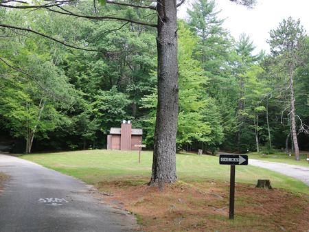
Campsites are organized into two loops. The facility is well shaded, and a grassy play area is available.
Accessible restrooms and a hand pump for drinking water are provided. There are no showers or dump station on-site. Noise from the road may be noticeable.
Natural Features
The campground is tucked away in a mixed white pine and hardwood forest in the southern part of White Mountain National Forest. The forest is home to many species of northern wildlife, including moose, white-tailed deer and black bear. Almost 200 species of birds, including the rare Bicknell’s Thrush, live in the forest.
Nearby Attractions
The nearby towns of Conway and North Conway offer tours, shopping, restaurants and many other amenities.
The Kancamagus Highway is a popular scenic byway perfect for a morning or afternoon drive on a clear day.
Within an hour drive, campers can access the Presidential Range, which consists of the tallest mountains in the forest, including the 6,288-ft. Mount Washington, the highest peak north of the Smoky Mountains and east of the Mississippi River.