DRIFTWOOD, OR Campground Reservation, Info, Images, Map, Directions

DRIFTWOOD, Oregon Campground Images, Info & Reservations

Listen

Directions

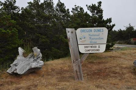
From Florence, OR travel seven miles south on Highway 101 turning right onto the Siltcoos Beach Access Road. Driftwood II Campground is on the right at mile 1.3.

Phone

541-271-6000

Activities

CAMPING, HIKING, WILDLIFE VIEWING

Keywords

DRIF,SIUSLAW NF – FS,Driftwood 2,Driftwood II

Related Link(s)

Rec Area Info & Images

Oregon State Tourism

Oregon State Road Conditions

Overview

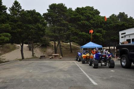
Driftwood is a designated off-road vehicle riding campground that offers direct sand access to the thrilling Oregon Dunes National Recreation Area. Heralded as the largest expanse of coastal sand dunes in North America, the recreation area attracts riders looking for the action of dune riding and the comfort of camping in a developed campsite with perks like hot showers.

Recreation

Off-road vehicle riding is the ultimate attraction here and the Driftwood II OHV Trail is a great place to start. For added variety, beach goers can enjoy swimming, sunbathing, and watching sea birds at the nearby beach. If in season, whales may be spotted in the ocean as well.

Facilities

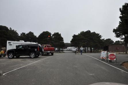
The layout of the campground is a large parking lot with designated camping sites. Most sites come with a picnic table and campfire pit, but RV pull-through sites 49-58 do not have these amenities. The campground has flush toilets, drinking water, hot showers, trash and recycling collection. First come first serve sites may be available.

Natural Features

The campground sits in the heart of Oregon’s coastal dunes, a short distance from the beaches of the Pacific Coast. The Oregon Dunes National Recreation Area, known for its wind-sculpted dunes reaching up to 500 feet above sea level, spans the coast for 47 miles. To the east are forests that extend up the Oregon Coast Mountain Range.

Nearby Attractions

The nearby Siltcoos Lake offers bass, cutthroat and rainbow trout fishing.

Reservation

More from CampingHiking.net:

RAYBURN, Texas Campground Images, Info & Reservations

Listen Directions From Pineland, TX, take FM 83 west 10 miles, then go south on FM 705 for 11 miles to FM 3127, then west for 1.5 miles and make a left into the park entrance. Phone 409-384-5716 Activities BOATING, CAMPING, FISHING, HIKING, HUNTING Keywords RAYB,SAM RAYBURN RESERVOIR,SAM RAYBURN LAKE,RAYBURN

EAGLE GUARD STATION, Montana Campground Images, Info & Reservations

Listen Directions All mileage is approximate from the highway. From Helena, take Highway 287 for 26 miles southeast towards Townsend, Montana. Turn right on Indian Creek Road just before crossing the Missouri River. Travel for 3 miles, then turn left onto Forest Road #4031 (purple sign). Travel 5 miles to

ORLEANS TRAIL, Missouri Campground Images, Info & Reservations

Listen Directions From Stockton, Missouri, take State Highway 39 south approximately 1/2-mile to R.B. Road. Take a left and drive approximately 1/2-mile. Turn right on Blake Street, continue about 1/2-mile, and follow signs to the park area. Phone 417-276-6948 Activities BOATING, CAMPING, FISHING, WILDLIFE VIEWING, SWIMMING SITE Keywords ORLE,STOCKTON LAKE,STOCKTON,SECOND

HOLIDAY, Georgia Campground Images, Info & Reservations

Listen Directions From LaGrange, Georgia, take State Highway 109 west for 7 miles. After crossing the First Lake Bridge, continue another mile and turn left onto Thompson Road. At the next intersection, bear left and follow signs to the park. This county road leads directly into the campground. Phone 706-884-6818