ALPINE NORTH LOOP, ID Campground Reservation, Info, Images, Map, Directions

ALPINE NORTH LOOP, Idaho Campground Images, Info & Reservations

Directions

From Alpine, Wyoming, travel 2 miles west on Highway 26 to the campground entrance.

Phone

208-270-0150 OR 541-351-1182

Activities

BIKING, BOATING, CAMPING, FISHING, HIKING, WATER SPORTS, WILDLIFE VIEWING

Keywords

ALPI,CARIBOU-TARGHEE NF – FS

Related Link(s)

Rec Area Info & Images

Forest Service Concessionaire

Idaho State Road Conditions

Idaho State Tourism

Overview

Alpine North Loop Campground is located in beautiful Star Valley, Wyoming at an elevation of 5,640 feet. The cozy town of Alpine is just 2 miles west. Visitors enjoy boating and fishing on Palisades Reservoir, and day-tripping to Jackson and Grand Teton National Park.

Recreation

Palisades Reservoir is very close, with excellent boating, water skiing, swimming and canoeing. Lake and shore fishing for wild and stocked cutthroat trout is very popular. Brown trout, Kokanee salmon and Mackinaw trout can also be found.

Boat ramps are located 2 miles away in Alpine and about 10 miles away near Blowout Campground, off Highway 26.

The Grey’s River, Salt River and Snake River merge nearby, offering great fishing and wildlife viewing opportunities.

The Palisades Creek Trail begins nearby, leading hikers, mountain bikers and horseback riders to beautiful Upper Palisades Lake and expansive views of Swan Valley.

Facilities

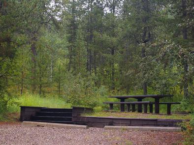
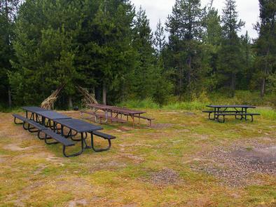
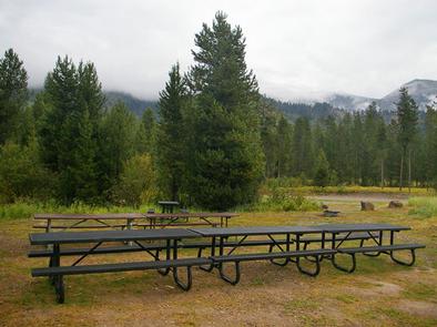
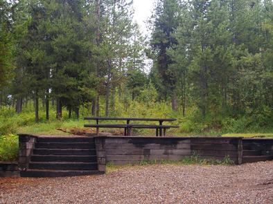
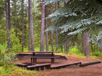
The campground offers three group sites that can accommodate up to 50 people each, with picnic tables and campfire rings with grills. Single and double sites are available as well, some have stairs from the parking spur to the site pad.

Vault toilets, drinking water and trash collection are provided, but there is no electricity. Roads and parking spurs within the site are gravel. Firewood is available for purchase from the host.

Natural Features

The campground is situated near Palisades Reservoir in a forest of lodgepole pines, which provide partial shade. The campground is relatively flat and some sites offer views of Star Valley. Summer wildflowers are abundant. Wind and summer thunderstorms should be expected.

Nearby Attractions

The town of Alpine is just 2 miles east. The popular Mountain Days Celebration is held annually in June, complete with arts and crafts shows, food, live music, a horseshoe tournament, authentic pioneer village and Native American dancers.

Jackson, Wyoming is 40 miles north, with restaurants, shops, galleries and ski resorts with summer activities.

Grand Teton National Park is approximately 55 miles north, with boating, fishing, hiking, canoeing and outstanding mountain scenery.

The Snake River and Swan Valley offer more great fishing and boating, as well as rafting, canoeing and numerous trails for hiking, biking, horseback and ATV riding.

Reservation

More from CampingHiking.net:

DEVILS GARDEN CAMPGROUND, Utah Campground Images, Info & Reservations

Directions From I-70, take Exit 182. Travel south for 26 miles to the park entrance. Take the park road 18 miles to Devils Garden. From Moab, take Highway 191 north for 4.5 miles to the park entrance. Take the park road 18 miles to Devils Garden. Phone 435-719-2299 Activities CAMPING,

LITTLE BEAR GROUP, Utah Campground Images, Info & Reservations

Directions The campground is located 13 miles west of Huntington, Utah, along Highway 31. Phone 435-384-2372 Activities BIKING, CLIMBING, CAMPING, FISHING, HIKING, HUNTING, WILDLIFE VIEWING Keywords LBEA,MANTI-LASAL NF -FS Related Link(s) Rec Area Info & Images Utah State Tourism Utah State Road Conditions Overview Little Bear Group Campground is located

MOOSE CREEK CABIN, Montana Campground Images, Info & Reservations

Directions From Helena, take U.S. Highway 12, and travel west for 7 miles to Rimini county road. From this intersection, take Rimini Road to the south approximately 4 miles to the cabin. It is located on the east side of the road just past the entrance to Moose Creek Campground.

JOHN C. BRISCOE GROUP USE, Missouri Campground Images, Info & Reservations

Directions From Hannibal, MO, travel west on highway 36 for 17 miles, then continue south on Route J and head south 10 miles. From Perry, travel north on Rt. J for 9 miles. Phone 573-735-4097 Activities CAMPING Keywords MWBG,BOUDREAUX GROUP CAMP AREA,MARK TWAIN LAKE,MW Boudreaux Group Camp,Briscoe Group Camp,Boudreaux Group

Creek Pasture Group Site, Utah Campground Images, Info & Reservations

Directions Turn west off US 191 onto Highway 211 and travel approximately 27 miles. The turn off to the campground is on the north side of the highway. It is located approximately 7.5 miles southeast of the Canyonlands National Park visitor’s center and 14.5 miles northwest of Newspaper Rock. The

WILLIS CREEK, Texas Campground Images, Info & Reservations

Directions From Interstate 35, take Highway 95. Go north on Highway 95 to County Road 346. Turn right on County Route 346 and go 4 miles to the park entrance. Follow signs. Phone 512-859-2668 Activities CAMPING, FISHING, HORSEBACK RIDING, WATER SPORTS, SWIMMING SITE Keywords WILC,GRANGER LAKE,LAKE GRANGER,GRANGER LAKE Related Link(s)