WARM RIVER, ID Campground Reservation, Info, Images, Map, Directions

WARM RIVER, Idaho Campground Images, Info & Reservations

Directions

From Ashton, Idaho, travel northeast on Highway 47 to Warm River. Turn right onto Fish Creek Road and continue 1/4-mile to the campground entrance.

Phone

208-558-7658

Activities

BIKING, BOATING, CAMPING, FISHING, HIKING, WATER SPORTS

Keywords

WARR,CARIBOU-TARGHEE NF – FS

Related Link(s)

Rec Area Info & Images

Idaho State Tourism

Forest Service Concessionaire

Idaho State Road Conditions

Overview

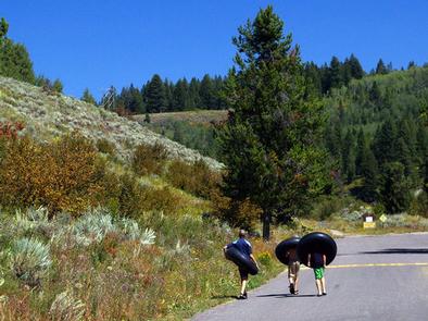
Warm River Campground is located on its namesake in the Caribou-Targhee National Forest of southwestern Idaho. Visitors love the campground for its river tubing opportunities. Fishing and hiking are popular as well.

Recreation

Warm River is a popular location for tubing and fishing. Anglers cast for whitefish, brook, rainbow and cutthroat trout.

Numerous hiking, mountain biking and horseback riding trails are in the immediate area, leading to natural springs, waterfalls and old railroad lines and tunnels.

Facilities

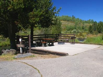
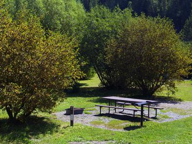
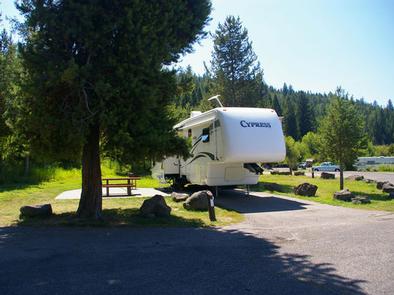
The campground offers one large group site that can accommodate up to 100 guests. Several single sites are also available, 11 of which are for tent camping only.

Vault toilets, drinking water and trash collection are provided. Firewood is available for purchase from the host.

Natural Features

The campground is situated along the slow-moving Warm River at an elevation of 5,200 feet. Thickets of willow line the riverbanks and pine trees offer partial shade.

Nearby Attractions

Ashton, Idaho, about 9 miles away, offers gas and grocery services.

Island Park is nearby, with numerous lakes, rivers, streams and trails, offering plentiful outdoor activities for visitors of all ages.

Yellowstone and Grand Teton National Parks are within a couple hour’s drive as well, with outstanding scenery and wildlife.

Reservation

More from CampingHiking.net:

MCGEE CREEK, California Campground Images, Info & Reservations

Directions From U.S. Highway 395 in California, take the McGee Creek exit, located 8 miles south of Mammoth Lakes and 37 miles north of Bishop. Proceed 2 miles south up the paved McGee Creek Road. The campground is on the left. Phone 760-935-4213 Activities CAMPING, FISHING, HIKING, HORSEBACK RIDING, WILDLIFE

DOYLE CREEK CAMPGROUND, Wyoming Campground Images, Info & Reservations

Directions From Buffalo, WY, take US Hwy 16 west 24 miles to County Rt. 3 (Hazelton Road). Turn left onto Hazelton Rd., and go 6.2 miles to campground turn off. Turn left and go 0.3 miles. Phone 406-587-9054 Activities BIKING, BOATING, CAMPING, FISHING, HIKING, WILDLIFE VIEWING, OFF ROAD VEHICLE TRAILS,

WHITETAIL RIDGE, Georgia Campground Images, Info & Reservations

Directions From Lagrange, Georgia, travel west on State Route 109 for about 7 miles. After crossing the first bridge across the lake, travel approximately one more mile, then turn left onto Thompson Road. After a mile, bear left and watch for the sign. Phone 706-884-8972 Activities BOATING, CAMPING, FISHING, WATER

SAGE HILL, California Campground Images, Info & Reservations

Directions From highway 101, take highway 154 approximately 15 miles to paradise road. Turn right and continue 5 miles to Los Prietos road. Turn left past the ranger station to the camp entrance. Phone 805-434-1996 Activities CAMPING, FISHING, HIKING, HORSEBACK RIDING, HUNTING, SWIMMING SITE Keywords SAGE,SANTA YNEZ RECREATION AREA,LOS PADRES