BIG MEADOWS RESERVOIR CAMPGROUND, CO Campground Reservation, Info, Images, Map, Directions

BIG MEADOWS RESERVOIR CAMPGROUND, Colorado Campground Images, Info & Reservations

Directions

From South Fork, Colorado, take Highway 160 for 13 miles west, turn onto Forest Road 410 SW, and go 1.8 miles to Big Meadows Campground.

Phone

435-245-6521

Activities

BOATING, CAMPING, FISHING, WILDLIFE VIEWING, DAY USE AREA

Keywords

BIGS,RIO GRANDE NF- FS

Related Link(s)

Rec Area Info & Images

Colorado State Road Conditions

Colorado State Tourism

Overview

Big Meadows is located in the San Juan Mountains in south-central Colorado, about 11 miles west of South Fork. The campground is lightly wooded with spruce trees, creating a beautiful meadow atmosphere.

The Rio Grande National Forest spans 1.86 million acres in south-central Colorado. The Continental Divide runs for 236 miles along most of the forest’s western border, presenting a myriad of ecosystems from alpine desert to dense wilderness.

Recreation

An accessible fishing pier, located on the north shore of the reservoir, allows anglers to cast for rainbow, brown and brook trout. Hunting, boating and hiking are also popular pastimes.

Hikers and horseback riders will enjoy the 6-mile Archuleta Trail. The trail accesses the Weminuche Wilderness, Colorado’s largest wilderness, which boasts the headwaters of dozens of major streams and rivers that feed into the Rio Grande and San Juan rivers.

Facilities

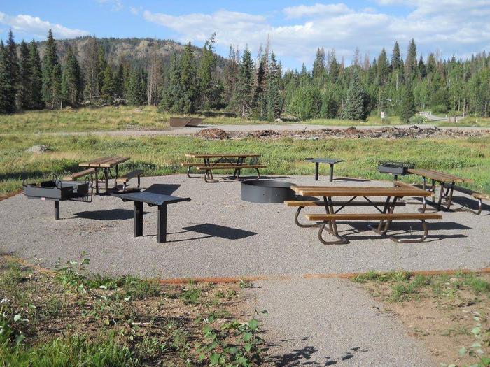
Each site has a campfire ring and picnic tables. Drinking water is available.

The nearest dump station is 13 miles away, and a boat ramp is located on the north shore of the reservoir.

Natural Features

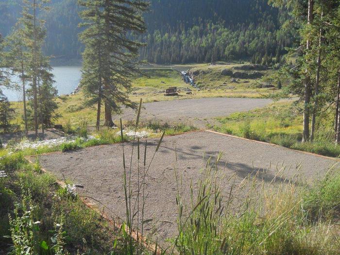
The campground meanders up a mountainside above Big Meadows Reservoir in a series of loops. As a sub-alpine region, the campground gets more rainfall than the opposite side of the lake, resulting in plentiful wildflowers and aspens surrounding the campsites.

Nearby Attractions

The surrounding area has plenty to keep visitors busy, with attractions like Great Sand Dunes National Park, Native American ruins, remnants of the Spanish Conquistadors and gold rush ghost towns. The Sangre de Cristo and San Juan Ranges are laced with trails for avid hikers.

Reservation

More from CampingHiking.net:

WALL CREEK CABIN, Montana Campground Images, Info & Reservations

Directions From Ennis, take US Highway south for about 18 miles to Indian Creek and the McAtee Bridge fishing access site. Turn right and go nearly 1 mile to junction just beyond bridge. Turn left and travel toward Wall Creek Wildlife Management Area for 2.7 miles to T junction. Turn

SMITH SPRINGS, Tennessee Campground Images, Info & Reservations

Directions From downtown Nashville, TN, take I-40 east 5 miles to exit 219. Turn right on Stewarts Ferry Pike, then left on Smith Springs Road. The recreation area is on the left after about 2 miles. Phone 615-889-1975 Activities BOATING, FISHING, PICNICKING, WILDLIFE VIEWING Keywords SMSP,J. PERCY PRIEST,PERCY PRIEST LAKE,J

FRENCHMAN, California Campground Images, Info & Reservations

Directions From Reno, Nevada, travel north on Highway 395. Merge onto Highway 70 west and travel 5 miles to Chilcoot. Turn north on Highway 284 and continue 8 miles to Frenchman Lake, turn right, cross the dam, and travel a mile to the campground. Phone 530-836-2575 Activities BOATING, CAMPING, FISHING,

PETERSBURG, Georgia Campground Images, Info & Reservations

Directions From I-20, take Exit 183 (Appling). Go north on HWY 221 approximately 6 miles. At the 4-way stop, go straight (HWY 221) another 2 miles. Campground road is on the left. Follow signs. Phone 706-541-9464 Activities CAMPING Keywords PETB,J STROM THURMOND LAKE Related Link(s) Rec Area Info & Images

FORT SPOKANE, Washington Campground Images, Info & Reservations

Directions Take State Highway 2 west of Spokane for 32 miles. Turn north on State Highway 25 at the town of Davenport and travel 24 miles. Follow the signs to the campground. Phone 509-754-7889 Activities BIKING, BOATING, HISTORIC & CULTURAL SITE, CAMPING, INTERPRETIVE PROGRAMS, FISHING, HIKING, PICNICKING, VISITOR CENTER, WATER

AVOSS LAKE CABIN, Alaska Campground Images, Info & Reservations

Directions Accessible early June through October. Located 35 air miles southeast of Sitka, east of Whale Bay, within South Baranof Wilderness Area. Access by floatplane takes 35 minutes from Sitka. This cabin is in a designated wilderness area; access by helicopter is illegal. For geographic features surrounding the cabin, refer