TUNNEL MILLS II, CA Campground Reservation, Info, Images, Map, Directions

TUNNEL MILLS II, California Campground Images, Info & Reservations

Listen

Directions

From east bound Interstate 80 take exit 158A or west bound Interstate 80 take exit 158B south to Emigrant Gap. After exiting the interstate take a right on Texas Hill Road towards Emigrant Gap. Continue on Texas Hill Road for about 8 miles and turn right into the campground.

Phone

530-265-4531

Activities

BIKING, CAMPING, FISHING, HIKING, HUNTING, WATER ACCESS

Keywords

TUNN,TUNNEL MILLS,TUNNEL MILL,EMIGRANT GAP,TAHOE NF – FS

Related Link(s)

Rec Area Info & Images

California State Road Conditions

California State Tourism

Overview

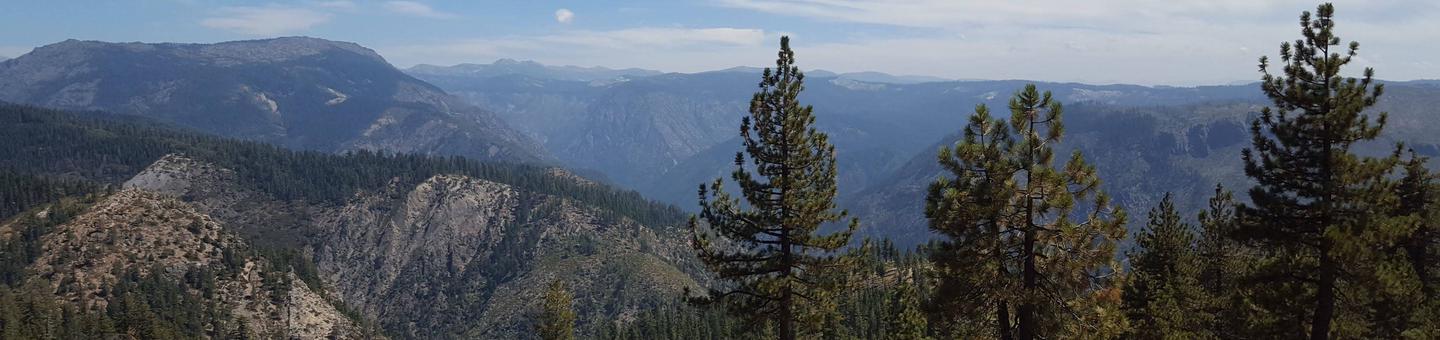
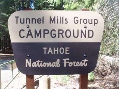
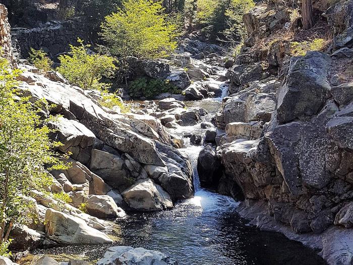
Tunnel Mills Group Campground is located along the East Fork of the North Fork of the North Fork American River in the Tahoe National Forest. It can be accessed off of Interstate 80, at the Emigrant Gap exit. Visitors enjoy fishing, hiking and hunting in this scenic area.

Recreation

Rainbow trout fishing is a popular activity on the river. Hiking and OHV trails and hunting opportunities are found in the surrounding area.

Facilities

The campground offers two group sites that can accommodate up to 30 people and six vehicles each. Site 1 is for tent and RV camping, while site 2 is designated for tent camping only. Picnic tables and campfire rings are provided, as are vault toilets.

Natural Features

The campground is near the creek-sized East Fork of the North Fork of the North Fork American River, in a remote location of north central California. A forest of cedar, pine and fir trees shades the campground.

Nearby Attractions

Many hiking, and OHV trails are located nearby as well as foot trail access into the North Fork American Wild and Scenic River canyon. Many more trails can be found a short distance east on Interstate 80 at Grouse Ridge Non-Motorized Area and Donner Summit.

Reservation

More from CampingHiking.net:

BRUSHY CREEK DAY USE, Texas Campground Images, Info & Reservations

Listen Directions From Jefferson, Texas, travel 3.8 miles northwest on Highway 49. Turn left onto FM 729 and continue for 3.5 miles, then turn left again onto FM 726. Travel 5.0 miles turn right at the stop sign and follow signs to the park entrance. Phone 903-777-3383 Activities BOATING, FISHING,

THE NARROWS, Kentucky Campground Images, Info & Reservations

Listen Directions From Glasgow, KY: Take 31-E south for 10 miles, turn right on 1318. Follow signs into campground entrance. Phone 270-646-3094 Activities CAMPING, HIKING, DAY USE AREA Keywords NARROWS,THE NARROWS,THEN,BARREN RIVER LAKE,BARREN RIVER,BARREN LAKE Related Link(s) Rec Area Info & Images Kentucky State Tourism Kentucky State Road Conditions Overview

HOLEY MEADOW, California Campground Images, Info & Reservations

Listen Directions From Highway 99, turn east on J22. Travel on J22 through California Hot Springs, then turn left at onto M50. After approximately 10 miles turn left at M107. The entrance to Holey Meadow Campground is on the left about a mile after the turn. Phone 559-539-5230 Activities BIKING,

CIRCLE PARK CAMPGROUND, Wyoming Campground Images, Info & Reservations

Listen Directions From Buffalo, WY, take US Hwy 16 west for 13.4 miles to FS Road 20 (Circle Park Road), turn right, go 2.1 miles. Phone 406-587-9054 Activities BIKING, BOATING, FISHING, HIKING, MOUNTAIN BIKING, WATER ACTIVITIES, CANOEING, STAR GAZING, BIRDING, WATER ACCESS, SCENIC DRIVE, BACKPACKING Keywords Related Link(s) Rec Area