

Directions
From Lowell, travel east on Highway 12 for about 25 miles to the campground.
The campground is located 120 miles east of Lewiston, Idaho; and 100 miles west of Missoula, Mont. It is located at milepost 122 on Highway 12.
Phone
208-926-4258
Activities
BIKING, BOATING, HISTORIC & CULTURAL SITE, CAMPING, FISHING, HIKING, WATER SPORTS, WILDLIFE VIEWING, DAY USE AREA, WHITEWATER RAFTING
Keywords
WILG,CLEARWATER NF -FS
Related Link(s)
Overview
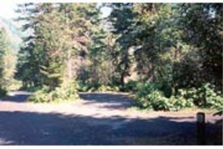
Wilderness Gateway Campground provides direct access to the Wild and Scenic Lochsa River. Visitors enjoy a variety of recreational opportunities, including world famous whitewater rafting. Hiking and horseback riding trails abound in the nearby Selway-Bitterroot Wilderness area, which is the 3rd-largest in the lower 48 United States. This large and unique campground offers respite for a variety of campers, including those with horses, horse trailers and RVs.
Recreation
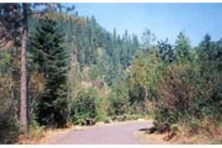
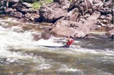
The Lochsa River is world famous for its exciting whitewater rafting opportunities. Visitors do not need a permit to float the Lochsa, but technical expertise is a must. The river is also a destination fly fishing experience for cutthroat and rainbow trout, chinook salmon and steelhead. There are a number of river access points near the campground, along Highway 12. Highway 12, also known as the Lewis and Clark Highway, winds along the narrow river canyon through evergreen trees and large rock outcroppings. Visitors to the area enjoy the scenic drive and historic sites along the way. Elk, deer, moose, bear, cougar and mountain goats make the steep canyon country their home, as well as other wildlife. A variety of birds are also active in the area. Boulder Creek cascades down into the campground on its descent from the neighboring 1.5-million acre Selway-Bitterroot Wilderness area. Several trails head into the wilderness from the campground, including the 15-mile Lochsa Peak Trail and the 27-mile Boulder Creek Trail. A 1-mile birding trail loops around the campground and the half-mile Downriver Trail leads to a scenic river overlook. All trails are open to hiking and the wilderness trails are also open to horseback riding. The Lochsa Historical Ranger Station, a living history visitor center, is located one mile southwest of the campground.
Facilities
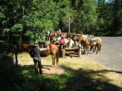
The campground offers dozens of accessible, single-family campsites and a large-group site, available for tent and RV camping. Utility hookups are not available and parking surfaces are paved. The group campsite can accommodate up to 208 people and 52 vehicles. If the group campsite (Loop A) is reserved, a combination code will be provided in your confirmation email to gain access to the site. Loop D hosts equestrian sites, which provide access to hitching rails, a watering and feeding station and staging area. Please only reserve Loop D if you have stock you intend to bring with you. From April until June 1 of every year, individuals with boats or campers are allowed to camp in the site. After June 1 – no other campers are allowed.
All campsites are equipped with tables and campfire rings with grills. Accessible vault toilets, flush toilets and drinking water are provided throughout the campground. Firewood is not provided, nor is it always available at the campground. Some sites are available on a first-come, first-served basis.
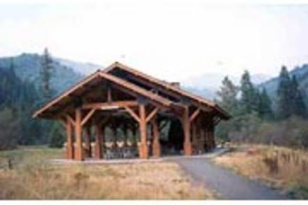
An adjacent, accessible group shelter is also available and can accommodate up to 200 people. If reserved, a combination code will be provided in the confirmation email. the code is needed to access the utility room which has a converter plug for the use with your personal generator. Access to the utility room is required to run the lights and electrical outlets in the pavilion. The pavilion is equipped with a stone fireplace and multiple tables. The Accessible flush toilets and a parking area are adjacent to the pavilion.
Natural Features
The campground is located in heavily wooded forest in north-central Idaho at an elevation of 2,100 feet. It is adjacent to the Lochsa River. Lochsa is a Nez Perce word meaning “rough water.” The 70-mile river and its tributaries have no dams and flow is unregulated from its headwaters near the Powell Ranger Station in the Bitterroots, to Lowell, where it joins the Selway River to form the Middle Fork of the Clearwater River. The Lochsa is one of the world’s best for continuous whitewater.
Nearby Attractions
*1 hour from access to the National Historic Lolo Trail Corridor *1 mile from the Lochsa Historical Ranger Station and Visitor Center