


Directions
From Poncha Springs, travel west on Highway 50 for about 15 miles, then turn left on County Road 231 and drive south to the Monarch Park Campground.
Phone
CAMPGROUNDS DO NOT HAVE PHONE SERVICE, CALLING TO CHECK AVAILABILITY PRIOR TO ARRIVAL IS NOT POSSIBLE. FOR RESERVATIONS CALL: 1-877-444-6777
Activities
BIKING, CAMPING, HIKING, WILDLIFE VIEWING
Keywords
MONA,MONARCH PASS,PIKE AND SAN ISABEL NF- FS
Related Link(s)
Colorado State Road Conditions
Overview
Monarch Park campground will not be taking reservations for the 2019 season to accommodate for tree removal due to the Spruce beetle epidemic. Campground will operate on a first-come, first served basis.
Monarch Park is nestled at the base of Monarch Ridge, a short drive north of Monarch Pass on Highway 50. Some campsites at the family-friendly destination are located on the banks of the South Fork Arkansas River, while others lie along a creek. Popular activities in the area include hiking the Colorado/Continental DivideTrail and fishing. Beaver ponds near the entrance to the campground make a great fishing spot for families with young children.
Monarch Pass is a high mountain pass along the southern part of Colorado’s Sawatch Range. The pass crosses the Continental Divide at an altitude of 11,312 feet.
Recreation
Popular trails near Monarch Park include Waterdog Lakes, the Monarch Crest Trail and the Hunt and Boss Lakes trails. Wildflowers are abundant on these trails in late summer. The river and nearby ponds provide quality fishing for all ages. Brook trout is the most likely reward for fishing efforts.
Facilities
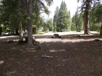
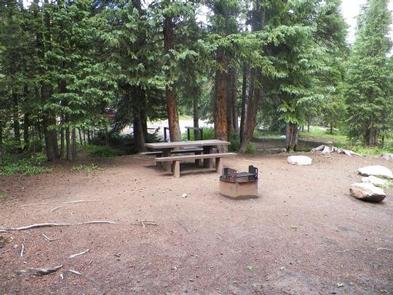
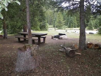
Drinking water from a hand pump is available. Vault toilets are available and one is wheelchair accessible. All sites come with picnic tables and campfire rings. Firewood is sold onsite. No electrical or sewer hookups are available.
The nearest RV dump station is at the Poncha Springs Visitor Center located at 7001 Highway 285 (near the intersection of US Highway 285 and US Highway 50) in Poncha Springs, CO.
Natural Features
The elevation is 10,500 feet, and visitors should plan for cool nighttime temperatures. Some campsites are located near the south fork of the Little Arkansas River.
Nearby Attractions
The city of Salida is only a short drive away where visitors can enjoy unique restaurants, shops, art galleries, and antique shops. The area boasts more than 100 miles of Arkansas River to raft, fish, float or kayak, as well as fifteen 14,000 ft. mountains. Visitors can choose from recreational activities like hiking, biking, ATV/UTV riding, kayaking, rafting, fishing, horseback riding, zip lining, and swimming.