Directions
From I-15 Exit 22* (northbound only), turn right onto the frontage road at the end of the freeway off-ramp. Travel south approximately 2 miles. Turn right just past the sign for the Red Cliffs Recreation Area. Proceed under the two freeway tunnels (height and width restricted to 12 x 12) and follow the paved road into the campground. Pay a day use fee and park in one of the day use parking spaces.
*From I-15 Exit 23 (southbound only), turn left on Silver Reef Road at the end of the freeway off-ramp. Turn right onto Main Street and travel south for 3.5 miles. Turn right just past the sign for the Red Cliffs Recreation Area. Proceed under the two freeway tunnels, and follow the paved road into the campground. Pay a day use fee and park in one of the day use parking spaces.
Access Note: Access to the Recreation Area is through tunnels that restrict vehicle size to less than 12 feet in height and width (dirt and gravel in the tunnel can lower the height by several inches). Parking Note: Parking for day use is extremely limited (52 general use parking spaces) and vehicles with trailers must park at the White Reef Trailhead (take the first right turn after the second tunnel).
During Spring and Fall, the most popular seasons to visit the Recreation Area, traffic control measures may be used, causing some visitors to be turned away for lack of parking. Plan accordingly.
Phone
435-688-3200
Activities
BIKING, CAMPING, HIKING, HORSEBACK RIDING, RECREATIONAL VEHICLES, WILDLIFE VIEWING, PHOTOGRAPHY
Camping Reservations
Reserve your campsite at these camping areas:
Hiking Trails
Looking for nice hiking areas to take a hike? Choose from these scenic hiking trails:
Related Link(s)
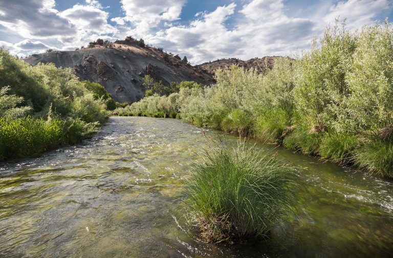
The Red Cliffs Recreation Area is located just off Interstate 15, 14 miles northeast of St. George, Utah. Tucked up against red sandstone cliffs and straddling Quail Creek, this recreation area is a pleasant surprise for most visitors. The backdrop of the looming cliffs and the voluminous riparian habitat is an unexpected if not welcome relief in the desert.
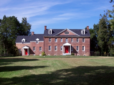
The picnic area is amply covered by large cottonwoods for a shady respite. If you’re looking for more activity, hike ? miles to the Red Cliffs Archaeological Site to see the remnants of a Virgin Anasazi habitation. Or hike the almost 6 mile Red Reef Trail into the Cottonwood Canyon Wilderness. For a taste of pioneer history, visit the Orson Adams House just down the road. To go back even further in time, check out the Early Jurassic dinosaur tracks on the Silver Reef Trail.
The Red Cliffs Recreation Area is inside the Red Cliffs National Conservation Area, which has been set aside to conserve, protect, and enhance ecological, scenic, wildlife, recreational, cultural, historical, natural, educational, and scientific resources. Please protect these resources by staying on designated trails and following all rules.
Access Note: Access to the Recreation Area is through tunnels that restrict vehicle size to less than 12 feet in height and width (dirt and gravel in the tunnel can lower the height by several inches).
Parking Note: Parking for day use is extremely limited (52 general use parking spaces) and vehicles with trailers must park at the White Reef Trailhead (take the first right turn after the second tunnel). During Spring and Fall, the most popular seasons to visit the Recreation Area, traffic control measures may be used, causing some visitors to be turned away for lack of parking. Plan accordingly.
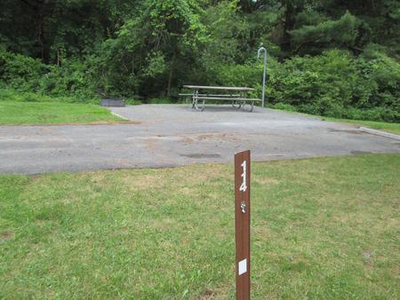
Camping Note: Camping is prohibited in the day use area, in the White Reef Trailhead, and up to one mile from the recreation area. Site includes:
Day Use Amenities
Vehicle Parking
Picnic Tables
Fire Rings with Grills
2 Vault Toilets (Accessible)
Dumpster
Self-Pay Register Kiosk
Directions

