LITTLE OAK CAMPGROUND, TENNESSEE Campground Reservation, Info, Images, Map, Directions

LITTLE OAK CAMPGROUND, Tennessee Campground Images, Info & Reservations

Directions

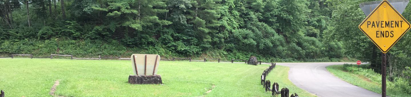
From Bristol, take US 421 south for 12 miles, and turn right onto paved Camp Tom Howard Road. After 0.5 miles, this road becomes Forest Road #87. Continue on Road #87 for six miles. Turn right on Road #87G for 1.5 miles to Little Oak.

Phone

423-735-1500

Activities

BIKING, BOATING, FISHING, HIKING, HORSEBACK RIDING, WILDLIFE VIEWING, SWIMMING, MOUNTAIN BIKING, WATER ACTIVITIES, KAYAKING, CANOEING, STAR GAZING, BIRDING, NON-MOTORIZED BOATING, WATER ACCESS, JET SKIING, WATER SKIING, SCENIC DRIVE, TUBING, BADMINTON

Keywords

LITTLE OAK CAMPGROUND

Related Link(s)

Rec Area Info & Images

Overview

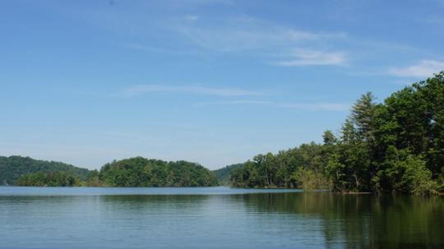
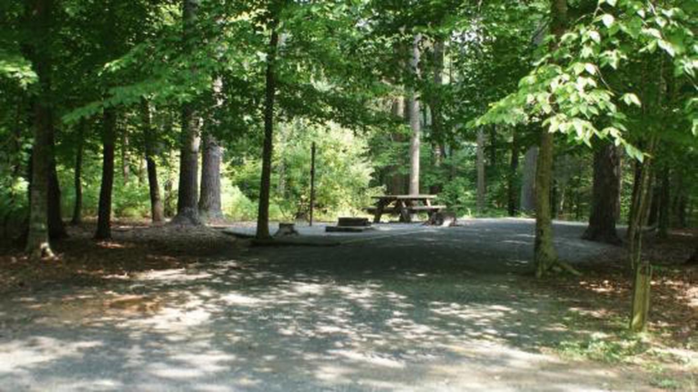
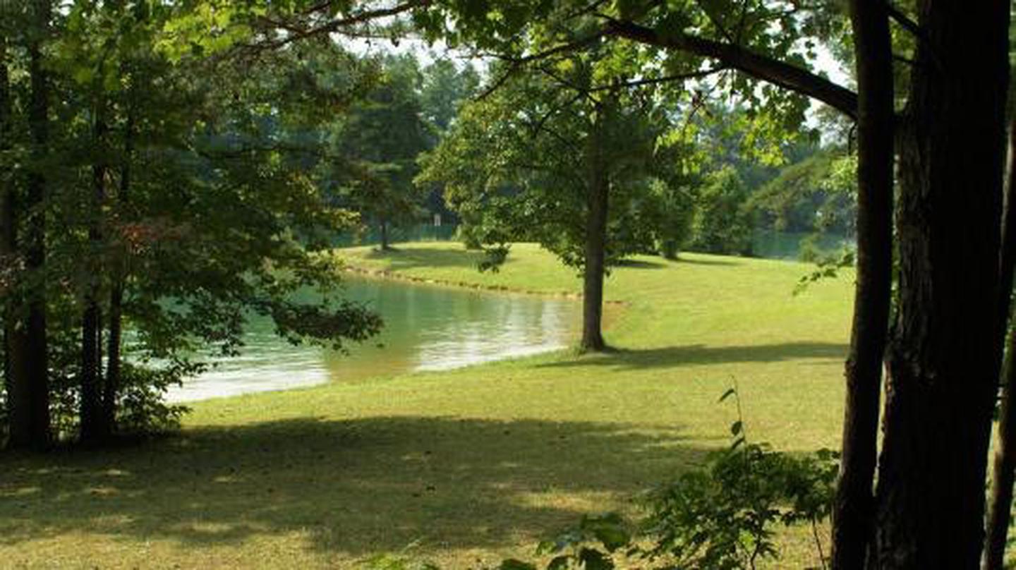
Little Oak Campground hugs the shores and inlets of beautiful South Holston Lake in Sullivan County, Tennessee. With a view of the Holston Mountain ridgeline and lake islands, Little Oak campsites are a relaxing setting for your vacation. There are 69 universally accessible campsites improved in 2012 including warm showers and a paved access road. Campground hosts are available on site to answer your questions.

Recreation

Fishing is a popular activity for campers at Little Oak, with a concrete boat launch within the campground. Numerous campsites have easy access to the lake shore for tying off your boat. There are nearby trails for hiking and horseback riding. Children and adults enjoy riding their bikes on the roads between camping loops. There is also a lakeside grassy area popular for swimming and picnicking. There is an array of wildflowers to enjoy throughout the season, resident deer and turkey and other natural wonders for the naturalist in your group.

Facilities

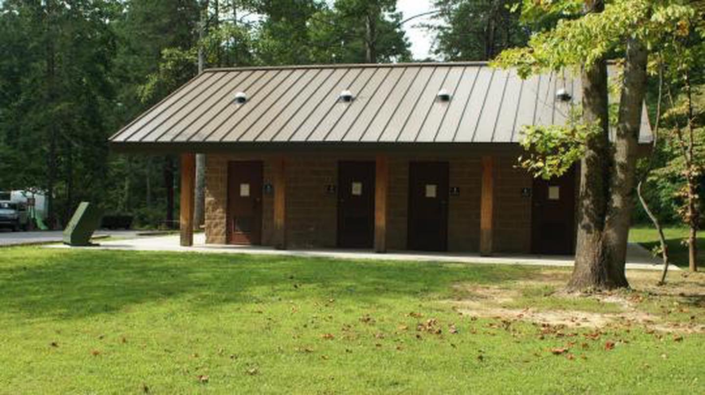
There are 69 universally accessible campsites for tents or RVs within four loops at Little Oak Campground. Each loop has a pair of vault toilets. In addition, there is an accessible shower house with 8 showers for the campground. There is a boat launch within the campground with an additional single vault toilet.

Natural Features

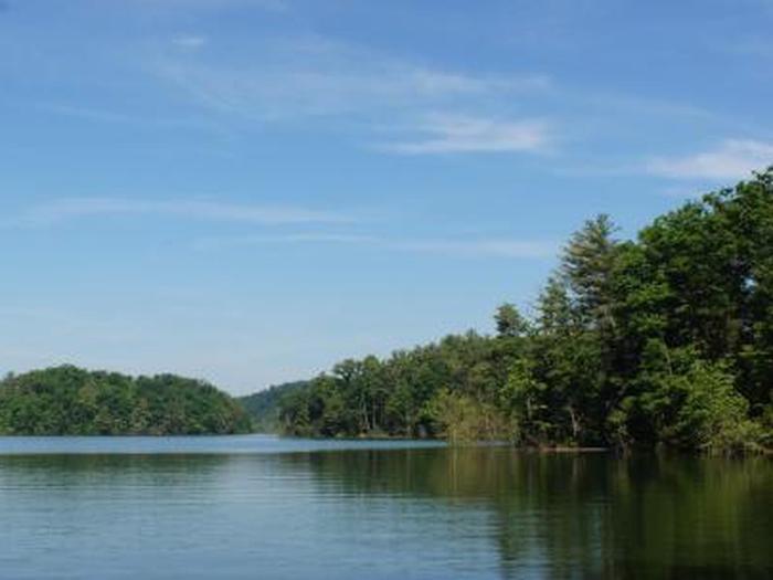
South Holston Lake is a 7,580-acre hydroelectric reservoir managed by the Tennessee Valley Authority and surrounded by the Cherokee National Forest. Holston Mountain and nearby Iron Mountain provide habitat for an array of wildlife including a healthy population of black bear.

Nearby Attractions

Little Oak Campground is within 30 minutes of Bristol, Tennessee, and nearby Bristol Motor Speedway. Backbone Rock Recreation Area is approximately 30 minutes away up beautiful Shadey Valley, and just five minutes past Backbone Rock is Damascus, Virginia. Jacobs Creek Campground and Swim Area is 25 minutes away for another view of South Holston Lake.

Reservation

More from CampingHiking.net:

MONOCLE LAKE, Michigan Campground Images, Info & Reservations

Directions 12600 E Lakeshore Drive Brimley Michigan 49715 From Bay Mills, travel west on County Road 42 (Whitefish Bay Scenic Byway) for approximately half a mile, then turn south on Forest Road 3699 to the campground entrance. Phone 906-203-9872 Activities BOATING, HISTORIC & CULTURAL SITE, CAMPING, FISHING, HIKING, WATER SPORTS,

MILL HOLLOW, Utah Campground Images, Info & Reservations

Directions From Woodland, Utah, travel 12 miles southeast on State Highway 35. Turn onto Forest Road 054 and travel 2.8 miles to the campground entrance. Phone HEBER RANGER DISTRICT 435-654-0470 OR UTAH RECREATION COMPANY 385-273-1100 Activities BOATING, CAMPING, FISHING, HIKING, WILDLIFE VIEWING Keywords MILH,UINTA NF – FS Related Link(s) Rec

Bumping Lake Campground, Washington Campground Images, Info & Reservations

Directions From Yakima, Washington, travel 25 miles on Highway 12 to the junction with Highway 410. Travel 29 miles on Highway 410 (Chinook Pass Highway) to milepost 88.4. Take Forest Road 18 (Bumping River Road) for 11.7 miles to campground. Phone 541-338-7869 Activities BIKING, BOATING, CAMPING, FISHING, HIKING, WATER SPORTS

Dundo Group Campground, Virginia Campground Images, Info & Reservations

Directions From Washington, D.C., metro area, travel west on Interstate 66 to exit 43A. Take US Highway 29 south approximately 55 miles to Ruckersville, Virginia, then take US Highway 33 west to Shenandoah National Park and Skyline Drive Swift Run Entrance. Follow Skyline Drive south approximately 18 miles and turn

BROOKCHAR, Arizona Campground Images, Info & Reservations

Directions From Show Low, Arizona, take Highway 260 east for 60 miles to Highway 261. Take Highway 261 south for 20 miles to Forest Road 115 and follow it south for 1 mile. Phone 928-735-7313 Activities BOATING, CAMPING, FISHING Keywords BROC,BIG LAKE,APACHE-SITGREAVES NF-FS Related Link(s) Rec Area Info & Images

NOISY CREEK, Washington Campground Images, Info & Reservations

Directions Campground is located ninety miles north of Spokane, Washington. From the junction of State Highway 20, take Highway 31 north for three miles to the junction of the Sullivan Lake Road (County Road 9345Follow the Sullivan Lake Road for 8 miles to the campground entrance. The campground is located