


Watch the Stunning Eagle Creek Trail Video
Directions
From Portland, OR: Travel east on Interstate 84 to exit #41 “Eagle Creek Recreation Area” which is just past the interstate tunnel…make sure you are in the right lane before entering the tunnel. Take a right at the end of the off ramp and follow the signs to Eagle Creek Campground. Follow the wooden fence south of the hatchery and head up the road.
From Hood River, OR: Travel west on I-84 to exit 40 “Bonneville Dam”. Turn left under I-84 and immediately left to the on ramp back to I-84 east and follow the directions above.
Phone
541-308-1700
Activities
BIKING, HISTORIC & CULTURAL SITE, CAMPING, INTERPRETIVE PROGRAMS, FISHING, HIKING, PICNICKING, RECREATIONAL VEHICLES, WATER SPORTS, WILDLIFE VIEWING, FISH HATCHERY, FISH VIEWING SITE, DAY USE AREA, ENVIRONMENTAL EDUCATION, WATER ACTIVITIES, BIRDING, WATER ACCESS, EVENING PROGRAMS, SCENIC DRIVE, BACKPACKING, AMPHITHEATER
Keywords
Related Link(s)
Overview
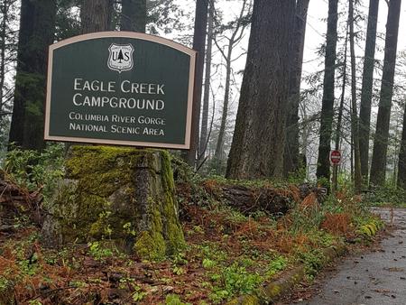
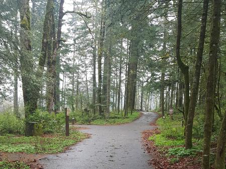
Eagle Creek campground is located above Interstate 84 among tall trees. It was the first developed campground in the Forest Service system. Campsites are well-spaced creating a feeling of privacy. It is, however, located on the bluff above Interstate 84 and railroad tracks so it can be noisy.
Recreation
This campground is part of the Eagle Creek Recreation Area featuring the classic and popular Eagle Creek trail and access to several other hiking and road biking trails. There are outstanding day hike opportunities with views and wildflowers as well as access to the Mt. Hood National Forest and Mark O. Hatfield Wilderness with extended overnight trips. Boating, river activities, interpretive centers, fish hatcheries, bird watching and picnicking are in this area.
Facilities
There are 16 campsites available, each with a paved parking apron and most are fully accessible. There is a central restroom, and faucets for drinking water are scattered throughout the campground. A full-time host is on site.
Natural Features
Located in the heart of the Columbia River Gorge National Scenic Area, Eagle Creek campground is situated in a classic Douglas fir and maple forest with osprey nesting overhead. Salmon fishing is popular on the nearby Columbia River.
Nearby Attractions
See huge sturgeon and other fish at the underwater viewing area at Bonneville dam and hatchery or take a self-guided tour of the onsite Cascade fish hatchery. Cascade Locks Museum and Sternwheeler are five minutes away to the east. The iconic Multnomah Falls and Columbia River Gorge Historic Highway are a short drive to the west. World-class kite boarding and board sailing are in Hood River, Oregon, about 20 minutes east.