LAKE FORK(RIO GRANDE NATL FORE, CO Campground Reservation, Info, Images, Map, Directions

LAKE FORK(RIO GRANDE NATL FORE, Colorado Campground Images, Info & Reservations

Directions

From Antonito, travel west on Highway 17 approximately 24 miles to the junction of Highways 17 and 250. Turn on Highway 250 and travel 18 miles on a gravel road to Lake Fork Campground.

Phone

719-852-5941

Activities

CAMPING, FISHING, HIKING

Keywords

LAKF,LAKE FORK RIO GRANDE NATL FORE,RIO GRANDE NF- FS

Related Link(s)

Rec Area Info & Images

Colorado State Tourism

Colorado State Road Conditions

Overview

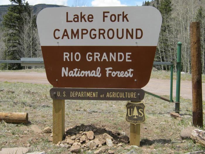
Lake Fork Campground sits in the Rio Grande Forest, 40 miles northwest of Antonito, Colorado. The campground is a true getaway from any city, and requires an 18-mile drive on a gravel road. This high elevation campground boasts limitless beauty with mountain peaks, alpine wildlife spotting and several varieties of birds.

Recreation

The campground is convenient to several trails, such as Lake Fork to Big Lake and Conejos Peak to Blue Lake.

The Conejos River is a Gold Medal River, meaning it offers the greatest potential for trophy trout fishing. Rainbow and brown trout are the most common species in the river.

Facilities

Some campsites overlook the river. There is one centrally located drinking water spigot. All parking spurs are gravel. Firewood can be purchased on-site. No electric hookups are available.

Campers will find an old-fashioned steel tub bath at Brummel’s Rocky Mountain Lodge about 10 miles south.

Natural Features

The campground is located in south central Colorado on the banks of the Conejos River. It is shaded by spruce, aspen and a few cottonwoods and willows at an elevation of 9,500 feet.

A variety of wildlife makes its home in the area, including black bears, deer and marmots. Wildflowers dot the region, creating colorful landscapes for photography enthusiasts.

Nearby Attractions

Take in spectacular views of the Conejos Canyon and River along Forest Road 250.

Reservation

More from CampingHiking.net:

PLASKETT CREEK CAMPGROUND, California Campground Images, Info & Reservations

Directions From San Luis Obispo, travel north on Highway 1 for approximately 65 miles to the campground. From Monterey, travel south on Highway 1 for approximately 50 miles to the campground. Phone 805-434-1996 Activities BIKING, CAMPING, FISHING, HIKING, HUNTING, WILDLIFE VIEWING Keywords Plaskett,Plaskett Creek,LOS PADRES NF -FS Related Link(s) Rec

MUSTANG, Texas Campground Images, Info & Reservations

Directions From FM 1187 Crowley Plover Road, turn north on Winscott Plover Road for a mile (0.6 km) to the park entrance. Phone 817-292-2400 Activities BOATING, CAMPING, FISHING, PICNICKING, SWIMMING SITE Keywords MUS2,BENBROOK LAKE Related Link(s) Rec Area Info & Images Texas State Tourism Texas State Road Conditions Overview Mustang

Priest Rock Cabin, Alaska Campground Images, Info & Reservations

Directions The cabin is 120 air miles from Anchorage and 8 miles from Port Alsworth. Visitors must arrange their own transportation. This cabin is accessible by float plane, water taxi, or private vessel. Kayakers with advanced skills can reach the cabin from Port Alsworth. There are no mooring buoys at

DENNIS COVE CAMPGROUND, Tennessee Campground Images, Info & Reservations

Directions Take US 321/TN 67 East out of Hampton, TN. Turn right onto Dennis Cove Road and drive approximately 5 miles. Dennis Cove Road is steep with hairpin turns, so plan to drive slowly.  Phone 423-735-1500 Activities CAMPING, FISHING, HIKING, HUNTING, WILDLIFE VIEWING, SWIMMING, MOUNTAIN BIKING, WATER ACCESS, BACKPACKING, EMERGENCY