BIG CREEK LAKES CAMPGROUND, CO Campground Reservation, Info, Images, Map, Directions

BIG CREEK LAKES CAMPGROUND, Colorado Campground Images, Info & Reservations

Directions

From Walden, follow Route 125 north for 9 miles into Cowdrey. Turn left (west) onto CR 6W and travel 18 miles to Pearl. Turn onto Forest Road 600 and drive for 6 miles, following signs to campground.

Phone

970-723-2700

Activities

BOATING, CAMPING, FISHING, HIKING, WILDLIFE VIEWING

Keywords

BIGL,MEDICINE BOW-ROUTT NF-FS

Related Link(s)

Rec Area Info & Images

Colorado State Road Conditions

Colorado State Tourism

Overview

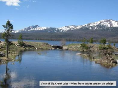
The popular Big Creek Lakes Campground offers a peaceful, scenic setting in the heart of the Rocky Mountains of northern Colorado. The campground is located in Routt National Forest at an elevation of 9,000-ft., and is adjacent to Big Creek Lake, where fishing, boating and hiking are available.

Recreation

This campground offers boating and fishing on Colorado’s second largest natural lake, hiking in the Mount Zirkel Wilderness and ATV trails nearby. There are also ample opportunities for viewing wildlife, including moose.

Fishing for trout, muskie, grayling and Kokanee salmon is available in the lake. Anglers also have access to a creek. Non-motorized boats are allowed on the upper section of the lake and motorized boats are permitted on the lower section.

Facilities

This facility has a campground and day use area. There are 24 reservable campsites and 30 first-come, first-served campsites, all of which are near Big Creek Lake.

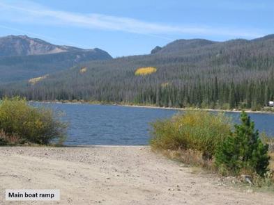
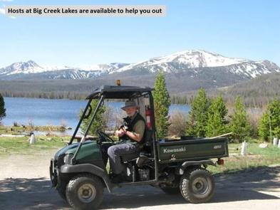
Two boat ramps are provided for the convenience of boaters and anglers. A campground host is on-site for visitor assistance.

Natural Features

Big Creek lies among Lodgepole pine and fir trees. Some previously forested areas of the campground have been thinned due to pests and now provide more sun. The campground offers beautiful views of the surrounding wilderness.

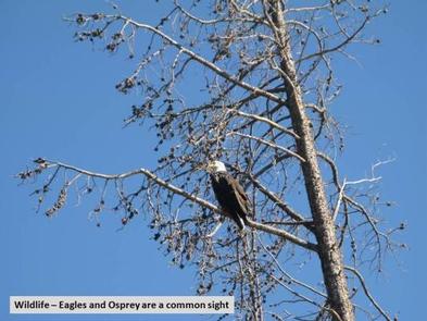
The wetlands around the lake are prime moose territory. Black bear, bobcat, coyote, elk, mule deer and moose are just some of the many animals that inhabit these rich and diverse lands.

The Medicine Bow-Routt National Forests and Thunder Basin National Grassland, encompass nearly 3 million acres from central and northeastern Wyoming to north-central Colorado.

Nearby Attractions

The closest town is Walden, Colorado, about 35 miles from the campsite. Many more outdoor recreation opportunities exist in the surrounding national forests and grasslands, including hiking, biking, camping, horseback riding, OHV riding, fishing, hunting, sightseeing and winter sports.

Reservation

More from CampingHiking.net:

RIVERSIDE (KS), Kansas Campground Images, Info & Reservations

Directions From Salina, KS: Take HWY 140 19 miles west to HWY 141. Travel 14 miles south on 141, then 1/2 mile east on Riverside Drive. Look for signs to the park. From Ellsworth, KS: Take HWY 140 15 miles east to HWY 141. Travel 14 miles South on Hwy

DIMOND O, California Campground Images, Info & Reservations

Directions From the Groveland District Office, head east 15 miles on Highway 120, then turn left on Evergreen Road and travel 4 miles. The campground is located on the left. Phone 209-379-2258 Activities BIKING, BOATING, CLIMBING, CAMPING, FISHING, HIKING, CANOEING, ROCK CLIMBING Keywords DIMO,DIAMOND O,DIMOND O,STANISLAUS NF -FS,Diamond (CA) Related

WHITE STAR, Colorado Campground Images, Info & Reservations

Directions From Leadville, travel 15 miles south on Highway 24 to Highway 82. Turn right and go west 5.5 miles on Highway 82, turn left into the White Star Campground. Phone 719-486-0749 (FOR INFORMATION ONLY, NO RESERVATIONS) Activities BOATING, CAMPING, FISHING, HIKING, MOUNTAIN BIKING Keywords WSTR,TWIN LAKES,PIKE AND SAN ISABEL

Susan Creek Campground, Oregon Campground Images, Info & Reservations

Directions The campground is located just past milepost 28 on Highway 138. Phone 541-440-4930 Activities BIKING, CAMPING, FISHING, HIKING, HORSEBACK RIDING, DAY USE AREA Keywords Related Link(s) Rec Area Info & Images Oregon State Tourism Oregon State Road Conditions Overview Susan Creek Campground is well known for its beautiful setting

DEER HAVEN, Utah Campground Images, Info & Reservations

Directions From Cedar City, Utah, take Highway 14 east for 16 miles. Turn south on Webster Flat Road and travel 3 miles to the campground. Phone 801-226-3564 Activities BIKING, CAMPING, HIKING, WILDLIFE VIEWING, DAY USE AREA Keywords DEEH,DIXIE NF – FS Related Link(s) Rec Area Info & Images Utah State

MIDDLE FORK, Wyoming Campground Images, Info & Reservations

Directions From Buffalo, Wyoming, take U.S. Highway 16 west 13 miles. Phone 406-587-9054 Activities BIKING, CAMPING, FISHING, HIKING, HORSEBACK RIDING, WILDLIFE VIEWING Keywords MIDD,BIGHORN NF – FS Related Link(s) Rec Area Info & Images Overview Middle Fork Campground is located 14 miles west of Buffalo, Wyoming, adjacent to the Cloud