THUNDER RIDGE, CO Campground Reservation, Info, Images, Map, Directions

THUNDER RIDGE, Colorado Campground Images, Info & Reservations

Directions

From the I-25 and Hwy 24 intersection in Colorado Springs, Colorado, travel west on Highway 24 for 17.4 miles to Baldwin St. in Woodland Park. Turn right (north) on Baldwin (which turns into Rampart Range Road). Travel approximately 3 miles to Loy Creek Road, turn right at the Y, and travel 1.5 miles to Rampart Range Road (Forest Road 300). Turn right (south) on Rampart Range Road. The Rampart Reservoir Recreation Area entrance is approximately 4 miles up the road on the left. Thunder Ridge Campground is approximately 0.7 miles on the left.

Phone

719-636-1602 (NO RESERVATIONS TAKEN AT THIS NUMBER. INFORMATION ONLY)

Activities

BIKING, CAMPING, FISHING, HIKING

Keywords

THUN,RAMPART RESERVOIR,PIKE AND SAN ISABEL NF- FS

Related Link(s)

Rec Area Info & Images

Colorado State Road Conditions

Colorado State Tourism

Forest Service Concessionaire

Overview

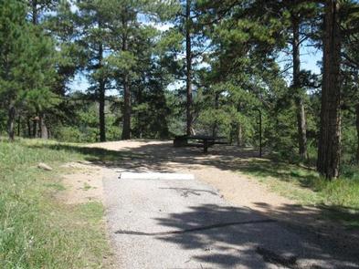
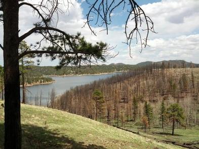
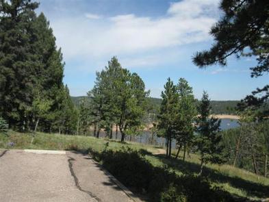
Thunder Ridge Campground, located above the Rampart Reservoir, is one of two campgrounds within the Rampart Reservoir Recreation Area. The campground overlooks the reservoir, which is popular for fishing. Boating and hiking are also common activities for campers here.

The campground is located on the Front Range of the Rocky Mountains, due north of the popular Pikes Peak. The peak has an altitude of 14,110 feet and is America’s easternmost peak reaching over 14,000 feet.

Recreation

Rainbow and mackinaw trout are plentiful in the reservoir and hikers can enjoy the trails in the area. Rampart Reservoir Trail is nearby. Rampart Reservoir Trail extends for 14 miles and is open to hiking and mountain biking.

Facilities

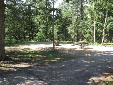
Three campsites and two of the vault toilets meet current accessibility standards. Most remaining sites have steps that lead below the road level to the site picnic table and campfire ring. Drinking water is provided and each site comes with a picnic table and campfire ring. Firewood can be purchased on-site.

Natural Features

The campground overlooks the Rampart Reservoir in a ponderosa pine forest at an altitude of 9,200 feet. The surrounding terrain includes a mix of grass meadows, spruce, Douglas fir and aspen.

Nearby Attractions

The U.S. Air Force Academy in Colorado Springs offers tours, and a visit to the quaint town of Green Mountain Falls makes a great day trip.

Reservation

More from CampingHiking.net:

ROBINSON CREEK NORTH, California Campground Images, Info & Reservations

Directions Take U.S. Highway 395 through Bridgeport. Turn south on Twin Lakes Road at the Shell gas station. Travel 9.3 miles on Twin Lakes Road, then turn left into the campground. Phone 760-932-7092 Activities CAMPING, FISHING, HIKING, WILDLIFE VIEWING Keywords ROBI,HUMBOLDT-TOIYABE NF-FS Related Link(s) Rec Area Info & Images California

DEER RIDGE LOOKOUT, Idaho Campground Images, Info & Reservations

Directions Take Highway 95/2 north from the Bonners Ferry Ranger Station for 5 miles. Turn right onto Highway 2 and head east for 2 miles. Turn left onto Meadow Creek Road and head north and east for 10 miles to the bridge over the Moyie River. Turn right onto Road

CAPE HORN WINTER RENTAL, Idaho Campground Images, Info & Reservations

Directions The guard station it is less than two miles by skiing cross-country from State Highway 21 or approximately four miles by following the Stanley-Landmark Snowmobile Trail. If you are a first time renter, it is important to get detailed directions. To obtain these, click here or call the district

OAK GROVE PICNIC AREA, Iowa Campground Images, Info & Reservations

Directions Physical Address: 4801 NW 98th Ave, Polk City, IA 50226 From Ankeny, travel 3.4 miles west on 1st Street. Turn right onto HWY 415 for 0.9 miles, then left onto NW 44th street, which turns slightly right and becomes NW 98th Ave. Picnic area is on the right. Phone

GRAYBACK, Idaho Campground Images, Info & Reservations

Directions From Boise, take State Highway 21 north for 36 miles. Campground access road is located on the east side of the road, between mileposts 36 and 37. Turn right and travel a quarter-mile to the campground. Phone 208-392-6681 Activities CAMPING, FISHING, HIKING, HUNTING, VISITOR CENTER, WILDLIFE VIEWING Keywords GRA1,GRAYBACK

WINNIE DAM CAMPGROUND, Minnesota Campground Images, Info & Reservations

Directions From Deer River, Minnesota, take Highway 2 west for one mile. Turn right on Highway 46 and go 12 miles. Turn left on Itasca County 9 and continue 2 miles, then turn left at signs and follow to the campground. Phone 218-326-6128 Activities CAMPING Keywords LAKW,WINNI DAM CAMPGROUND,WINNI CAMPGROUND,MISSISSIPPI