KELSEY CAMPGROUND, CO Campground Reservation, Info, Images, Map, Directions

KELSEY CAMPGROUND, Colorado Campground Images, Info & Reservations

Directions

From Denver, take Highway 285 southwest to Pine Junction and turn south on Jefferson County Road 126. Travel approximately 17 miles to the campground.

Phone

303-275-5610

Activities

BIKING, CLIMBING, CAMPING, HIKING, WILDLIFE VIEWING

Keywords

KELS,PIKE AND SAN ISABEL NF- FS

Related Link(s)

Rec Area Info & Images

Colorado State Road Conditions

Colorado State Tourism

Forest Service Concessionaire

Overview

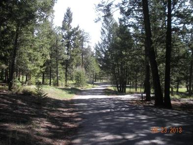
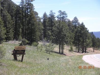
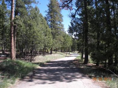
Kelsey is one of two campgrounds within the Buffalo Creek Recreation Area, about an hour’s drive southwest of Denver, Colorado. Visitors enjoy a variety of recreational opportunities, including hiking, rock climbing, mountain biking and trout fishing.

Recreation

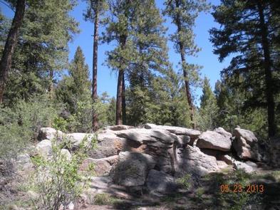
The Buffalo Creek Recreation Area is home to a 40-mile trail system most popular with mountain bikers, but hikers and horseback riders enjoy the area as well. Several trailheads are within the area, including Little Scraggy Trail, just 3 miles north of the campground. Access to the Colorado Trail and the Buffalo Burn Trail begin from this trailhead. Shinglemill Trail is also nearby.

Buffalo Creek is a popular fishing stream for brook trout. The area offers great wildlife viewing opportunities for turkey, elk, mule deer, chipmunks and porcupines.

Facilities

The campground offers single-family sites, some of which are designated for tent camping only. Each site is equipped with picnic tables and campfire rings with grills. Vault toilets are provided. Drinking water is available from a hand pump, but hookups are not available.

Natural Features

The campground sits at an elevation of 7,400 feet in the Front Range of the Rocky Mountains. Summer temperatures are mild and range from 75-80 during the day to 55-65 at night.

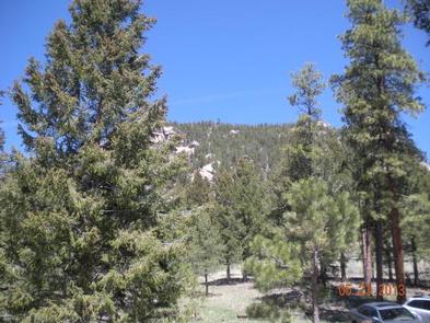
The Kelsey Overlook is just north of the campground along County Road 126, offering beautiful views of the valley below.

Nearby Attractions

The drive along County Road 126 southwest from Pine Junction affords magnificent views of the valleys below. Pikes Peak, at 14,110 feet, can be seen in the distance and other prominent rock formations present themselves throughout the scenic drive.

Reservation

More from CampingHiking.net:

BOISE CREEK, California Campground Images, Info & Reservations

Directions From Willow Creek, California, take State Route 299 for 2 miles west. Enter the campground directly from the highway. Phone 530-629-2118 Activities BIKING, BOATING, HISTORIC & CULTURAL SITE, CAMPING, FISHING, HIKING, HUNTING, VISITOR CENTER, WATER SPORTS, WILDLIFE VIEWING, SWIMMING SITE Keywords BOCR,Boise Creek Campground Related Link(s) Rec Area Info

SHAFER BUTTE, Idaho Campground Images, Info & Reservations

Directions From Boise, Idaho, travel along Bogus Basin Road for approximately 20 miles. The last three miles are on a gravel road. Turn right (east) on the signed gravel road and travel just over a mile to the campground and picnic area. Phone 208-587-7961 Activities BIKING, CAMPING, HIKING, WILDLIFE VIEWING

NORWAY BEACH LOOP, Minnesota Campground Images, Info & Reservations

Directions From Cass Lake, Minnesota, take U.S. Highway 2 east for 4 miles to the Norway Beach Recreation Area. Turn left and follow the campground road until the signs indicate the Norway Loop. Phone 21-835-4291 Activities BIKING, BOATING, CAMPING, FISHING, WATER SPORTS, SWIMMING SITE Keywords Norway Beach Campground,Norway Campground Related

FINDLEY CAMPGROUND, California Campground Images, Info & Reservations

Directions Take Interstate 80 to the Truckee/Highway 89 North exit. Follow Highway 89 north for 17 miles, to the Jackson Meadows turnoff. Travel west on Forest Road 07 for 18 miles, to Jackson Meadows Reservoir. Proceed across the dam and continue on a paved/gravel road for approximately four miles. Turn

HUNTER COVE, Nebraska Campground Images, Info & Reservations

Directions From Highway 80, take Highway 183 south to Alma, Nebraska. Turn left onto Highway 136. then turn right on Berrigan Road and travel 1.25 miles to the intersection of Road B. Turn right and travel one mile; the park entrance is on south side of the road. Phone 308-799-2105

LOST RAPIDS, Oklahoma Campground Images, Info & Reservations

Directions From Broken Bow, OK, take Highway 3 west 22 miles to the park entrance. Turn south at the sign and follow the access road. Phone 580-876-3720 Activities BOATING, CAMPING, FISHING, PICNICKING, CANOEING Keywords LOSR,PINE CREEK LAKE,PINE CREEK LAKE Related Link(s) Rec Area Info & Images Oklahoma State Tourism Oklahoma