BLACK BEAR GROUP AREA, NM Campground Reservation, Info, Images, Map, Directions

BLACK BEAR GROUP AREA, New Mexico Campground Images, Info & Reservations

Listen

Directions

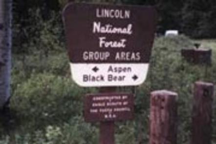
In southeast New Mexico, approximately 20 miles east of Alamagordo. From Alamagordo take US 82 east. Go 16 miles. Just before Cloudcroft, turn right (south) on NM 130. Go 1.4 miles. Turn left (east) on Forest Road 24B. Go .5 miles. Black Bear Group area is on right (south) side of road across from Aspen Group Area.

Phone

575-682-7570

Activities

CAMPING

Keywords

BLAC,LINCOLN NF – FS

Related Link(s)

Rec Area Info & Images

New Mexico State Tourism

Forest Service Concessionaire

New Mexico State Road Conditions

Overview

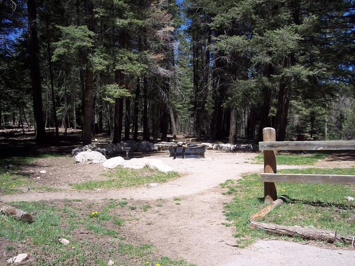
Black Bear is perched atop the scenic Sacramento Mountains of south-central New Mexico, near Alamogordo and Cloudcroft. The site is surrounded by the aromatic pine trees and aspen groves of Lincoln National Forest. The group area is conveniently connected to a network of hiking and biking trails. Bring your camera and binoculars for the chance to spot elk, deers, birds, and even black bear.

The black bears are arguably the most celebrated wildlife in the area due to the fact that the original Smokey Bear was found here. While battling a fire in 1950, firefighters rescued a burned bear cub clinging to a scorched tree in Lincoln National Forest. The bear was adopted by the US Forest Service and became the real-life mascot for forest fire prevention.

Recreation

Evening skies are often clear of clouds – bring a telescope for stargazing. The campground is surrounded by a series of hiking trails. A popular hike is the Osha Trail, which is a 2.5-mile loop.

Facilities

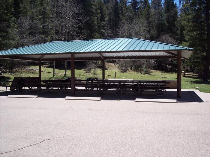
Whether for a family reunion or a large social event, Black Bear is a convenient location for groups up to 70. No water is provided at this site, but it is available at Deerhead Campground from Memorial Day to Labor Day.

Natural Features

Set 9,000 feet above sea level in the Sacramento Mountains, Black Bear is in a pine forest area overlooking the desert valley of the Tularosa Basin. The basin stretches 6,500 square miles between the Sacramentos and the San Andres Mountains.

Nearby Attractions

The campground is a mile from Cloudcroft, a quaint tourist village with New Mexico’s only standing railroad trestle. It’s also a quarter mile from the Rim Trail, which is popular for mountain biking, hiking, and horseback riding. Other nearby trails are open to ATV enthusiasts.

Reservation

More from CampingHiking.net:

Esswine Group Camp, Washington Campground Images, Info & Reservations

Listen Directions From Seattle, Washington, go north on I-5 to Everett. Take exit 194 onto Highway 2, then at Highway 204 go north toward Lake Stevens. Turn north on Highway 9, then east on Highway 92 to Granite Falls. The campground is approximately 16 miles east of Granite Falls on

CADES COVE GROUP, Tennessee Campground Images, Info & Reservations

Listen Directions Cades Cove Campground 10042 Campground Drive Townsend, TN 37882 865-448-2472 Lat/Long: N35.6009 W083.7742 From Maryville, TN: Take U.S. 321 North (you’ll actually be driving south!) from Maryville to Townsend, TN (about 22 miles). At the traffic light in Townsend, continue straight on TN 73 and follow signs to

SANTA CRUZ SCORPION, California Campground Images, Info & Reservations

Listen Directions Boat transportation can be arranged with Island Packers from Ventura Harbor. To park headquarters in Ventura, Ca: exit Highway 101, at Victoria or Seaward to Ventura Harbor. Phone 805-658-5730 Activities BOATING, HISTORIC & CULTURAL SITE, CAMPING, INTERPRETIVE PROGRAMS, FISHING, HIKING, PICNICKING, VISITOR CENTER, WATER SPORTS, WILDLIFE VIEWING, WILDERNESS,

DOWNSTREAM, Montana Campground Images, Info & Reservations

Listen Directions From Nashua, MT, travel on Highway 117 south for 10.5 miles continue straight onto Yellowstone Rd for 1 mile and the campground will be on the left. From Glasgow, MT, travel on Highway 24 south for 18 miles to Fort Peck Dam. Turn Left onto Highway 117 travel

RED CANYON, Utah Campground Images, Info & Reservations

Listen Directions Located on Forest Road 095/Red Canyon Road off Highway 44, approximately 40 miles north of Vernal, Utah. Phone 435-784-3445 Activities BIKING, BOATING, CAMPING, FISHING, HIKING, WILDLIFE VIEWING Keywords RECA,RED CANYON COMPLEX,FLAMING GORGE,ASHLEY NF – FS,Flaming Gorge National Recreation Area Related Link(s) Rec Area Info & Images Utah State