FLAT CANYON, UT Campground Reservation, Info, Images, Map, Directions

FLAT CANYON, Utah Campground Images, Info & Reservations

Directions

From Fairview, Utah, travel east on Highway 31 to Highway 264, then continue east on Highway 264 for four miles.

Phone

(435)283-4151

Activities

BIKING, BOATING, CAMPING, FISHING, HIKING

Keywords

FLAC,MANTI-LASAL NF -FS

Related Link(s)

Rec Area Info & Images

Utah State Tourism

Utah State Road Conditions

Overview

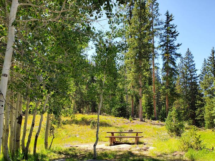
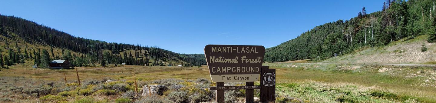
Flat Canyon Campground is located high on the Wasatch Plateau, at an elevation of 8,800 feet. The site is conveniently located near Electric Lake, where visitors enjoy boating and fishing.

Recreation

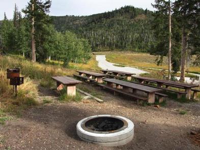
A trail leads from the campground to small Boulger Reservoir, directly below the site. Electric Lake is approximately one mile away. Boating, fishing, hiking, biking and scenic driving are popular activities in the area.

Facilities

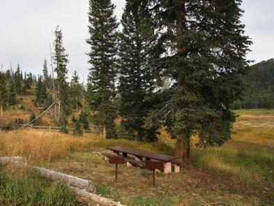
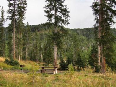
The campground contains one group site that can accommodate up to 50 people. Several single-family campsites are available within the campground as well. Picnic tables and fire rings are provided, as are vault toilets.

Natural Features

The campground is situated on a hillside above the highway. Hundreds of hazardous trees have been removed from the site, opening up the canopy and reducing shade to a minimum. Several large spruce trees remain, however, and grasses and summer wildflowers are abundant in the area.

Reservation

More from CampingHiking.net:

Panther Creek campground, Washington Campground Images, Info & Reservations

Directions From Carson, WA: Travel 6 miles north to Old State Highway, (follow signs) turn right and then take your first left on Panther Creek Road. Proceed on Panther Creek Road for 4 miles to the campground. Phone 541-338-7869 Activities CAMPING, FISHING, HIKING, HUNTING Keywords PANC,GIFFORD PINCHOT NF – FS

ALAVA BAY CABIN, Alaska Campground Images, Info & Reservations

Directions The cabin is approximately 20 air miles southeast of Ketchikan on Revillagigedo Island. Accessible by floatplane, kayak or boat with mooring buoy. Navigation is challenging due to tides, merging currents and open ocean waters. Please check tide tables in advance. Refer to USGS Ketchikan A-4. Phone 907-225-2148 Activities CAMPING,

MOLINO, Arizona Campground Images, Info & Reservations

Directions From Tucson, Arizona, take Catalina Highway off Tanque Verde Road in Tucson. Drive 4.2 miles northeast to the Coronado National Forest boundary and continue 5.7 miles to the campground. The campground is between mileposts 5 and 6. All campsites are adjacent to paved roads. Phone 520-749-8700 Activities BIKING, HISTORIC

SUPPLY PARK, Oklahoma Campground Images, Info & Reservations

Directions From Woodward, Oklahoma, travel 9 miles northwest on Highway 3/270 to Fort Supply Lake sign. Turn west and follow for 3 miles, crossing Fort Supply Dam. Continue 3/4 mile to the four-way stop; turn left and follow access road into the campground. Phone 580-766-2001 Activities BOATING, CAMPING, HUNTING, SWIMMING

GREENBRIER PICNIC PAVILION, Tennessee Campground Images, Info & Reservations

Directions There is no street address for the picnic pavilion. From Gatliinburg, TN: Proceed east on U.S. 321 North about 6 miles. Turn right (south) at the Greenbrier sign. Picnic pavilion is about 3.5 miles from U.S. 321. Phone 865-436-1261 Activities HISTORIC & CULTURAL SITE, CAMPING, FISHING, HIKING, WILDLIFE VIEWING