BOULDER OAKS EQST, CA Campground Reservation, Info, Images, Map, Directions

BOULDER OAKS EQST, California Campground Images, Info & Reservations

Directions

Boulder Oaks is located 55 miles east of San Diego, California. Take I-8 to the Buckman Springs Road exit. Continue east on Old Highway 80 for 2 miles to the campground entrance. Campground is located on the right hand side of the road when heading east.

Phone

619-445-6235

Activities

CAMPING, HIKING, HORSEBACK RIDING, HUNTING, PICNICKING, WILDLIFE VIEWING, HORSE CAMPING, BIRDING, BACKPACKING

Keywords

CLEV,CLEVELAND NF – FS

Related Link(s)

Rec Area Info & Images

California State Tourism

California State Road Conditions

Overview

Boulder Oaks offers equestrian and family sites in the scenic Cleveland National Forest, about an hour away from San Diego, California.

Visitors are drawn here for the convenience of horseback riding and day hiking on the Pacific Crest Trail, as well as picnicking in the beautiful mountain setting.

Recreation

The national forest lends itself well to horseback riding and hiking. Boulder Oaks has direct access to a segment of the 2,650-mile Pacific Crest Trail, a national scenic trail that runs from Mexico to Canada. Horseback riding is also permitted on all Cleveland National Forest roads and trails, except for nature trails.

Facilities

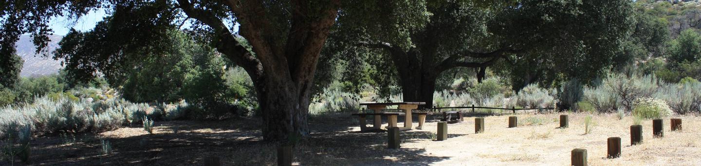
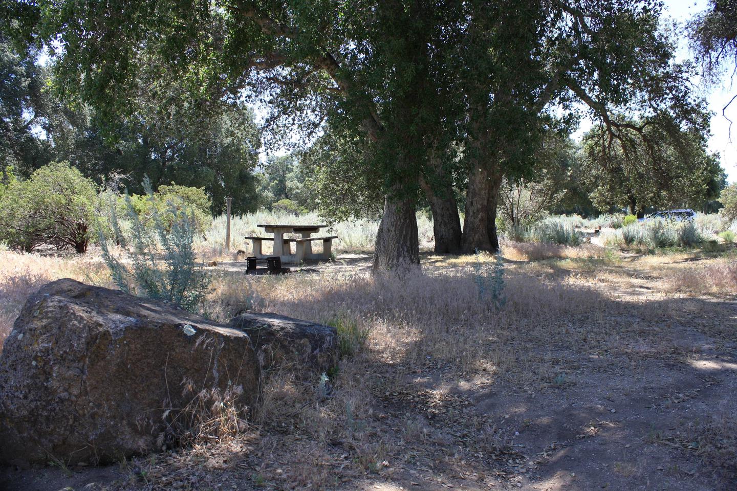
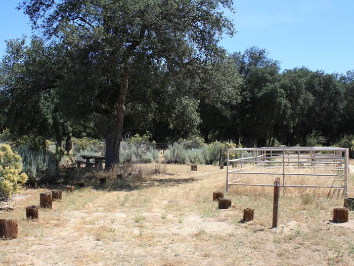
The campground consists of two loops. One has equestrian sites and corrals, and the other offers family campsites. The facility is equipped with one vault toilet.

Natural Features

The campground sits at an elevation of 3,300 ft. with oak and manzanita trees providing shade. The surrounding mountains are dotted with sagebrush, and wildflowers add color to the landscape in spring and early summer. The area is home to many species of local and migratory birds. The campground is habitat for the endangered Arroyo Toad.

Nearby Attractions

Pacific Crest National Scenic Trail

Reservation

More from CampingHiking.net:

MIDDLE MEADOWS, California Campground Images, Info & Reservations

Directions From Sacramento, California, take Interstate 80 east to Auburn. Take the Elm Street exit and turn left at the stoplight. Follow Highway 49 down the canyon, across the American River, to Cool. Turn onto Highway 193 towards Georgetown. Turn left at the stop sign, then continue 22 miles to

La Wis Wis Campground, Washington Campground Images, Info & Reservations

Directions From Packwood, Washington, go 5 miles east on State Route 12 to Campground. Phone 541-338-7869 Activities BIKING, CAMPING, INTERPRETIVE PROGRAMS, FISHING, HIKING, WILDLIFE VIEWING, DAY USE AREA Keywords LAWI,WHITE PASS,PACKWOOD,MT RANIER,GIFFORD PINCHOT NF – FS,COHO Related Link(s) Rec Area Info & Images Washington State Tourism Forest Service Concessionaire Washington

TOKETEE LAKE CAMPGROUND, Oregon Campground Images, Info & Reservations

Directions From Roseburg, OR, travel east on OR-138 East /NE Diamond Lake Boulevard for 59 miles, turn left onto Forest Road 34. Keep left at the bottom of the hill and cross the bridge. Proceed 1.5 miles to the campground entrance on the right. Phone 541-498-2531 Activities BOATING, FISHING, HIKING,

WILLOW PRAIRIE HORSECAMP, Oregon Campground Images, Info & Reservations

Directions From Butte Falls, take County Road 821 (Butte Falls-Fish Lake Highway) approximately 17 miles southeast to Forest Road 3738. Turn west (right) on Forest Road 3738 and drive 1.3 miles to where Forest Road 3738 intersects Forest Road 3735. Turn left onto Forest Road 3735 and you will see

ROBBS HUT, California Campground Images, Info & Reservations

Directions From Placerville, drive 21 miles east on Highway 50, turn left on Ice House Road and go 23 miles north to the Robbs Hut Road turnoff. Look for small sign and turn left on dirt road. In winter, park here and ski or hike 3 miles along the road