

Directions
From either east bound or west bound Interstate 80 in Truckee take exit 188, Highway 89 north toward Sierraville. In aproximately 3.5 miles turn right at the sign for Prosser Recreation Sites then in about two miles the campground will be on the right.
Phone
530-587-3558. FOR RESERVATIONS, PLEASE CALL: 1 (877) 444-6777.
Activities
BIKING, BOATING, CAMPING, FISHING, HIKING, SWIMMING, MOUNTAIN BIKING, KAYAKING, CANOEING, WATER ACCESS
Keywords
POCA,TAHOE NF – FS
Related Link(s)
California State Road Conditions
Overview
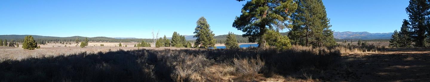
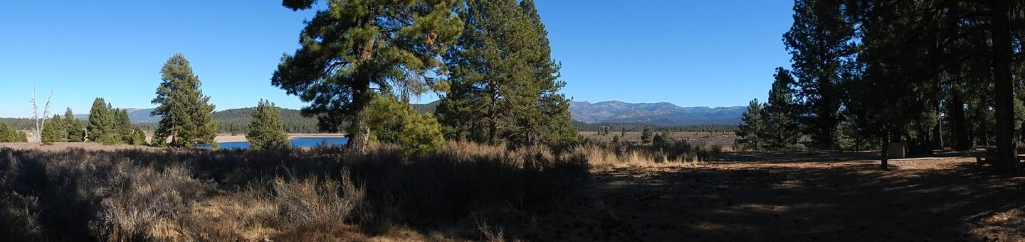
Prosser Ranch Group Campground is located on the picturesque Prosser Reservoir, within the Tahoe National Forest, about 10 minutes north of Truckee. Visitors enjoy the area for its boating, kayaking, swimming, fishing and abundant hiking and off-road trails.
Recreation
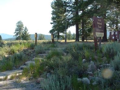
Prosser Reservoir is a popular location for kayaking, swimming and fishing. Power boating is allowed but a 10-mph speed limit is enforced. A boat ramp is located on-site. The surrounding area offers many hiking, biking, horseback riding and off-road vehicle trails.
Facilities
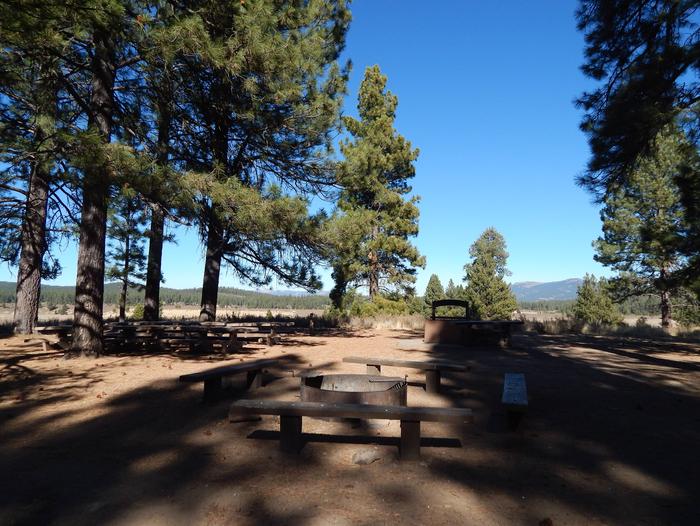
The campground offers one large-group, tent-only campsite, that can accommodate up to 50 people and 10 vehicles. The site is not suitable for RV camping. Picnic and serving tables, a large BBQ, and a campfire circle are provided, along with vault toilets and drinking water.
Natural Features
The campground is situated on the western shore of the reservoir. A scenic forest of Jeffrey pine and fir trees covers the area, while sagebrush dots the forest floor. The site affords views of the reservoir and the surrounding mountains can be seen through the trees.
Nearby Attractions
Boca Reservoir is 30 minutes east of the campground, offering additional boating, water skiing, swimming and fishing opportunities. Truckee, 10 minutes south, offers all the amenities of a year round recreational mountain town including Interstate highway connectivitiy, top notch restaraunts, resorts and hotels, grocery stores, gas stations, shopping, and historic sites, Lake Tahoe is located 30 minutes south and offers excellent boating, kayaking, fishing, hiking and scenic driving opportunities, as well as dining, shopping and lodging options. Other recreational opportunities include Donner Camp Interpretive Trail, Overland Emigrant Commemorative Trial, Stampede Reservoir Recreation Area, Prosser Pits OHV area, and numerous hiking, mountain biking, and OHV trails.