STONY POINT, MN Campground Reservation, Info, Images, Map, Directions

STONY POINT, Minnesota Campground Images, Info & Reservations

Directions

From Walker, Minn., take Highway 200 east 6 miles to County Road 13. Go north 3 miles on County Road 13 to Forest Road 3793, then east 2.5 miles on FR 3793 to the campground.

Phone

218-547-1044

Activities

BOATING, CAMPING, FISHING, HIKING, SWIMMING SITE

Keywords

STOP,CHIPPEWA NF – FS

Related Link(s)

Rec Area Info & Images

Minnesota State Road Conditions

Minnesota State Tourism

Overview

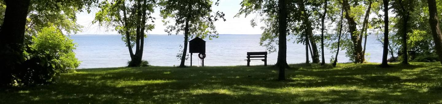
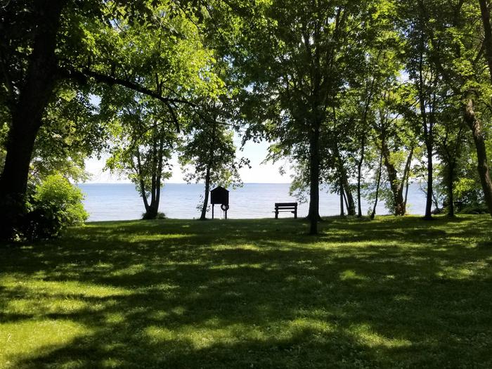
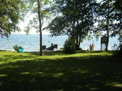
Reservations to all Chippewa National Forest Campgrounds can be made six months in advance. Stony Point is located on beautiful Leech Lake, in the heart of Minnesota’s Chippewa National Forest. Visitors enjoy the area for its boating, canoeing, fishing and birding opportunities.

Recreation

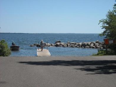
Boating and fishing are very popular activities enjoyed by visitors to the campground. Anglers will find walleye, perch, bass, northern pike and muskie, where every cast has the potential to yield a trophy-sized catch. A boat ramp and dock are located within the campground. Miles of scenic hiking trails meander around Leech Lake, including the Paul Bunyon State Trail, Heartland Trail, Soo Line Trail and North Country National Scenic Trail.

Facilities

The campground offers sites with 30 amp electric hookups, and one walk-to tent site without electric hookups. Flush and vault toilets, showers, drinking water and a dump station are provided.

Natural Features

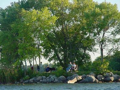
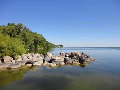
The campground is situated on the banks of Leech Lake in an open, grassy area, surrounded by an old growth forest of oak, elm, maple and ash trees. Some trees are over 200 years old. Leech Lake is the third-largest lake in Minnesota at more than 112,000 acres, with nearly 200 miles of shoreline. Campers commonly hear the telltale call of loons on the water.

Nearby Attractions

The very popular tourist town of Walker, Minnesota is located approximately 14 miles west of the campground, with a variety of restaurants, shops and festivals available there throughout the year.

Reservation

More from CampingHiking.net:

GREEN VALLEY, California Campground Images, Info & Reservations

Directions From Running Springs, travel east on Highway 18 about 3 miles to Green Valley Lake Road. Turn left and continue about 6 miles to the campground. Phone 909-866-8550 Activities BOATING, CAMPING, FISHING, HIKING, SWIMMING SITE Keywords GREV,GREEN VALLEY San Bernardino,SAN BERNARDINO NF – FS Related Link(s) Rec Area Info

ZIPS PLACE CABIN, Montana Campground Images, Info & Reservations

Directions From Hungry Horse, travel east on U.S. Highway 2 for 48 miles, to mile marker 191. Travel south on Geifer Greek/Lodgepole Lane (a gravel road that veers left initially). Follow the signs to the cabin. During the winter months or when the road conditions are impassable, renters must park

DEERLICK CREEK, Alabama Campground Images, Info & Reservations

Directions From I-59 in Alabama, take Exit 73 (MacFarland Boulevard). Go west on MacFarland Blvd./Highway 82 for approximately 4.2 miles. Veer right onto Rice Mine Road. At the stoplight turn left onto Rice Mine Rd. Then, turn right at the stoplight onto New Watermelon Road and follow it for 3.4

RED BLUFF CAMPGROUND, Missouri Campground Images, Info & Reservations

Directions From St. Louis, Missouri, take I-44 west to Cuba. Continue on Highway 19 south to Cherryville. Take 49 south to Highway V, turn left to Davisville and travel approximately 1 mile and turn left into the campground. Phone 573-743-6042 Activities CAMPING, FISHING, WATER SPORTS Keywords REDB,MARK TWAIN NF -FS

INDIAN HENRY, Oregon Campground Images, Info & Reservations

Directions From Estacada, Oregon, travel east on Highway 224 for 24 miles to the campground. Phone 503-630-5721 Activities CAMPING, FISHING, HIKING, WATER SPORTS, DAY USE AREA Keywords INDH,MT. HOOD NF – FS Related Link(s) Rec Area Info & Images Oregon State Tourism Forest Service Concessionaire Oregon State Road Conditions Overview