ANGEL LAKE, NV Campground Reservation, Info, Images, Map, Directions

ANGEL LAKE, Nevada Campground Images, Info & Reservations

Directions

Take Interstate 80 to the West Wells exit. Turn south on Angel Lake Road (State Route 231) and travel 12 miles to the end of the road at Angel Lake.

Phone

775-752-3357

Activities

BOATING, CAMPING, FISHING, HIKING, WILDLIFE VIEWING

Keywords

ANGL,RUBY MOUNTAINS,HUMBOLDT-TOIYABE NF-FS

Related Link(s)

Rec Area Info & Images

Nevada State Road Conditions

Forest Service Concessionaire

Nevada State Tourism

Overview

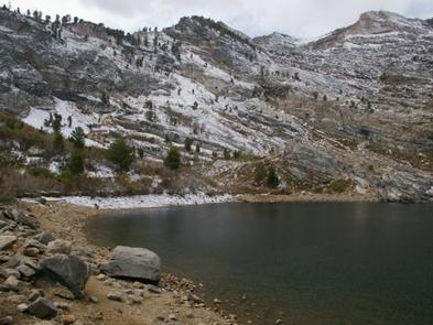
Angel Lake Campground is located next to beautiful Angel Lake, high on the East Humboldt Mountain Range. It sits at an elevation of 8,400 feet, just 12 miles from the city of Wells, in northeast Nevada. Visitors enjoy canoeing, fishing, hiking and viewing wildlife.

Recreation

Angel Lake offers great canoeing and fishing for rainbow and brook trout. Greys Lake Trail, a 4.75-mile roundtrip path to a hidden alpine lake, begins at the campground entrance.

Facilities

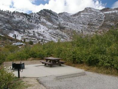
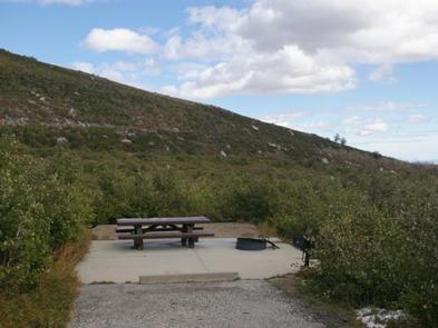
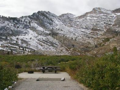
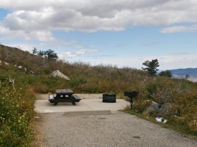
The campground offers single and double campsites, some of which have lake views. Each site contains a picnic table, campfire ring and grill. Vault toilets, drinking water and trash collection are also provided. Firewood is available for purchase from the campground host. A day-use picnic area is adjacent to the campground, along the lakeshore.

Natural Features

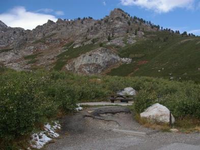
The campground sits at the foot of rugged and scenic glacial cirques, that top out around 10,000 feet. Dwarf aspens cover the campground, providing privacy between campsites, but little to no shade.

A variety of wildlife, including bighorn sheep, mountain goats, deer and birds of prey, make its home around the lake, creating good viewing opportunities.

Reservation

More from CampingHiking.net:

NORTH FORK CAMPGROUND, Colorado Campground Images, Info & Reservations

Directions Take I-70 west of Denver, Colorado, to Rifle. Take Highway 13 to Meeker, and turn on Country Road 8 for 32 miles. Turn left into North Fork Campground. Phone 970-927-0107 Activities BIKING, CAMPING, FISHING, HIKING, HORSEBACK RIDING, HUNTING, WILDLIFE VIEWING Keywords NOR2,MEEKER,WHITE RIVER,NORTH FORK CAMPGROUND,WHITE RIVER NF -FS Related

WILSON POINT (Day Use), Oklahoma Campground Images, Info & Reservations

Directions From Sawyer, OK, take Highway 147 north for a mile, then turn left into the day use area. Phone 580-326-0173 Activities BOATING, CAMPING, FISHING, HIKING, HUNTING, WILDLIFE VIEWING, SWIMMING SITE Keywords None Related Link(s) Rec Area Info & Images Oklahoma State Tourism Oklahoma State Road Conditions Overview Wilson Point

THREE CREEKS LAKE CAMPGROUND, Oregon Campground Images, Info & Reservations

Directions From Sisters, OR: Travel 17.0 miles south on Forest Road 16 (Elm Street in Sisters). Phone 541-323-1746 Activities CAMPING Keywords THREE CREEKS LAKE CAMPGROUND Related Link(s) Rec Area Info & Images Oregon State Road Conditions Oregon State Tourism Overview Three Creeks Lake Campground is the last of four facilities

WOLF CREEK CALIFORNIA, California Campground Images, Info & Reservations

Directions From Placerville, get on Highway 50 and head east for 21 miles to Icehouse Road. Turn left 21 miles to turnoff. Then go three-quarters of a mile to campground. Phone 831-245-6891 Activities BIKING, BOATING, CAMPING, FISHING, HIKING, WATER SPORTS, WILDLIFE VIEWING, SWIMMING SITE, BIRDING, WATER SKIING Keywords WOLA,ELDORADO NF

KENNEL CREEK CABIN (AK), Alaska Campground Images, Info & Reservations

Directions Kennel Creek Cabin is located approximately 19 air miles southeast of the City of Hoonah, Alaska on the south shore of Freshwater Bay. Access is by vehicle, float plane, or boat. Total distance by gravel road is approximately 27 miles. By road travel south from Hoonah past the airport.