
Directions
From Seattle, Washington, go north on I-5 to US Highway 2, exit 194. Approximately 49 miles along Highway 2 turn north onto Forest Road 65. Turn at the campground sign and continue about 1.5 miles.
Phone
360-419-5115
Activities
BIKING, BOATING, CAMPING, FISHING, HIKING, HUNTING, WILDLIFE VIEWING
Keywords
BECR,MT. BAKER-SNOQU NF – FS
Related Link(s)
Washington State Road Conditions
Overview
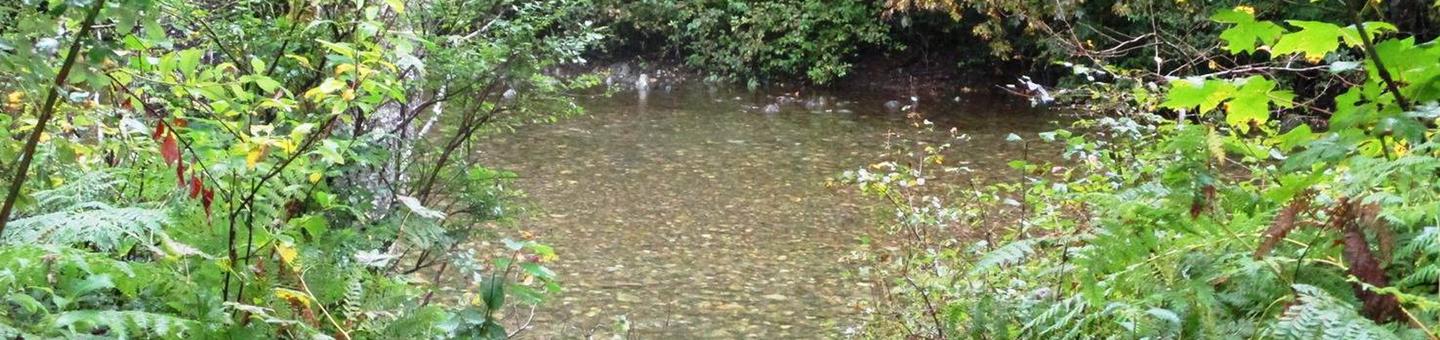
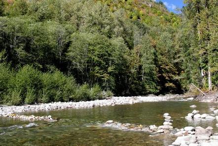
Situated along at the banks of the tranquil Beckler River in Mt. Baker-Snoqualmie National Forest, this campground offers some of the most stunning scenery in the Northern Cascade Range of Washington.
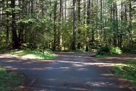
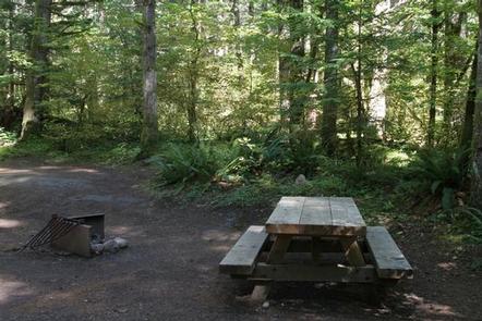
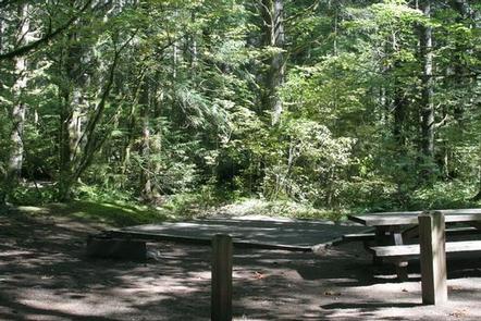
The spacious campsites are nestled in a dense old-growth forest of Douglas fir, cedar and western hemlock, and are within walking distance to the river.
Campers will find a wide variety of recreational activities in the North Fork Skykomish, Beckler River and West Fork Foss River areas.
Recreation
In addition to being a prime location for hiking, biking and fishing in the summer and early fall, Beckler River offers excellent skiing and snowshoeing in the winter months.
The Mt. Baker-Snoqualmie National Forest boasts 1,500 miles of trails. From smooth paths meandering through deep quiet forests to challenging ascents up boulder-studded mountains, opportunities abound for every skill level.
Starting at the Jennifer Dunn Trailhead, the Beckler Peak Trail offers hikers the opportunity to view the diverse landscapes of the area from a variety of perspectives. Starting out on a decommissioned logging road, the trail climbs through young alder and vine maple to an expansive vista of the Skykomish Valley. The trail continues to switchback through massive trees and by the remains of a trapper’s cabin. The final ridge affords hikers panoramic views of near and distant peaks.
Facilities
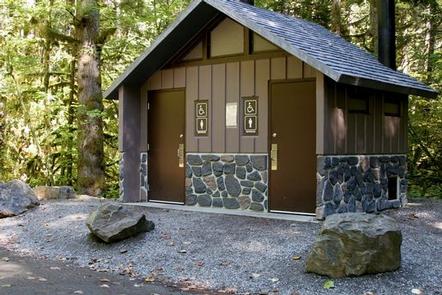
Beckler River campground offers standard sites, accommodating both tent and RV camping. Picnic tables, vault toilets and drinking water are provided.
Access to the Skykomish River is available from the campground, and several sites are near the river’s edge.
Natural Features
Hemmed in by several designated wilderness areas, the Mt. Baker-Snoqualmie National Forest showcases rugged peaks, sparkling alpine lakes and old-growth forests.
Mt. Baker, the most prominent feature of the Mt. Baker Wilderness Area, dominates the landscape on a clear day. Rising to an elevation of 10,781 feet, this active volcano is perpetually snow-capped and mantled with an extensive network of creeping glaciers. Mt. Baker’s summit, Grant Peak, is actually a 1,300-foot-deep mound of ice, which hides a massive volcanic crater.
The undeveloped wilderness, clean streams and diverse forests support a variety of wildlife, including mountain goats, coyotes, pine marten, a variety of migratory birds and native fish.
Nearby Attractions
Visitors enjoy the North Cascades and Mt. Rainer National Parks, where interpretive programs and exhibits offer education about the diverse landscape and history of the area.
The spectacular Pacific Crest Trail (PCT), one of the world’s premier National Scenic Trails, showcases some of North America’s most fantastic scenery, winding its way its way from Mexico to Canada through California, Oregon and Washington, and is accessible near the campground.