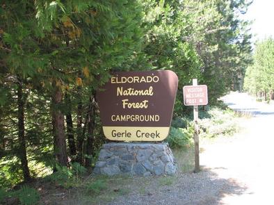
GERLE CREEK, CA Campground Reservation, Info, Images, Map, Directions

GERLE CREEK, California Campground Images, Info & Reservations

Listen

Directions

From Placerville, drive 21 miles east on Highway 50 to the Icehouse Road turnoff. Turn left and go 28 miles north. Take the left fork 3 miles to the campground.

Phone

831-245-6891

Activities

CAMPING, FISHING, HIKING, SWIMMING SITE

Keywords

GERL,ELDORADO NF – FS

Related Link(s)

Rec Area Info & Images

Forest Service Concessionaire

California State Tourism

California State Road Conditions

Overview

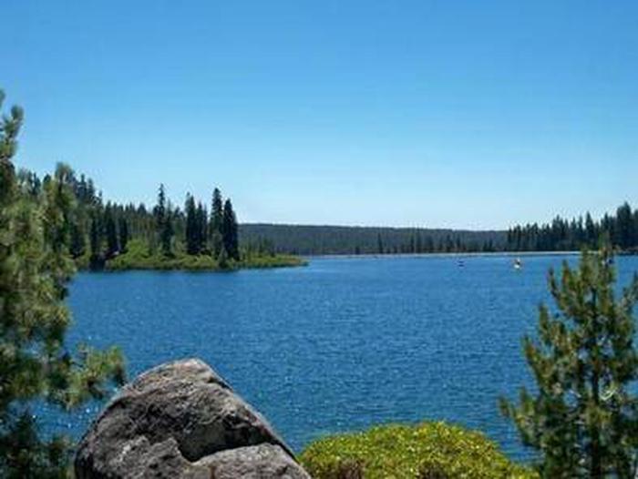
Gerle Creek Campground is nestled on the banks of the Gerle Creek Fork among a lush forest of hardwoods. The area provides lots of opportunity for fishing and water play. Hiking and biking are also popular.

Recreation

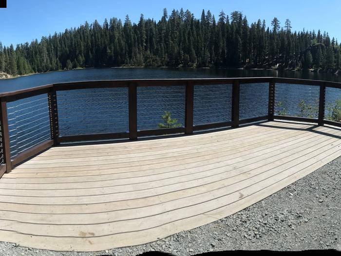
Swimming, canoeing, kayaking and fishing are some of the fun things to do on the creek. Common fish species include brown and rainbow trout. An accessible fishing dock is located on-site.

The Gerle Creek Interpretive Trail is fully accessible and provides scenic views and interesting displays.

Facilities

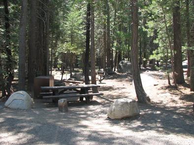
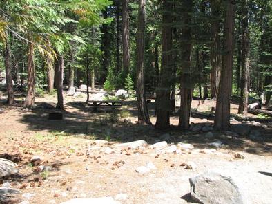
The campground offers single and double-family campsites, many of which are accessible. Each site is equipped with a picnic table and campfire ring. Vault toilets are provided and firewood is available for purchase.

Natural Features

Gerle Creek Campground sits at an elevation of 5,300 feet, upstream of Gerle Creek Divide Reservoir. It is on the Georgetown Divide within the Eldorado National Forest. Gerle Creek was named for two brothers who were early settlers and farmers in the region.

Eldorado National Forest boasts over 400 miles of hiking trails, an abundance of lakes and rivers for fishing and swimming, and incredible scenery. The climate is similar to that of the Mediterranean, with warm, dry summers and cold, wet winters.

Nearby Attractions

Union Valley Reservoir and Loon Lake are within a short drive of the campground, offering additional fishing and boating opportunities.

Reservation

More from CampingHiking.net:

GLEASONS LANDING, Michigan Campground Images, Info & Reservations

Listen Directions From Baldwin, take 7th street west 5 blocks to Cherry Street, then south 1.5 blocks to 52nd Street (Carr Road), go west 2 miles to Jenks Road and turn left. Drive 0.4 miles and turn right on Shortcut Road and drive 0.7 miles. Turn right at T junction

KIMBALL BEND PARK, Texas Campground Images, Info & Reservations

Listen Directions From Kopperl, TX, travel north on HWY 56 for approximately 2.5 miles. Turn right on HWY 174 and go approximately 2.3 miles. Turn left into the park, just before the HWY 174 bridge. From Cleburne, TX, travel south on HWY 174 for 22 miles. Turn right into the

TILLICUM, Oregon Campground Images, Info & Reservations

Listen Directions The campground is on Highway 101, 3 miles north of Yachats and 4 miles south of Waldport, Oregon. Look for campground and beach signs on 101. Physical Address: 8199 Hwy 101 N Yachats, OR 97498 Phone 541-547-3679 Activities CAMPING, FISHING, HIKING, SWIMMING Keywords TILI,SIUSLAW NF – FS Related

Soda Springs Campground, Washington Campground Images, Info & Reservations

Listen Directions Take Highway 410 to milepost 88.4, then turn left on Bumping Lake Road and continue for 5 miles to the campground. Phone 541-338-7869 Activities CAMPING, FISHING, HIKING, WATER SPORTS Keywords SOSP,Bumping River,OKANOGAN – WENATCHEE NF -FS Related Link(s) Rec Area Info & Images Washington State Tourism Washington State

SOUTH PIKE BAY, Minnesota Campground Images, Info & Reservations

Listen Directions From Cass Lake, Minn., travel 3 miles south on Highway 371. Turn east onto Forest Road 2137 and travel 2 miles to the campground. Phone 218-547-1044 Activities BIKING, BOATING, HISTORIC & CULTURAL SITE, CAMPING, FISHING, WATER SPORTS, SWIMMING SITE Keywords SPKB,Pike Bay Related Link(s) Rec Area Info &