GLACIER VIEW CAMPGROUND, ID Campground Reservation, Info, Images, Map, Directions

GLACIER VIEW CAMPGROUND, Idaho Campground Images, Info & Reservations

Directions

From Stanley, Idaho, take State Highway 75 south approximately 4 miles. Go west onto Forest Road 214. Turn left at Glacier View Campground entrance sign.

Phone

928-537-8888

Activities

BIKING, BOATING, CAMPING, FISHING, HIKING, HORSEBACK RIDING, WILDLIFE VIEWING, SWIMMING SITE

Keywords

GLAC,SAWTOOTH NF – FS

Related Link(s)

Rec Area Info & Images

Forest Service Concessionaire

Idaho State Road Conditions

Idaho State Tourism

Overview

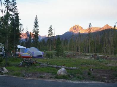
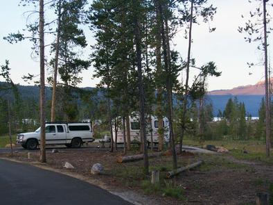
Glacier View Campground is located next to beautiful Redfish Lake, beneath the Sawtooth Mountain Range, at an elevation of 6,500 feet.

Recreation

Glacier View is in the heart of the beautiful Sawtooth National Recreation Area, where outdoor activities abound.

Redfish Lake offers excellent boating, water skiing, canoeing, kayaking and fishing for rainbow trout and Kokanee salmon. Little Redfish Lake is just down the road, offering additional fishing and canoeing.

The Redfish Lake Visitor Center is within 1/4-mile, offering interpretive activities, evening programs and wildlife, geology and historical exhibits.

Facilities

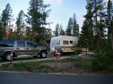
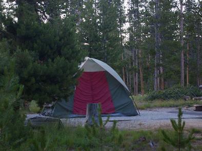
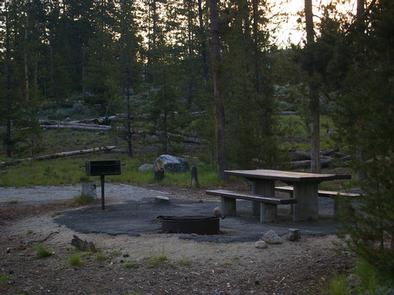
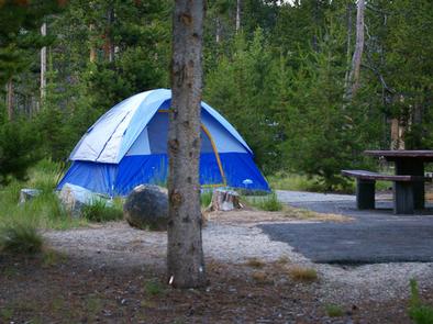
The campground offers several family sites, many with views of the lake and rugged Mount Heyburn. Flush toilets and drinking water are provided. Roads and parking spurs throughout the site are paved.

Younger visitors love the campground’s two playgrounds. Sandy Beach Boat Ramp is less than a mile away and an RV dump station is just over a mile away.

Natural Features

Summer wildflowers are plentiful, lodgepole pines provide partial shade and Fishhook Creek is nearby. Temperatures are cool, with an average summer high of 78 degrees and a low of 40 degrees.

Nearby Attractions

The Sawtooth National Recreation Area offers a myriad of excellent hiking and biking opportunities; an estimated 750 miles of trails crisscross the valley and surrounding mountains.

Alpine Way, Fishhook Creek, Redfish Lake Creek and Bench Lakes Trails all offer trailheads in the immediate area. The Idaho Centennial Trail passes nearby.

The Salmon River offers excellent fishing for rainbow trout, Westslope cutthroat trout and occasional hybrid cutbows and bull trout.

Popular area events include an Arts and Crafts Fair in July, and Wagon Days, Salmon Festival, Quilt Fair, and Fireman’s Ball in September.

Reservation

More from CampingHiking.net:

SWEETWATER CG, Georgia Campground Images, Info & Reservations

Directions From I-75 take exit 290 and head east on Highway 20 toward Canton/Rome. After approximately 12 miles turn right onto Fields Chapel Road and follow for 2 miles into the campground. From I-575 take extit 16. Follow Highway 20 west toward Cartersville, after 5 miles turn left on Fields

STONY CABIN, Montana Campground Images, Info & Reservations

Directions From Philipsburg, travel west on Rock Creek Road/County Road 348 for approximately 14 miles, then turn right onto Rock Creek Road/County Road 102 and continue about 5 miles. Turn left at Stony Creek Road/County Road 241 and the cabin is about a quarter-mile on the right. Depending on snow

RIPPLEBROOK, Oregon Campground Images, Info & Reservations

Directions From Estacada, travel east on Highway 224 for 26 miles to the campground, which is just past the Ripplebrook Camp Store. Phone 503-630-5721 Activities CAMPING, FISHING, WATER SPORTS Keywords RIPP,MT. HOOD NF – FS Related Link(s) Rec Area Info & Images Oregon State Tourism Forest Service Concessionaire Oregon State

FREMONT CAMPGROUND, California Campground Images, Info & Reservations

Directions From Santa Barbara, take Highway 154 approximately 9 miles to Paradise Road. Turn right and follow the road to the campground. Phone 805-434-1996 Activities BIKING, BOATING, CAMPING, FISHING, HORSEBACK RIDING, SWIMMING SITE Keywords FRCA,Fremont Park,Fremont Recreation Area,LOS PADRES NF -FS Related Link(s) Rec Area Info & Images California State

MOUND VALLEY, Kansas Campground Images, Info & Reservations

Directions From Cherryvale, Kansas, take U.S. Highway 169 and turn east onto Main Street. Continue through the town and turn right onto Olive Street. Go 1/2 a block and turn left onto County Route 5000. Proceed 4.5 miles to Big Hill Lake and follow signs to Mound Valley. Phone 620-328-2050